Plizio Visual Lab
Pic Toussidé
Weather…
Water temperature…
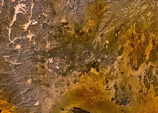
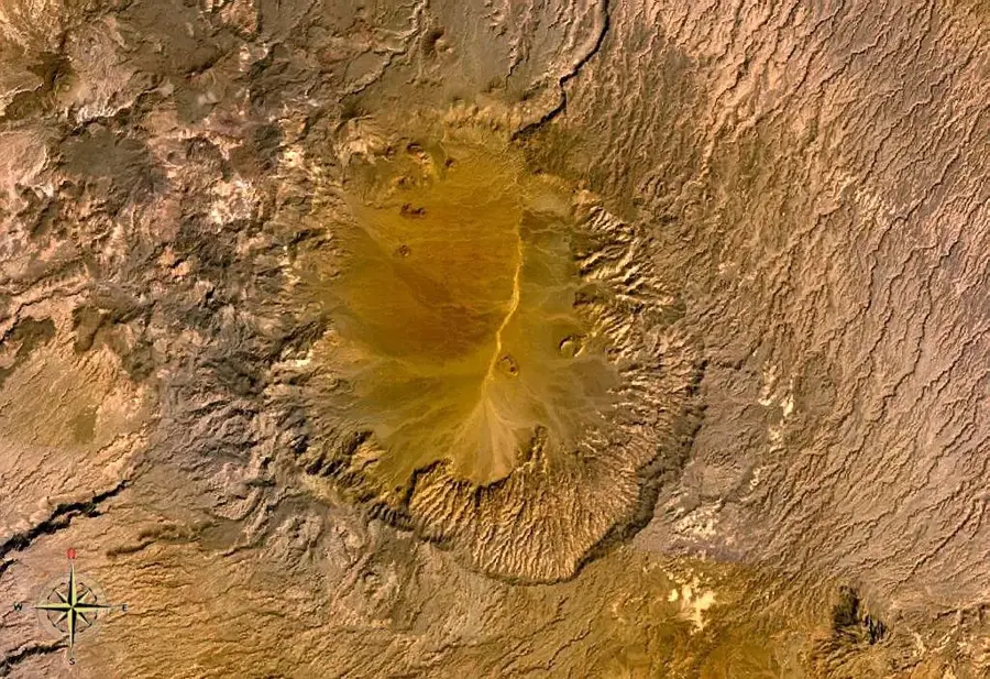
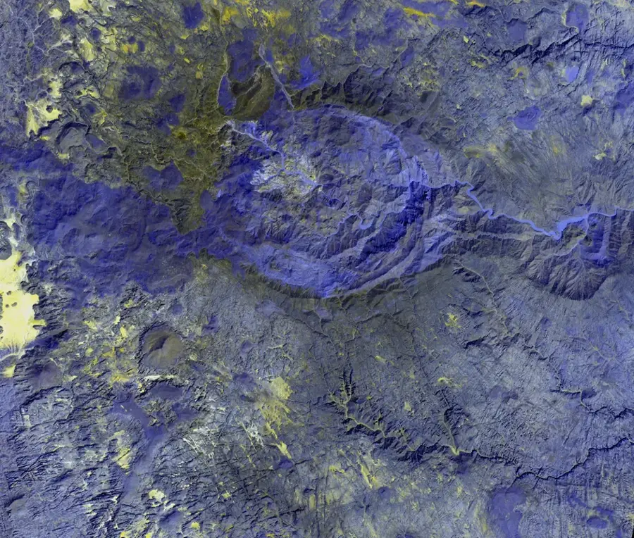
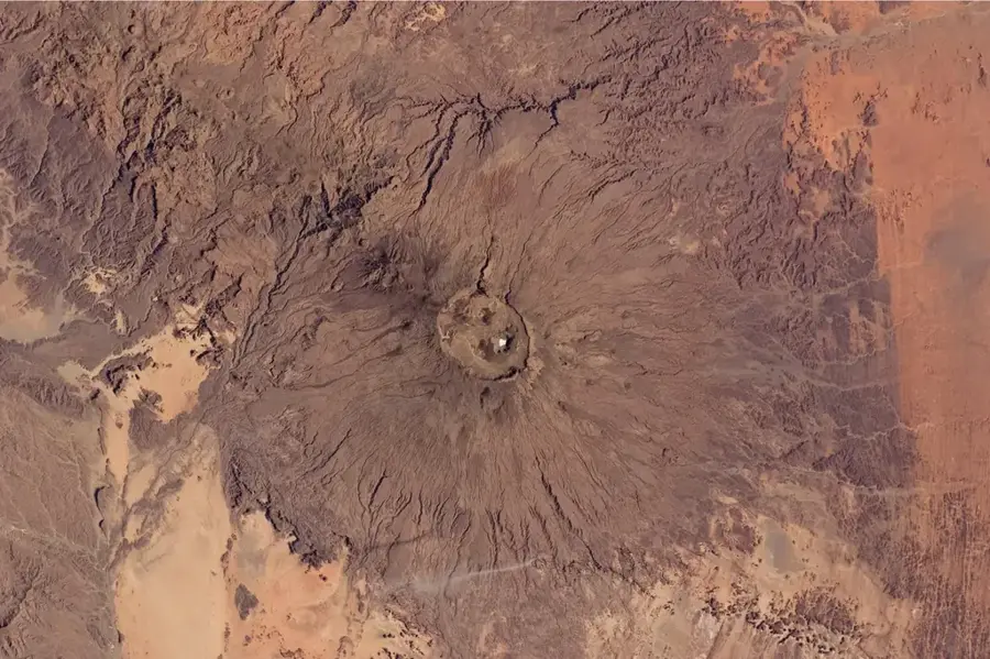
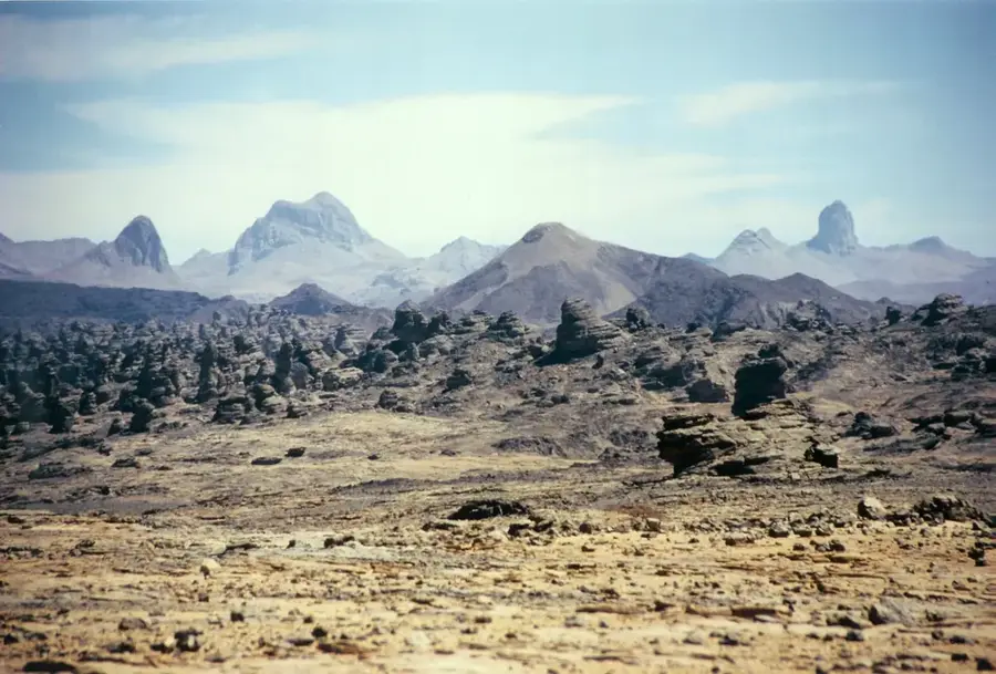
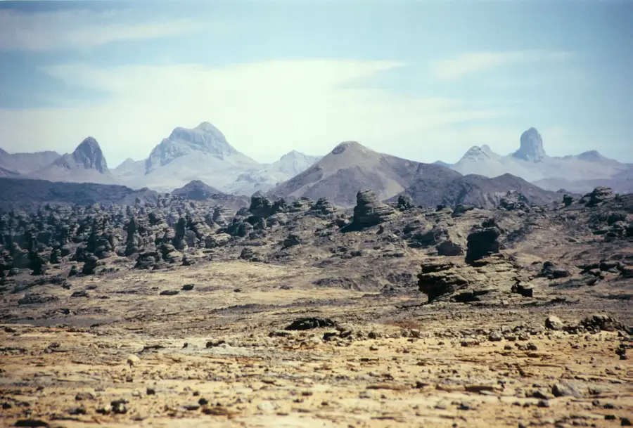
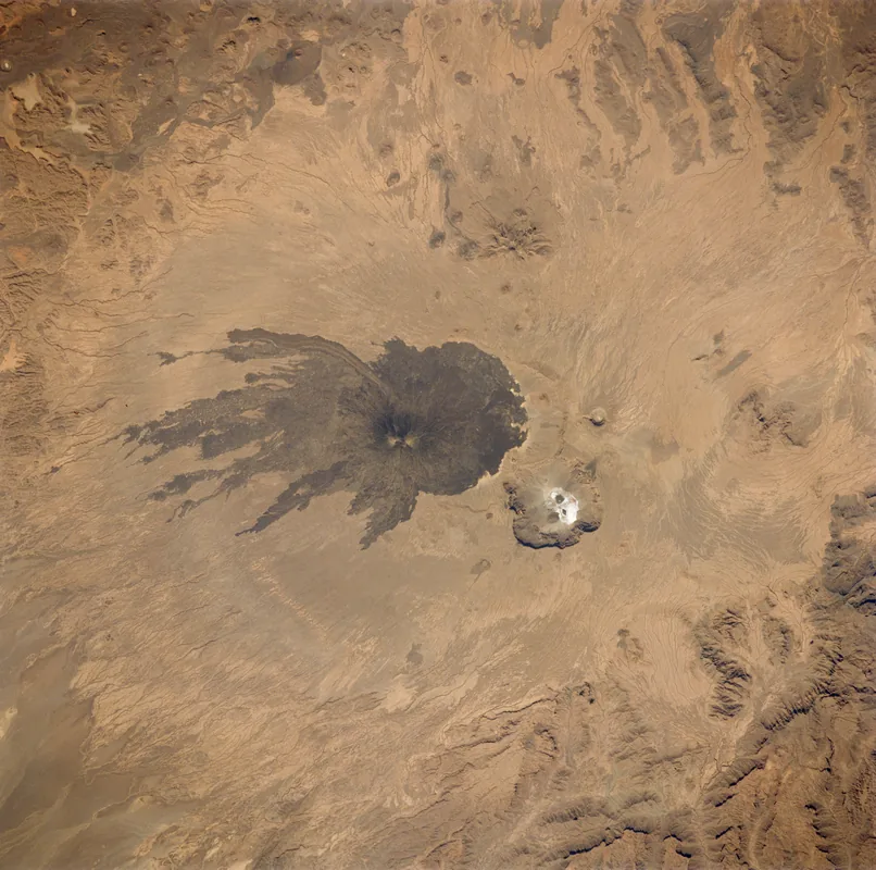
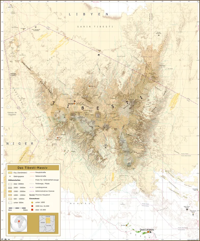
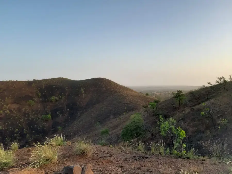
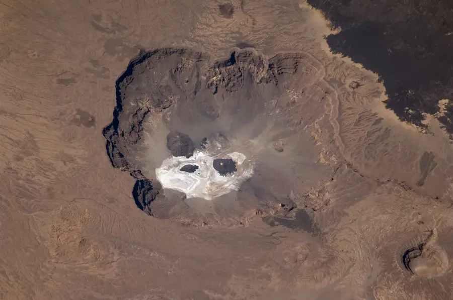
Pic Toussidé, reaching an elevation of 3,265 meters, is one of the most prominent and active volcanic peaks in the Tibesti Mountains of northern Chad. This volcano forms the western part of the Toussidé massif and is easily identifiable by its dark, basaltic lava dome, which stands in stark contrast to the lighter-colored surrounding terrain. Geologically, it is a stratovolcano that still exhibits signs of activity through active fumaroles located at its summit and along its slopes. Nearby lies the spectacular 'Trou au Natron', a massive caldera approximately 8 kilometers in diameter, with a floor covered in bright white sodium carbonate deposits. Climbing Pic Toussidé is regarded as one of the most challenging expeditions in the Sahara, offering unparalleled views of the Tibesti's surreal volcanic landscape. Despite the extreme arid conditions, the volcanic soils support specialized flora adapted to low rainfall and high temperature fluctuations, making the area a unique site for geological and botanical study.
Best time to visit & climate
The most pleasant time to visit is Jan, Feb, Dec.
| Jan | Feb | Mar | Apr | May | Jun | Jul | Aug | Sep | Oct | Nov | Dec | |
|---|---|---|---|---|---|---|---|---|---|---|---|---|
| Avg °C | 19 | 23 | 27 | 30 | 33 | 34 | 33 | 31 | 31 | 29 | 24 | 20 |
| Rain mm | 0 | 0 | 0 | 0 | 1 | 2 | 24 | 61 | 10 | 1 | 0 | 0 |
📋 Practical info
Geography
Facts
- Elevation: 3,265 m
- Range: Tibesti Mountains
- Type: Active stratovolcano
- Feature: Dark basaltic lava dome
- Proximity: Near Trou au Natron caldera
- Signs of life: Active fumaroles present
Explore nearby
Notable places around
Route planner — Car & Motorhome
Where do you start? We build the route here, with stops and country notes along the way.
© OpenStreetMap contributors · OpenRouteService
Sights nearby
Frequently asked questions
Can you climb Pic Toussidé?
What is the difficulty level?
Does the peak offer a good view?
Are there accommodations on the way?
When should you start the ascent?
Pic Toussidé: where is it located?
Pic Toussidé: when is the best time to visit?
Pic Toussidé: why is it worth visiting?

Nearby cities

History & landmarks

More places