Plizio Visual Lab
Limpopo River
Weather…
Water temperature…
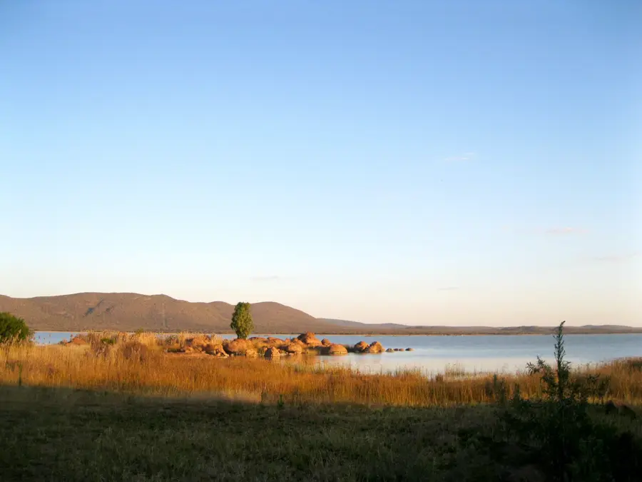
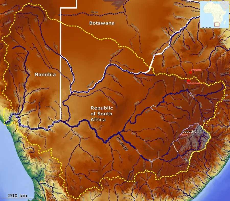
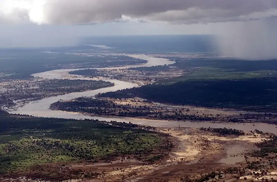
The Limpopo River is one of the most significant rivers in Southern Africa, stretching approximately 1,750 kilometers and forming a major natural border between Botswana, South Africa, and Zimbabwe. It originates in the Witwatersrand mountains of South Africa and flows in a broad eastward arc until it eventually empties into the Indian Ocean near Xai-Xai in Mozambique. The river is noted for its seasonal nature; during the dry season, it can almost completely dry up in many sections, whereas heavy rainfall can transform it into a massive, flooding torrent. The Limpopo basin is a fertile region vital for agriculture and livestock farming, while also supporting a rich array of flora and fauna, including hippos, crocodiles, and numerous waterfowl. Historically, the Limpopo served as a crucial trade route and the boundary for powerful kingdoms like Mapungubwe. In Botswana, it traverses the Tuli Block area, famous for its spectacular sandstone formations and towering Mashatu trees. The river is also a central component of the Great Limpopo Transfrontier Park, an international conservation initiative.
- Location: Botswana
- Top sights: Solomons Wall · Vhembe Game Reserve
Best time to visit & climate
The most pleasant time to visit is May, Aug, Sep.
| Jan | Feb | Mar | Apr | May | Jun | Jul | Aug | Sep | Oct | Nov | Dec | |
|---|---|---|---|---|---|---|---|---|---|---|---|---|
| Avg °C | 27 | 27 | 26 | 23 | 20 | 17 | 17 | 20 | 23 | 26 | 27 | 27 |
| Rain mm | 77 | 61 | 43 | 19 | 5 | 3 | 1 | 1 | 6 | 23 | 59 | 81 |
📋 Practical info
Geography
Facts
- The Limpopo is the second-largest eastward-flowing river in Africa, after the Zambezi.
- The name Limpopo means 'river of waterfalls' in several regional dialects.
- The river's mouth into the Indian Ocean was first charted by Vasco da Gama in 1498.
- The river drains a massive catchment area of approximately 413,000 square kilometers.
- The Mapungubwe World Heritage site, an 11th-century kingdom, is located near its banks.
- The Limpopo is famous for its dense crocodile populations, especially in its lower reaches.
Explore nearby
Notable places around
Route planner — Car & Motorhome
Where do you start? We build the route here, with stops and country notes along the way.
© OpenStreetMap contributors · OpenRouteService
Sights in the town Limpopo River (2)
Sights nearby
Frequently asked questions
Where does the Limpopo River originate?
Does the river form a national border?
Does the Limpopo flow year-round?
What major cities are on the Limpopo?
Are there crocodiles in the river?
Limpopo River: where is it located?
Limpopo River: what is there to see?
Limpopo River: when is the best time to visit?
Limpopo River: why is it worth visiting?

History & landmarks


More places