Plizio Visual Lab
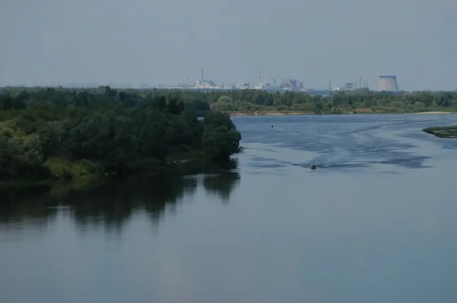
Pripyat Floodplain
Weather…
Water temperature…
The Pripyat Floodplain in southern Belarus is one of the largest and most ecologically significant riverine wetlands remaining in Europe. This expansive lowland is shaped by the unchannelized Pripyat River, which undergoes massive seasonal fluctuations, flooding vast areas every spring during the snowmelt. These annual floods transform the landscape into a complex maze of distributaries, oxbow lakes, and temporary pools, creating a unique wilderness often called the 'Lungs of Europe.' The floodplain is a critical junction for migratory birds traveling along the East European flyway, supporting hundreds of thousands of waterfowl. Vegetation is dominated by resilient floodplain forests, including ancient swamp oaks and willow thickets. Internationally recognized as a Ramsar site, the floodplain is vital for global biodiversity and climate regulation. Historically, the area sustained local Polesian cultures through traditional fishing and forest beekeeping. Today, it remains an extraordinary destination for environmental research and eco-tourism, offering a glimpse into a river system that functions entirely according to natural laws.
- Location: Belarus
- Nearby: Pyetrykaw (26 km)
📋 Practical info
Geography
Facts
- The Pripyat Floodplain is protected as an international Ramsar wetland.
- Water levels can rise by up to 5 meters during the peak spring flood.
- Over 1.5 million migratory birds use the area as a vital stopover annually.
- It supports some of the largest white stork colonies in Belarus.
- The Pripyat River remains largely unchannelized and natural in this area.
- The floodplain contains vast populations of rare aquatic and marsh plants.
Explore nearby
Notable places around
Route planner — Car & Motorhome
Where do you start? We build the route here, with stops and country notes along the way.
© OpenStreetMap contributors · OpenRouteService
Sights nearby
Frequently asked questions
When is the best time to visit the Pripyat floodplain?
Are there guided boat tours in the region?
What rare birds can be seen here?
Are rubber boots necessary for hiking?
Where can you stay nearby?
Pripyat Floodplain: where is it located?
Pripyat Floodplain: why is it worth visiting?

Nearby cities