Plizio Visual Lab
Altiaghaj National Park
Weather…
Water temperature…
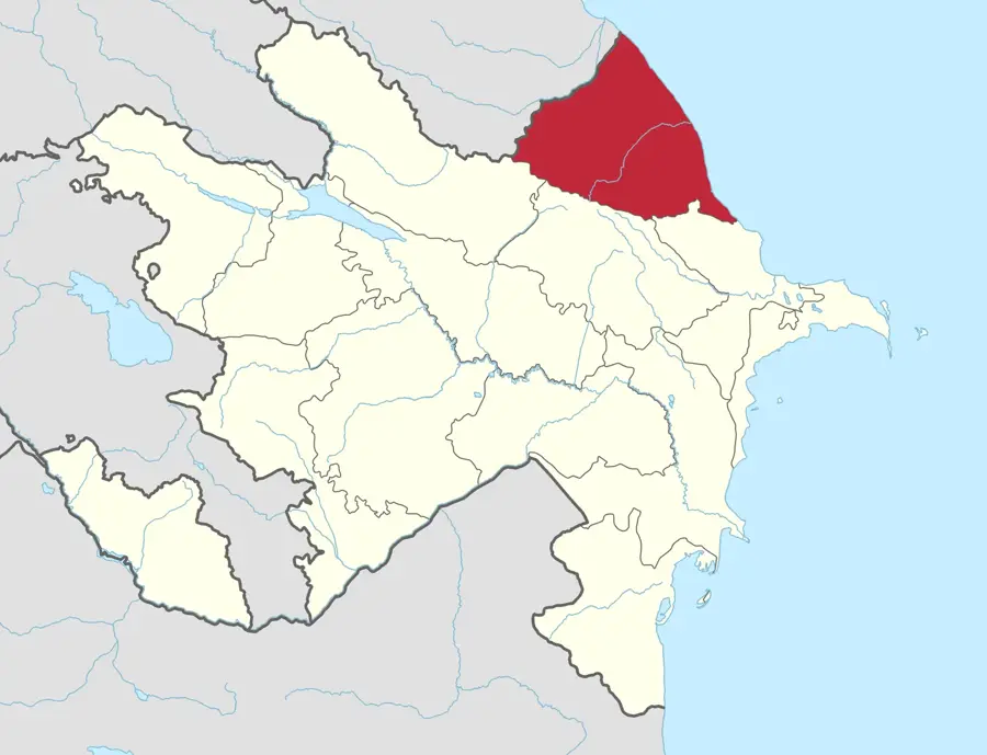
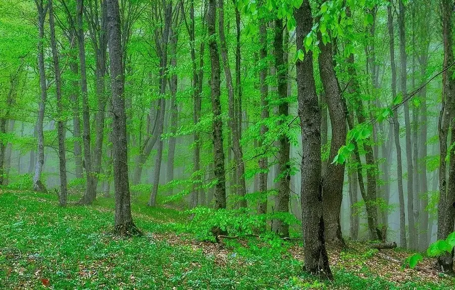
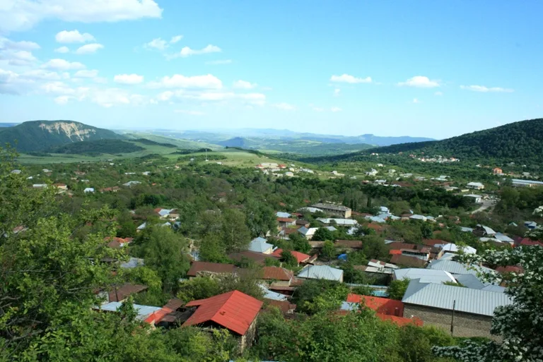
Altiaghaj National Park is set on the northeastern slopes of the Greater Caucasus Mountains within the Khyzy and Siazan districts of Azerbaijan. Established on August 31, 2004, it covers an area of 6,938 hectares and is dedicated to the preservation of the region's lush broad-leaved forests and mountainous terrain. The name 'Altiaghaj' stems from an ancient unit of distance meaning 'six tree-lengths' (approx. 42 km), which historically marked the distance between two local caravanserais. Approximately 90% of the park is forested, with Oriental beech, oak, and ash being the dominant tree species. The landscape is defined by rolling hills and scenic river valleys, providing a vital habitat for species such as roe deer, wild boars, brown bears, and lynx. A distinctive feature of the park is the National Wildlife Rehabilitation Center, the only facility of its kind in Azerbaijan, where injured animals are treated and prepared for reintroduction to the wild. Due to its temperate climate and scenic beauty, Altiaghaj is a popular destination for eco-tourism and hiking, especially during the summer months when visitors seek respite from the heat of the plains.
- Location: Azerbaijan
- Nearby: Shamakhi (37 km)
Best time to visit & climate
The most pleasant time to visit is Jun–Aug.
| Jan | Feb | Mar | Apr | May | Jun | Jul | Aug | Sep | Oct | Nov | Dec | |
|---|---|---|---|---|---|---|---|---|---|---|---|---|
| Avg °C | -2 | -1 | 4 | 8 | 14 | 19 | 21 | 21 | 16 | 10 | 4 | 0 |
| Rain mm | 18 | 24 | 27 | 28 | 29 | 24 | 16 | 14 | 28 | 34 | 29 | 19 |
📋 Practical info
Geography
Facts
- The park was established on August 31, 2004, covering 6,938 hectares.
- Lush deciduous forests cover approximately 90% of the park's territory.
- The name Altiaghaj translates to 'six tree-lengths' from an ancient unit.
- It houses the country's only official State Wildlife Rehabilitation Center.
- The Ata-Chay River is the primary water source for the park's ecosystems.
- The park's elevation ranges from several hundred to over 1,500 meters.
Explore nearby
Notable places around
Route planner — Car & Motorhome
Where do you start? We build the route here, with stops and country notes along the way.
© OpenStreetMap contributors · OpenRouteService
Sights in the town Altiaghaj National Park (1)
Sights nearby
Frequently asked questions
What can you experience in Altiaghaj National Park?
Is it suitable for family trips?
Are there accommodation options?
Is the park heavily visited?
When is the park most beautiful?
Altiaghaj National Park: where is it located?
Altiaghaj National Park: when is the best time to visit?
Altiaghaj National Park: why is it worth visiting?

Nearby cities
History & landmarks
Nature
More places