Plizio Visual Lab
Vorotan Gorge
Weather…
Water temperature…
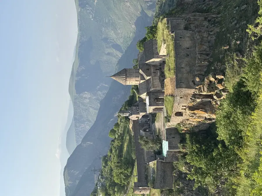
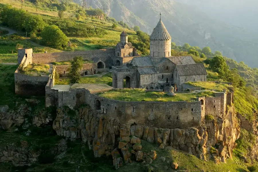
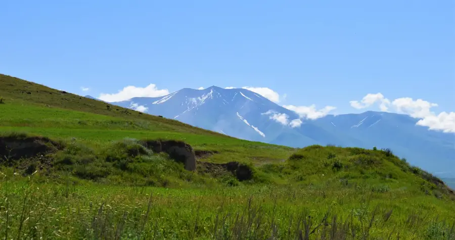
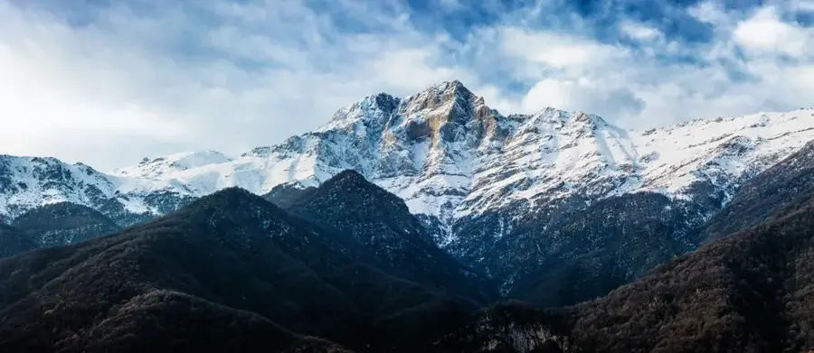
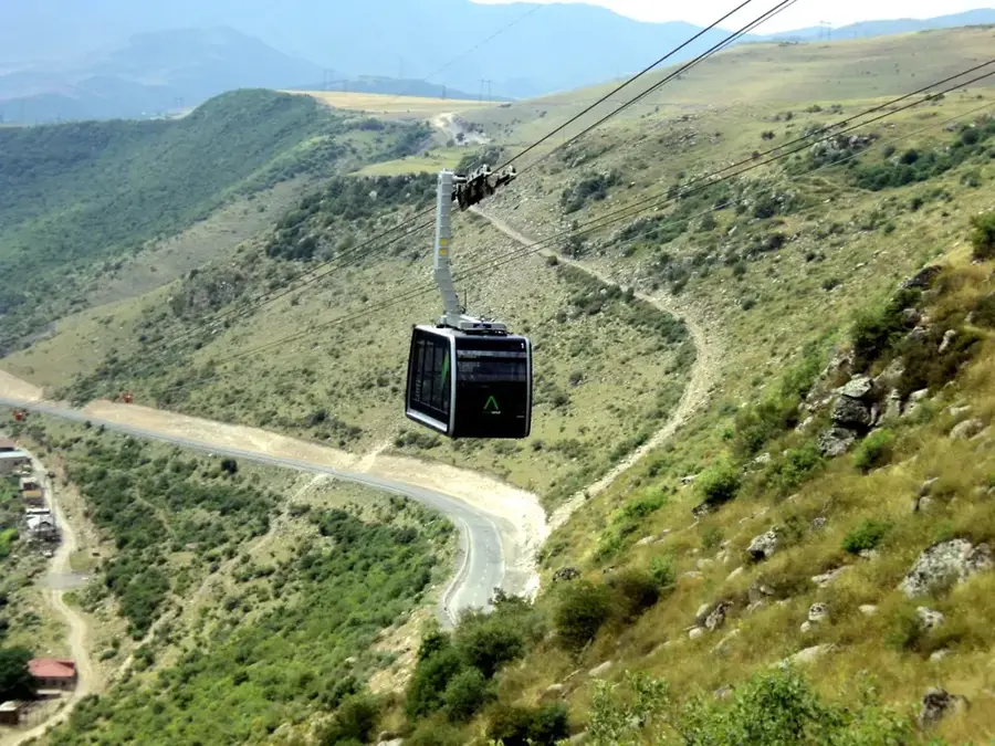
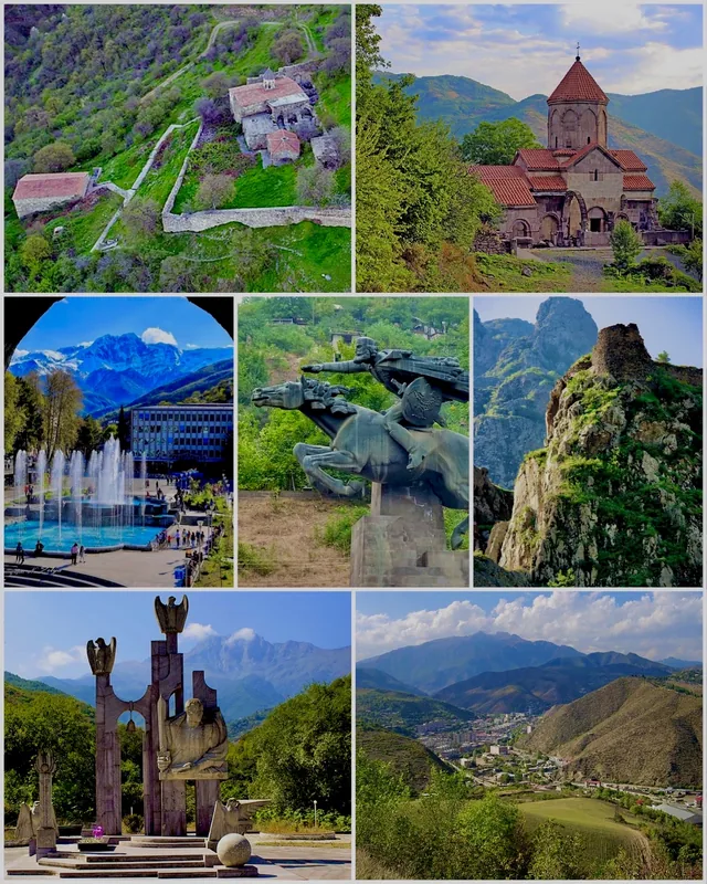
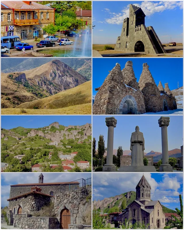
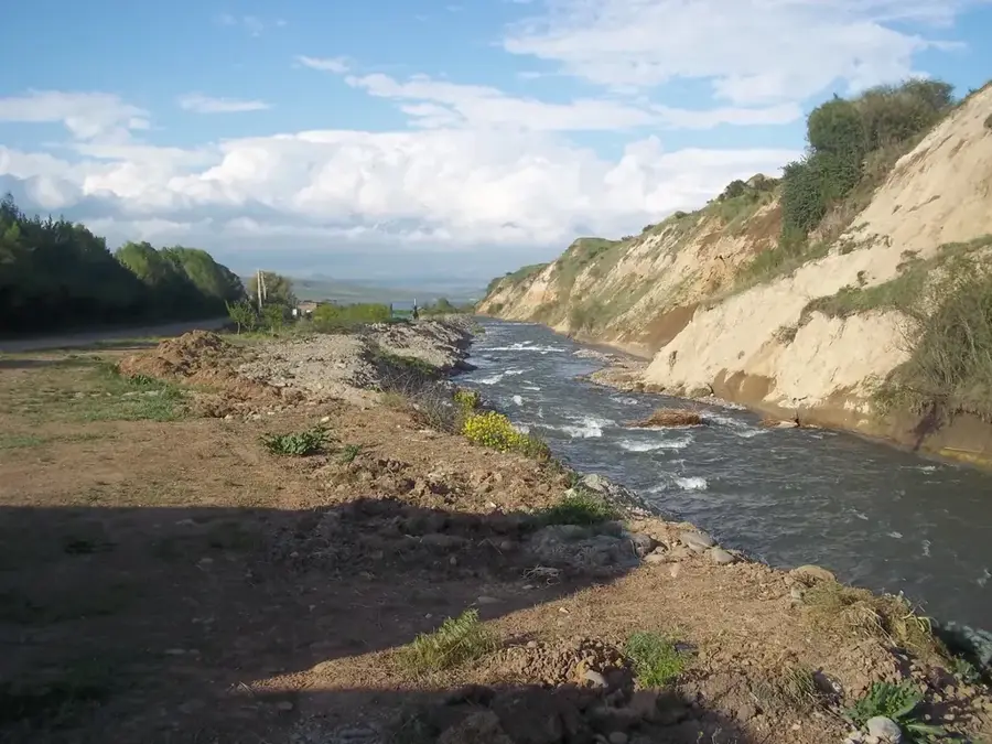
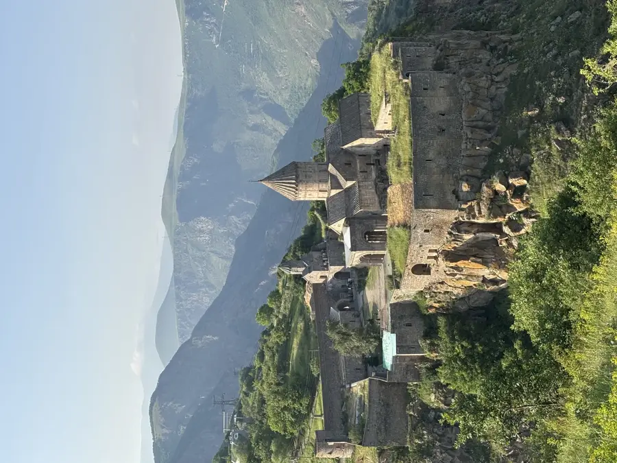
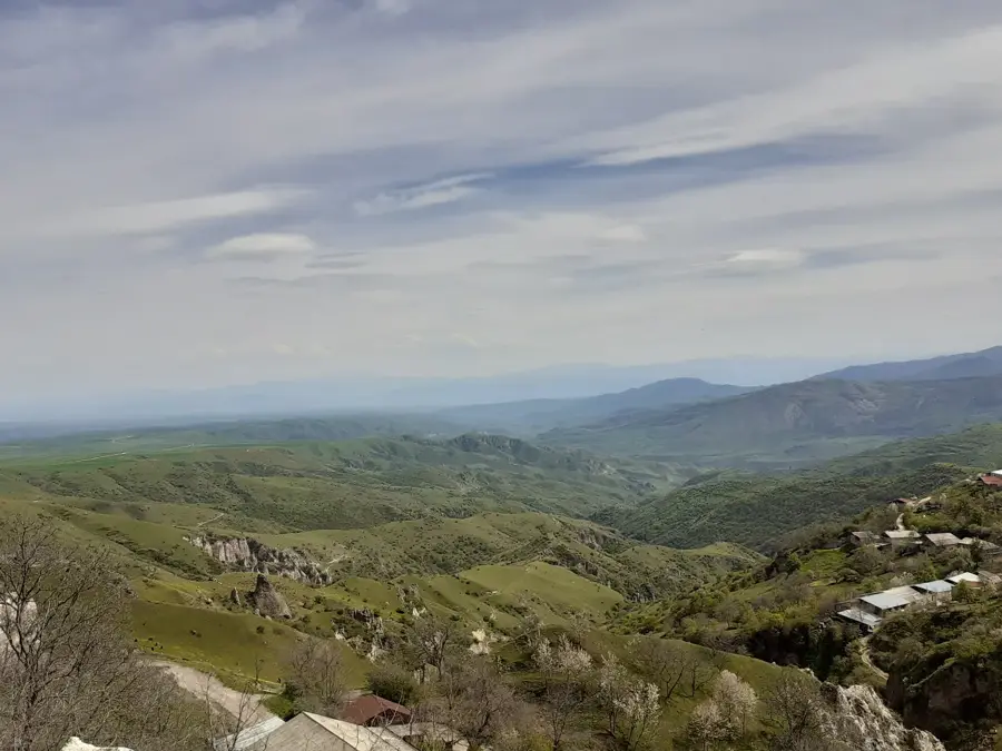
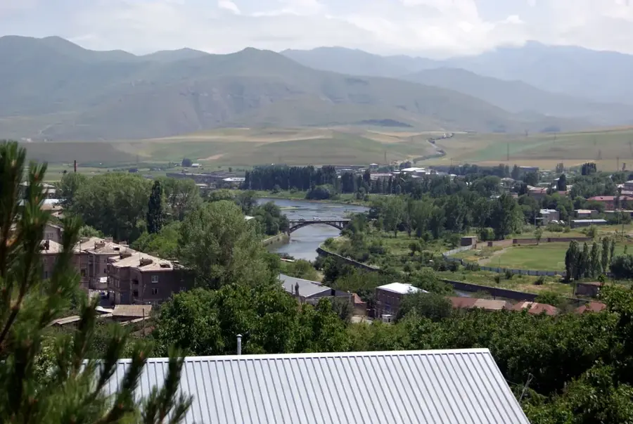
The Vorotan Gorge, located in the Syunik Province of southern Armenia, is one of the most dramatic natural landscapes in the Caucasus. Carved by the Vorotan River over millions of years, the gorge reaches depths of up to 800 meters, cutting through ancient volcanic rock and basalt plateaus. The area is a focal point of Armenian history and culture, most famously home to the Tatev Monastery, a 9th-century masterpiece that once served as a premier intellectual and spiritual hub. Deep within the canyon lies the 'Devil's Bridge' (Satani Kamurj), a natural travertine bridge formed by mineral-rich thermal springs over the river. The rugged terrain of the gorge provided a natural defense system for centuries, with many caves inhabited by hermits and villagers during times of war. Today, the gorge is spanned by the 'Wings of Tatev' aerial tramway, the world's longest non-stop double track cable car, offering a unique aerial perspective of this geological marvel.
- Location: Armenia
- Top sights: Petroskhach · Yerablur · Grate Qarablur
- Nearby: Tatev (Halidzor) (5 km)
Best time to visit & climate
The most pleasant time to visit is Jun–Aug.
| Jan | Feb | Mar | Apr | May | Jun | Jul | Aug | Sep | Oct | Nov | Dec | |
|---|---|---|---|---|---|---|---|---|---|---|---|---|
| Avg °C | -4 | -2 | 2 | 6 | 12 | 16 | 18 | 18 | 15 | 9 | 2 | -2 |
| Rain mm | 15 | 17 | 31 | 37 | 46 | 28 | 13 | 11 | 17 | 29 | 21 | 16 |
📋 Practical info
Geography
Facts
- The Vorotan Gorge reaches a maximum depth of approximately 800 meters.
- The Vorotan River spans 178 kilometers across the Armenian highlands.
- The 'Wings of Tatev' cable car was completed in October 2010.
- Tatev University was one of the most important medieval science centers.
- Devil's Bridge is a 30-meter wide natural travertine structure.
- The gorge area contains several 17th-century hermitage ruins.
Explore nearby
Notable places around
Route planner — Car & Motorhome
Where do you start? We build the route here, with stops and country notes along the way.
© OpenStreetMap contributors · OpenRouteService
Sights in the town Vorotan Gorge (8)
Sights nearby
Frequently asked questions
What is the Vorotan Gorge known for?
How much time do you need for the gorge?
Is the road through the gorge safe?
When is the best time to visit?
Are there good photo spots?
Vorotan Gorge: where is it located?
Vorotan Gorge: what is there to see?
Vorotan Gorge: when is the best time to visit?
Vorotan Gorge: why is it worth visiting?

Nearby cities
History & landmarks

Nature
More places