Plizio Visual Lab
Jebel Marra Highlands
Weather…
Water temperature…
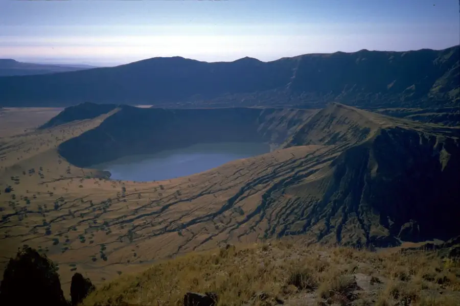
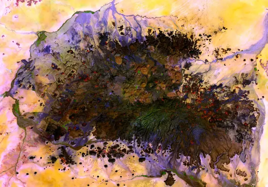
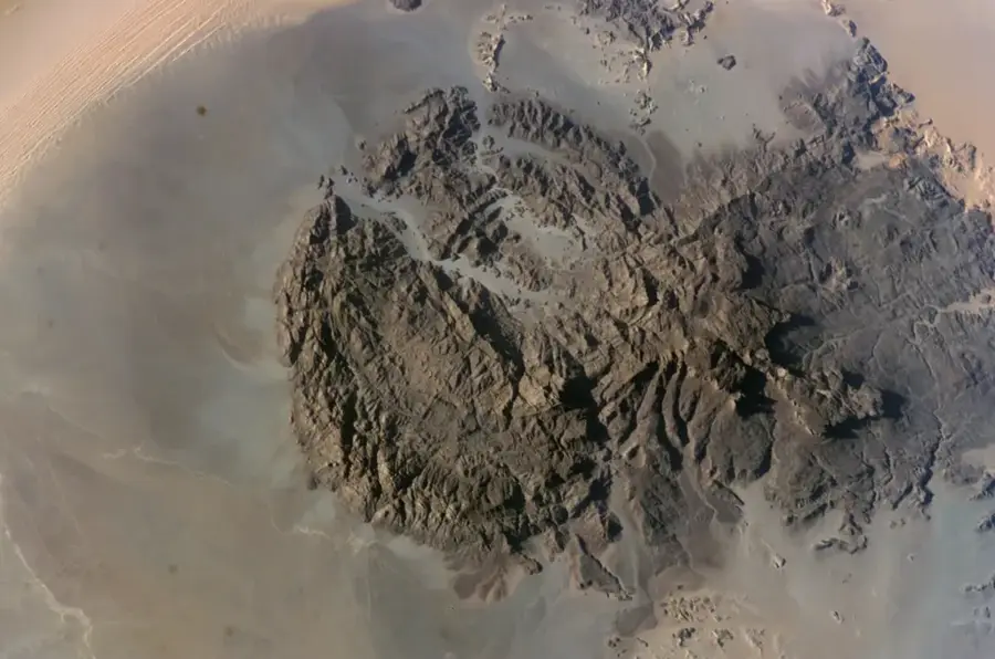
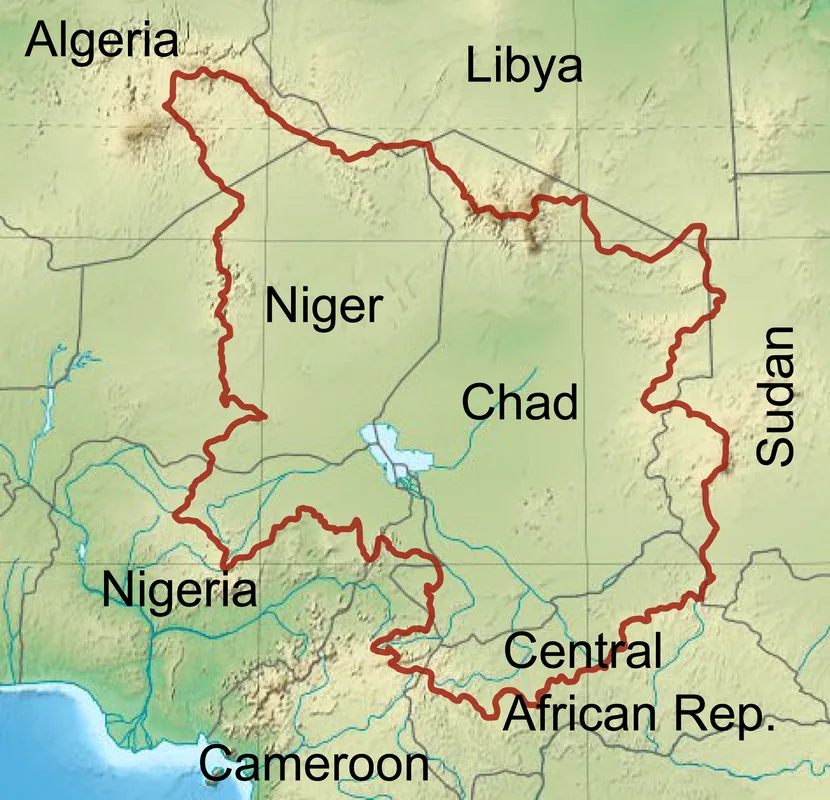
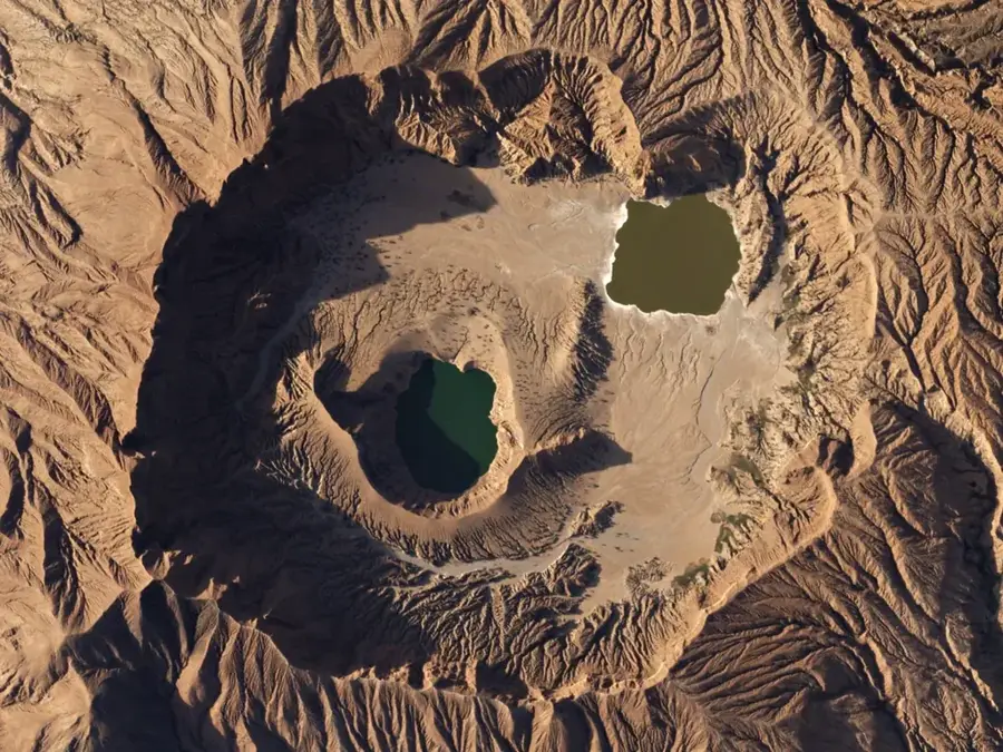
The Jebel Marra Highlands are a vast volcanic massif in the Darfur region of western Sudan. It covers an area of approximately 12,800 square kilometers and reaches an elevation of 3.042 meters at the Deriba Crater, making it the second highest elevation in the country. The region is characterized by a temperate climate and fertile volcanic soils, which enable intensive agriculture of fruits, vegetables, and grains. The central feature is the Deriba Caldera, which formed after a massive eruption about 3,500 years ago and now houses two crater lakes. The highlands function as an important water reservoir for the surrounding dry plains, feeding numerous wadis that extend far into Chad and Sudan. Culturally, Jebel Marra is the historical heartland of the Fur people and was the center of the Sultanate of Darfur for centuries. The landscape diversity ranges from alpine meadows to tropical plantations in the lower valleys.
Best time to visit & climate
The most pleasant time to visit is Feb, Mar, Nov.
| Jan | Feb | Mar | Apr | May | Jun | Jul | Aug | Sep | Oct | Nov | Dec | |
|---|---|---|---|---|---|---|---|---|---|---|---|---|
| Avg °C | 18 | 21 | 24 | 26 | 27 | 26 | 24 | 22 | 23 | 23 | 20 | 18 |
| Rain mm | 0 | 0 | 0 | 1 | 20 | 33 | 164 | 216 | 66 | 26 | 0 | 0 |
📋 Practical info
Geography
Facts
- The Deriba Crater is the highest point at 3,042 meters.
- The Deriba Caldera has a diameter of approximately 5 kilometers.
- The volcano is considered dormant; the last eruption was around 1500 BC.
- Jebel Marra receives up to 800 mm of rainfall per year.
- The mountains are the home of the Fur ethnic group.
- Two permanent lakes (one salt and one freshwater) are located in the caldera.
Explore nearby
Notable places around
Route planner — Car & Motorhome
Where do you start? We build the route here, with stops and country notes along the way.
© OpenStreetMap contributors · OpenRouteService
Sights nearby
Frequently asked questions
Is Jebel Marra safe for tourists?
What is special about these highlands?
Is there a tourist center there?
What is the region known for?
What is nearby?
Jebel Marra Highlands: where is it located?
Jebel Marra Highlands: when is the best time to visit?
Jebel Marra Highlands: why is it worth visiting?

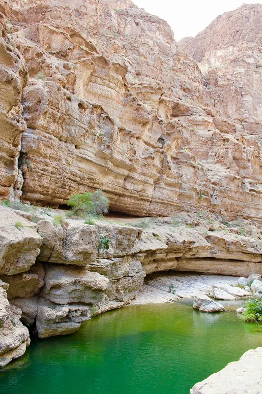
Nature
More places