Plizio Visual Lab
Caminito del Rey
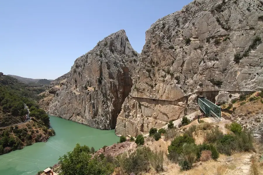
The Caminito del Rey (King's Little Path) is a world-renowned, adrenaline-inducing walkway in the Andalusian province of Málaga, clinging to the vertical walls of the Gaitanes Gorge (Desfiladero de los Gaitanes). Originally constructed between 1901 and 1905 to provide workers access between two hydroelectric power plants, the path hovers nearly 100 meters above the Guadalhorce River. Over the decades, it fell into severe disrepair, earning a notorious reputation as the world's most dangerous walkway. Following a massive restoration project, it was safely reopened to the public in 2015. Today, the newly constructed wooden boardwalks, securely pinned to the sheer limestone cliffs, offer visitors a thrilling yet safe journey through the gorge. The geology of the canyon is spectacular, narrowing to just 10 meters across in some sections while dropping hundreds of meters deep. The sheer cliffs are also an important habitat for large birds of prey, providing excellent opportunities to spot griffon vultures and golden eagles soaring above.
- Location: Galicia, Spain
- Top sights: Bobastro · Mirador del Embalses · Garganta del Chorro
- Nearby: Antequera (22 km)
Best time to visit & climate
The most pleasant time to visit is May, Jun, Sep.
| Jan | Feb | Mar | Apr | May | Jun | Jul | Aug | Sep | Oct | Nov | Dec | |
|---|---|---|---|---|---|---|---|---|---|---|---|---|
| Avg °C | 8 | 9 | 11 | 14 | 18 | 23 | 26 | 26 | 22 | 18 | 12 | 9 |
| Rain mm | 53 | 55 | 71 | 53 | 28 | 4 | 1 | 3 | 27 | 68 | 78 | 71 |
📋 Practical info
Geography
Facts
- Suspended approximately 100 meters above the Guadalhorce River
- Original construction took place between 1901 and 1905
- King Alfonso XIII walked the path in 1921, giving it its name
- Safely reopened to the public in 2015 after a multi-million euro restoration
- The total length of the linear hiking route is nearly 8 kilometers
- The Gaitanes Gorge narrows to a width of just 10 meters in some sections
- The modern wooden boardwalks are anchored directly into the limestone cliffs
Explore nearby
Notable places around
Route planner — Car & Motorhome
Where do you start? We build the route here, with stops and country notes along the way.
© OpenStreetMap contributors · OpenRouteService
Sights in the town Caminito del Rey (5)
Sights nearby
Frequently asked questions
Do you need to book tickets in advance?
Is the path dangerous?
How long does the hike take?
Is there an age limit?
Do you have to wear a helmet?
Caminito del Rey: where is it located?
Caminito del Rey: what is there to see?
Caminito del Rey: when is the best time to visit?
Caminito del Rey: why is it worth visiting?

Nearby cities