Plizio Visual Lab
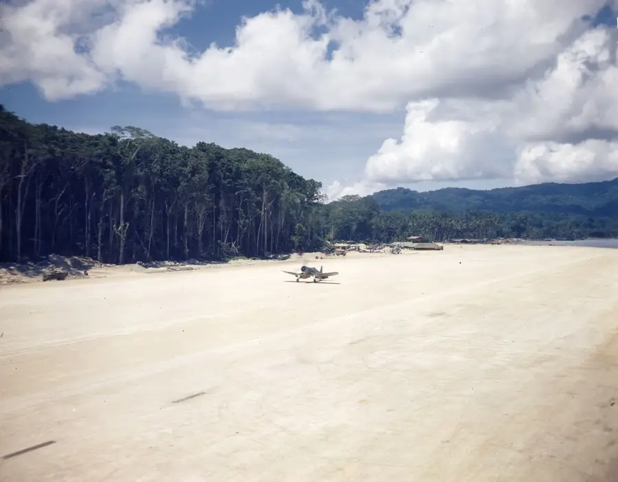
Barakoma Airfield
Weather…
Water temperature…
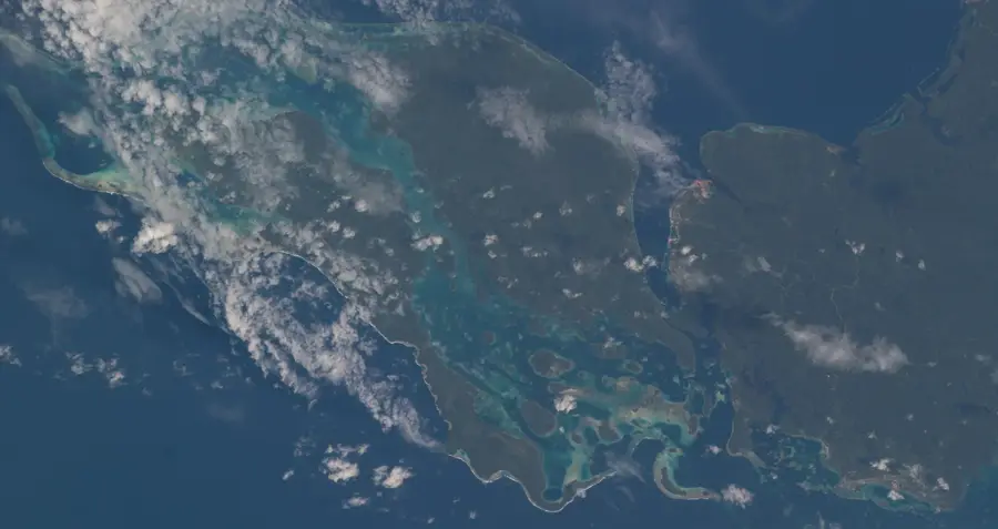
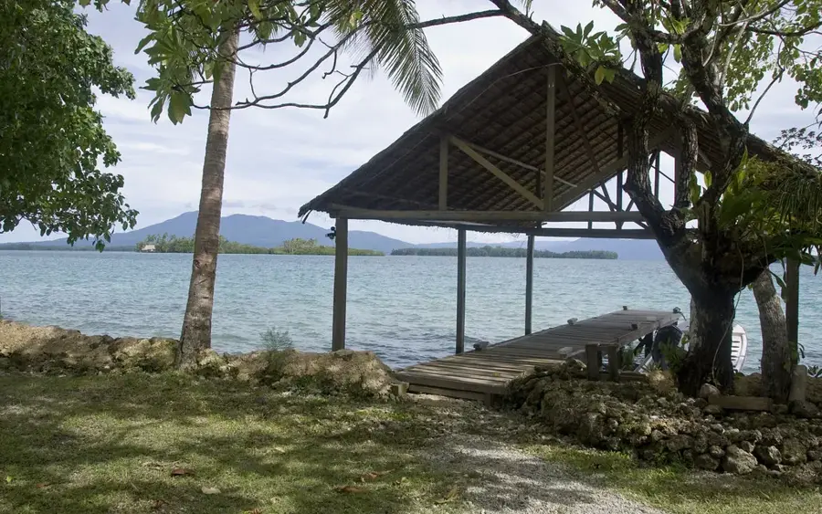
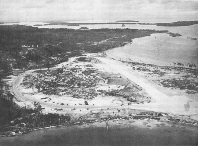
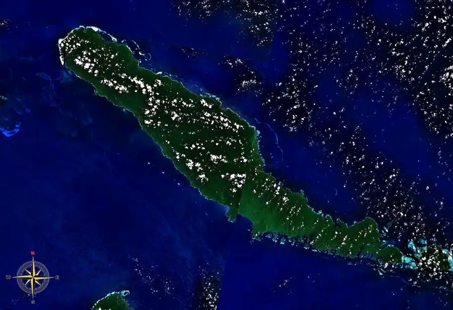
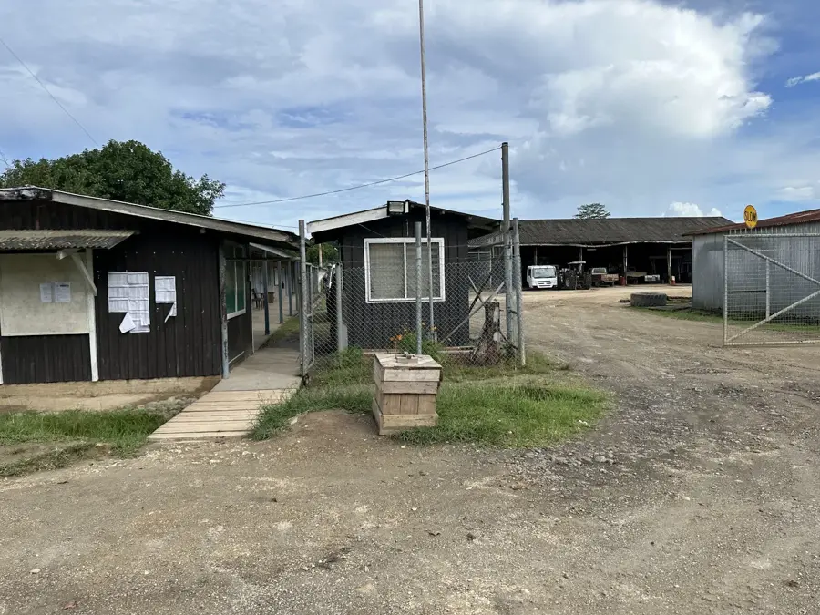
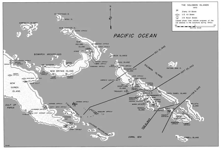
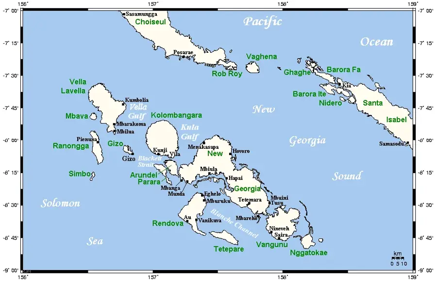
Barakoma Airfield on Vella Lavella Island was a remarkable feat of combat engineering by U.S. Navy Seabees during World War II. Following the Allied landings in August 1943, the 58th Naval Construction Battalion began clearing the dense jungle on the island's southeastern coast. In an astonishing ten days, they completed a functional coral-surfaced runway capable of hosting fighter aircraft. Barakoma Field played a vital role in supporting Allied air operations against Japanese positions on Kolombangara and Bougainville, offering a forward base that significantly reduced flight times. The airfield was home to various distinguished units, including U.S. Marine Corps fighter squadrons and the Royal New Zealand Air Force (RNZAF). Its strategic location allowed for continuous combat air patrols over the central Solomon Islands. After the war, the airfield was abandoned and reclaimed by the jungle; today, only remnants of the runway and scattered wartime artifacts remain as evidence of its past military activity.
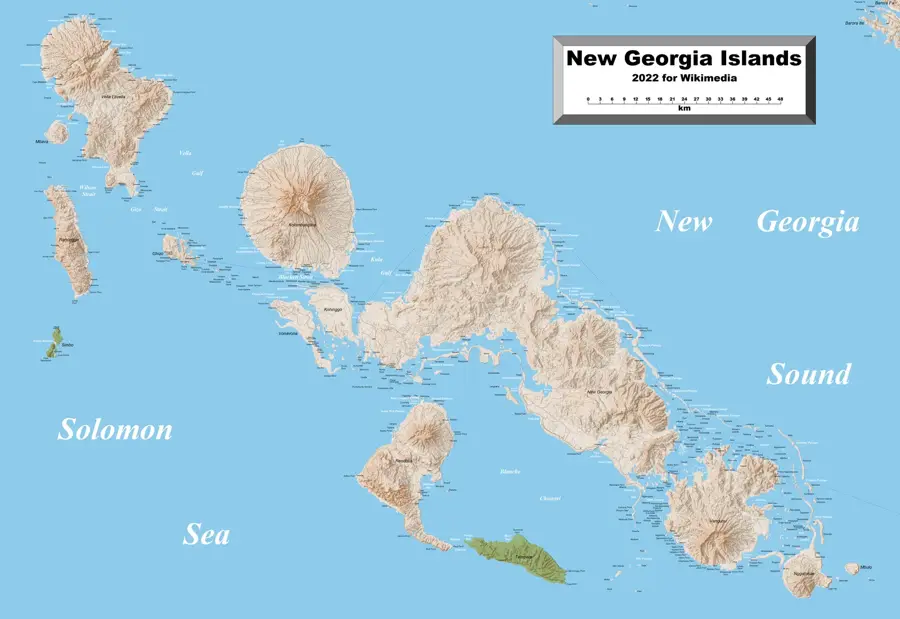
- Location: Solomon Islands
- Nearby: Maru (28 km)
Best time to visit & climate
The most pleasant time to visit is Oct–Dec.
| Jan | Feb | Mar | Apr | May | Jun | Jul | Aug | Sep | Oct | Nov | Dec | |
|---|---|---|---|---|---|---|---|---|---|---|---|---|
| Avg °C | 29 | 28 | 28 | 28 | 29 | 28 | 28 | 28 | 28 | 28 | 28 | 29 |
| Rain mm | 325 | 343 | 311 | 271 | 319 | 325 | 342 | 294 | 282 | 276 | 233 | 228 |
📋 Practical info
Geography
Facts
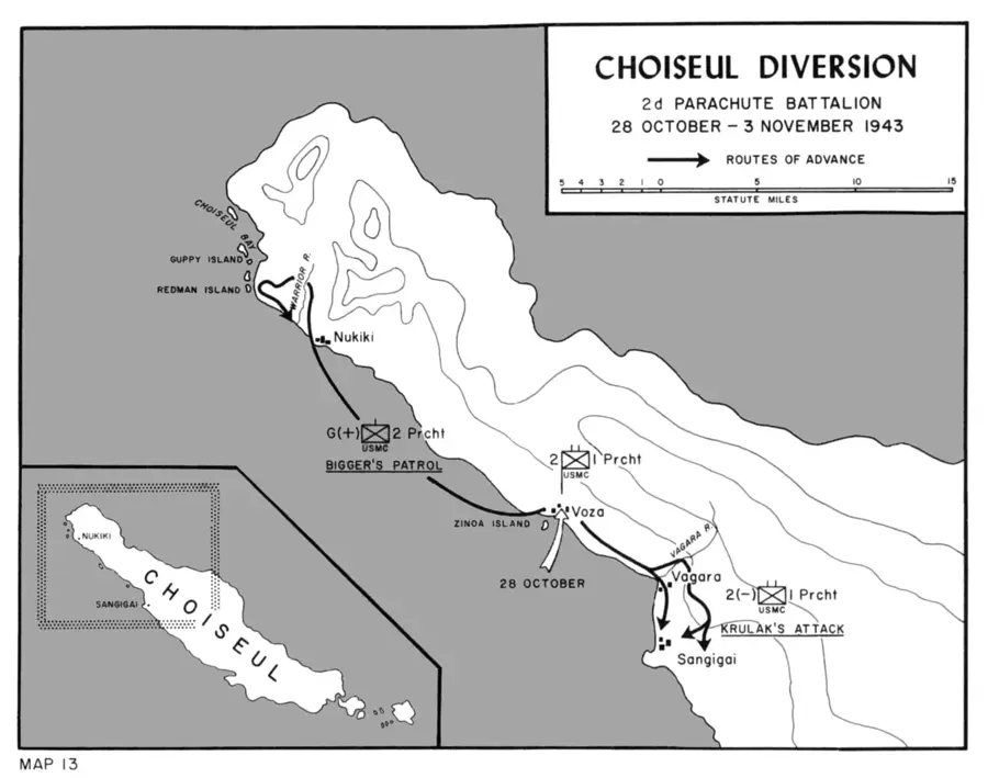
- Construction of the airfield began on August 15, 1943, during the initial landings.
- The original runway was approximately 3,500 feet long and surfaced with coral.
- The Royal New Zealand Air Force’s No. 15 Squadron was based at Barakoma.
- The airfield faced nearly daily Japanese air raids during its first few weeks of operation.
- Barakoma served as a vital emergency landing strip for planes damaged over Kolombangara.
- Within two months, the facility was expanded to include over 100 aircraft revetments.
Explore nearby
Notable places around
Route planner — Car & Motorhome
Where do you start? We build the route here, with stops and country notes along the way.
© OpenStreetMap contributors · OpenRouteService
Sights nearby
Frequently asked questions
Is Barakoma Airfield public?
What can you see there?
Do you need permission to enter?
Is the site accessible?
How much time should you plan for?
Barakoma Airfield: where is it located?
Barakoma Airfield: when is the best time to visit?
Barakoma Airfield: why is it worth visiting?

Nearby cities


History & landmarks

Nature
More places