Plizio Visual Lab
Tete
ℹ️Practical info — Tete
▾
🌤 Weather — 5 days
📍 Nearby
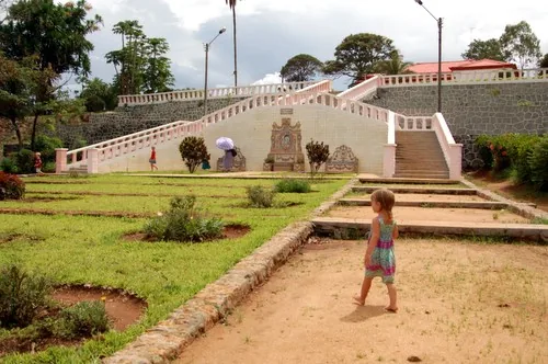
Sights nearby
💡 Tips
- Tete is one of the hottest places in Mozambique; avoid strenuous walks during the peak afternoon heat.
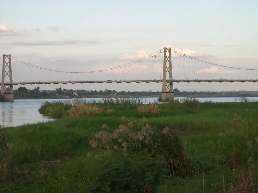
- The Samora Machel Bridge over the Zambezi River is a key landmark, but walking across can be exhausting; crossing by car or chapa (minibus) is much easier.
- Chapas are the main local transport, but keep in mind they only depart when completely full.
- Bring plenty of mosquito repellent, especially for the evenings when staying near the river.
🍽 Food
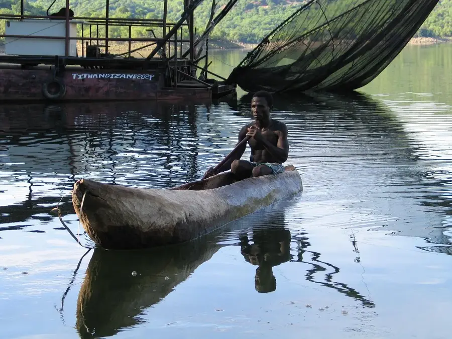
Fresh river fish, typically grilled or fried, served at riverside restaurants.
Cassava leaves cooked in a rich peanut sauce, a Mozambican staple.
Spicy grilled chicken, widely available in casual local eateries.
🛍 Shopping · 🧘 Quiet spots
The bustling main market for fresh produce, bright capulanas (fabrics), and everyday goods.
Look for informal vendors selling carved wooden curios near the riverbanks.
Find a shaded spot at a local riverside lodge or café to watch the sunset.
A historic Jesuit mission located outside the city center, offering a quiet, historical atmosphere.
Water temperature…
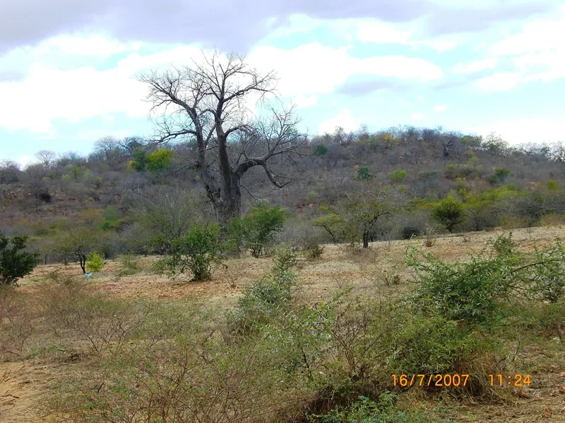
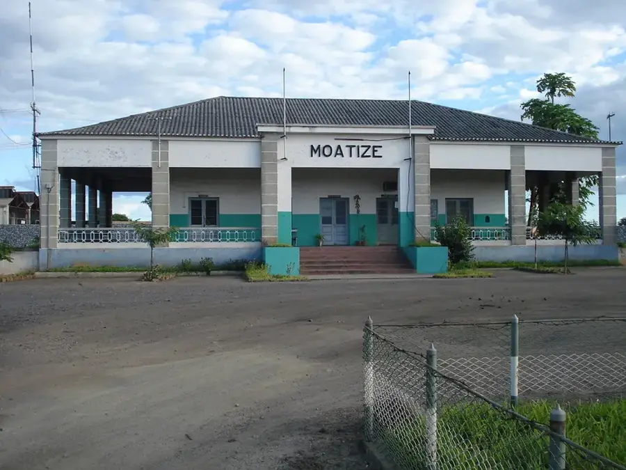
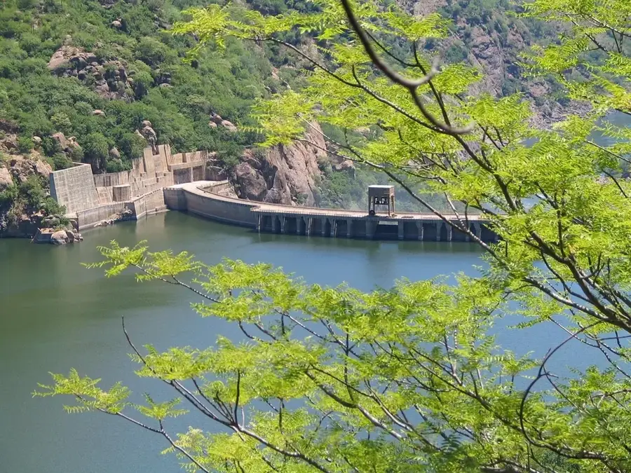
Tete is a historic and strategically vital city located on the banks of the mighty Zambezi River in northwestern Mozambique. Serving as the capital of Tete Province, it is one of the oldest European settlements in East Africa, established by the Portuguese in 1531. Long before then, it was a thriving Swahili trade center for gold and ivory. Tete is notoriously known as the 'hot house' of Mozambique, situated in a valley where temperatures frequently soar above 110°F (43°C). The city's geography is defined by its relationship with the Zambezi, crossed by the iconic Samora Machel Bridge, a suspension bridge that serves as a critical link in the regional highway network connecting Zimbabwe, Malawi, and the Mozambican coast. In the 21st century, Tete has transformed into a global mining frontier following the discovery of some of the world's largest metallurgical coal deposits in nearby Moatize. This 'coal rush' led to rapid urban growth, an influx of international companies, and a significant expansion of the city's hospitality and logistics sectors. Beyond mining, the city is a major player in the regional energy market due to its proximity to the Cahora Bassa Dam, one of Africa's largest hydroelectric plants. The local culture is primarily Nyungwe, whose language and artistic expressions, such as traditional dances and pottery, are celebrated throughout the province. The landscape around Tete is iconic for its giant baobab trees and rugged hills. Educationally, the city hosts several vocational institutes specializing in engineering and geology. Despite the harsh climate and industrial dust, Tete remains a dynamic engine for Mozambique's economy, blending its centuries-old heritage as a river crossing with its modern role as an industrial powerhouse.
- Location: Mozambique
- Top sights: Estádio do Chingale · Fort São Tiago Maior · Tete, Mozambique
- Nearby: Moatize (15 km)
- Population: ~357.000 (2026)
Best time to visit & climate
The most pleasant time to visit is May–Jul.
| Jan | Feb | Mar | Apr | May | Jun | Jul | Aug | Sep | Oct | Nov | Dec | |
|---|---|---|---|---|---|---|---|---|---|---|---|---|
| Avg °C | 27 | 26 | 26 | 25 | 23 | 21 | 21 | 24 | 27 | 30 | 30 | 28 |
| Rain mm | 232 | 173 | 113 | 26 | 9 | 8 | 15 | 3 | 5 | 10 | 71 | 187 |
Geography
Facts
- Tete is the hottest city in Mozambique with a record high of 47°C.
- The city's first municipality was established in 1761.
- The Zambezi River flows at a rate of over 3,000 cubic meters per second here.
- Tete serves as a major hub for the 'Beira Corridor' logistics route.
- The city is home to the Unizambeze University headquarters.
- Mining contributes over 30% to the GDP of the Tete province.
- The Samora Machel Bridge is depicted on various Mozambican postage stamps.
- The local Nyungwe language is spoken by over 400,000 people in the region.
Explore nearby
Notable places around
Route planner — Car & Motorhome
Where do you start? We build the route here, with stops and country notes along the way.
© OpenStreetMap contributors · OpenRouteService
Sights in the town Tete (3)
Frequently asked questions
What kind of place is Tete?
Can one visit the city as a tourist?
How hot is it there?
What can you do nearby?
Are there hotels?
Tete: where is it located?
Tete: what is there to see?
Tete: when is the best time to visit?
Tete: why is it worth visiting?

Nearby cities
History & landmarks
More places