Plizio Visual Lab
Tintane
ℹ️Practical info — Tintane
▾
🌤 Weather — 5 days
📍 Nearby
Sights nearby
💡 Tips
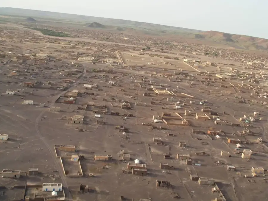
- Understand the layout: Much of the town was rebuilt on higher ground as 'New Tintane' after a major flood in 2007.
- Travel stopover: Tintane is a practical place to spend the night while traveling along the Route de l'Espoir.
- Safety advice: Avoid driving at night, as the town is relatively close to the Malian border zones.
- Checkpoint prep: Keep plenty of passport copies (fiches) ready for the frequent military checkpoints in the region.
- Stock up: This is a major trade hub; refill your water and fuel supplies before heading further east.
🍽 Food
A hearty peanut-based meat stew often found in the small eateries near the main commercial area.
Buy a bag of fresh or dried dates from roadside vendors as a healthy snack for the long drive.
Local bakers produce warm bread every morning, excellent for a simple breakfast before hitting the road.
🛍 Shopping · 🧘 Quiet spots
As a merchant town, Tintane gives a wide variety of textiles and Saharan household goods.
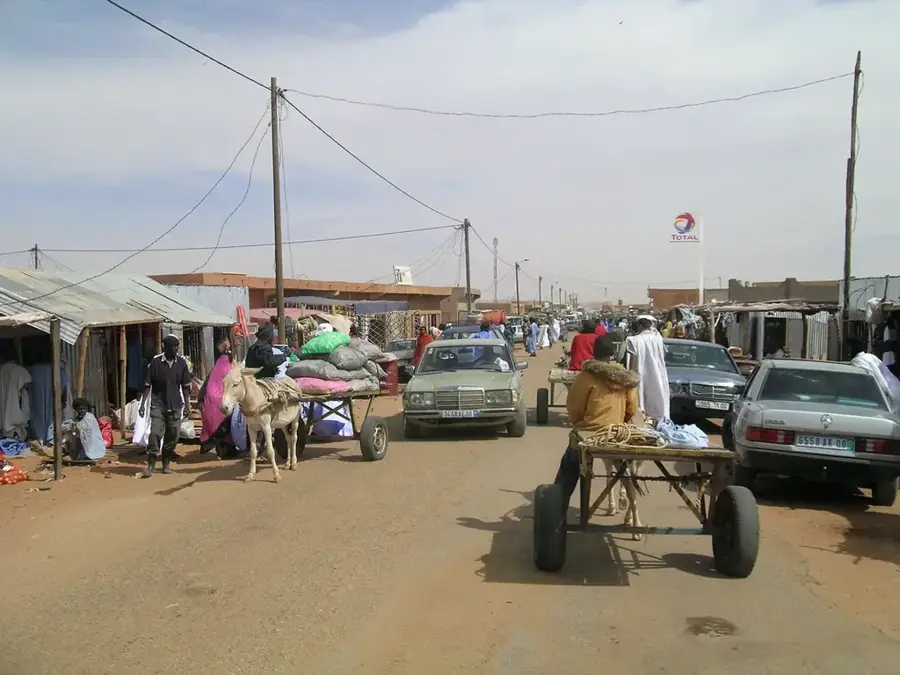
A fascinating place to witness the traditional trade of goats and camels in an authentic setting.
Take a walk at sunrise to the edge of the new town where the Saharan dunes begin to rise.
Away from the main transit road, the newer residential areas offer quiet streets for a relaxed stroll.
Water temperature…
Tintane is a significant urban center in the Hodh El Gharbi region of eastern Mauritania, serving as one of the country's most vital commercial crossroads. The city is renowned for its bustling livestock market, which is one of the largest in the Sahel, where traders gather to exchange camels, cattle, and goats. Geographically, Tintane sits along the essential transit route connecting the capital, Nouakchott, with the eastern territories and the border with Mali. In 2007, the city faced a major catastrophe when severe flooding destroyed much of its traditional center, leading to a massive government-led reconstruction and modernization effort. Today, Tintane stands as a symbol of resilience, maintaining its role as a key economic engine for the region despite the harsh desert environment. It provides an unfiltered glimpse into Saharan life, where the ancient traditions of nomadic pastoralists meet the demands of contemporary trans-regional trade.
- Location: Mauritania
- Nearby: Boumdeid Trading Post (66 km)
- Population: ~15.684 (2024)
Best time to visit & climate
The most pleasant time to visit is Jan, Feb, Dec.
| Jan | Feb | Mar | Apr | May | Jun | Jul | Aug | Sep | Oct | Nov | Dec | |
|---|---|---|---|---|---|---|---|---|---|---|---|---|
| Avg °C | 21 | 24 | 28 | 32 | 35 | 35 | 31 | 29 | 29 | 29 | 26 | 22 |
| Rain mm | 0 | 1 | 0 | 0 | 5 | 26 | 91 | 153 | 81 | 18 | 1 | 0 |
Geography
Facts
- population: approx. 10,000
- region: Hodh El Gharbi
- elevation: approx. 200 m
- distance to Mali: near
- main economy: livestock
- water supply: limited
Explore nearby
Notable places around
Route planner — Car & Motorhome
Where do you start? We build the route here, with stops and country notes along the way.
© OpenStreetMap contributors · OpenRouteService
Frequently asked questions
What is special about Tintane?
What is the atmosphere like?
What can you see in Tintane?
Is a 4x4 necessary?
When is the best time to travel?
Tintane: where is it located?
Tintane: when is the best time to visit?
Tintane: why is it worth visiting?

Nearby cities