Plizio Visual Lab
Ayoun el Atrous Valley

Weather…
Water temperature…
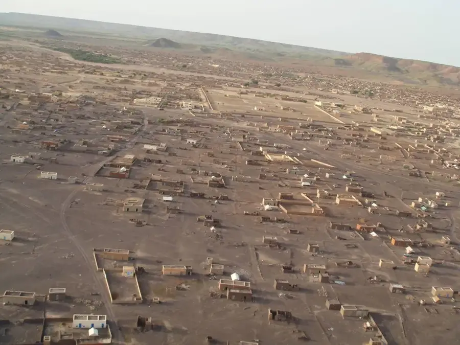
The Ayoun el Atrous Valley, situated in the eastern Hodh region of Mauritania, is a distinctive geographical depression that serves as a life-giving oasis amidst the Sahara's harsh environment. Part of the expansive Taoudenni Basin, the valley's sedimentary structure allows it to act as a natural catchment area for seasonal rainfall. When the brief rainy season concludes, the flat terrain transforms into a lush, green grassland, providing essential nutrients for the livestock of local nomadic communities. For centuries, this valley has been a critical hub for pastoralists, where herds of camels, goats, and cattle gather to graze. The landscape is marked by wide, sandy horizons and subtle rocky outcrops that reveal the region's geological history. Visiting this remote valley gives a unique window into the traditional Sahelian way of life, where human existence is intricately tied to the availability of seasonal water and the ancient rhythms of nomadic migration across the vast desert plains.
- Location: Mauritania
- Nearby: Aïoun (7 km)
Best time to visit & climate
The most pleasant time to visit is Jan, Feb, Dec.
| Jan | Feb | Mar | Apr | May | Jun | Jul | Aug | Sep | Oct | Nov | Dec | |
|---|---|---|---|---|---|---|---|---|---|---|---|---|
| Avg °C | 21 | 24 | 28 | 32 | 35 | 35 | 32 | 30 | 30 | 30 | 26 | 22 |
| Rain mm | 0 | 1 | 0 | 0 | 5 | 24 | 84 | 152 | 75 | 17 | 1 | 0 |
📋 Practical info
Geography
Facts
- Capital of Hodh El Gharbi
- Key stop on the Route de l'Espoir
- Characterized by quartzite rocks
- Elevation approx. 260 meters
- Sandstorms common in spring
- Traditional caravan base
Explore nearby
Notable places around
Route planner — Car & Motorhome
Where do you start? We build the route here, with stops and country notes along the way.
© OpenStreetMap contributors · OpenRouteService
Sights nearby
Frequently asked questions
Is the valley used for agriculture?
How to get to the valley?
Is there a town nearby?
Best time to visit?
Are there markets?
Ayoun el Atrous Valley: where is it located?
Ayoun el Atrous Valley: when is the best time to visit?
Ayoun el Atrous Valley: why is it worth visiting?

Nearby cities