Plizio Visual Lab
Ankarana Karst
Weather…
Water temperature…
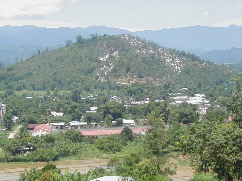
The Ankarana Massif in northern Madagascar is one of the world's most striking karst landscapes, famous for its needle-sharp limestone formations known as tsingy. This geological marvel was formed during the Jurassic period, approximately 150 million years ago, through the erosion of ancient coral reefs and limestone plateaus. The protected area encompasses an extensive system of caves, deep canyons, and underground rivers, many of which are considered sacred by the local Antakarana people. The region's biodiversity is exceptional, hosting eleven species of lemurs and various endemic birds within its dry deciduous forests. Vegetation has uniquely adapted to the harsh rocky environment, often thriving in the humid microclimates found at the bottom of steep fissures. Ankarana serves as both a significant geological site and a vital ecological sanctuary, preserving a landscape that has remained largely unchanged for millennia.
- Location: Madagascar
- Top sights: Tsingy · Ankarana l Reserve · Tsingy Rary
- Nearby: Ambilobe (23 km)
Best time to visit & climate
The most pleasant time to visit is Jul–Sep.
| Jan | Feb | Mar | Apr | May | Jun | Jul | Aug | Sep | Oct | Nov | Dec | |
|---|---|---|---|---|---|---|---|---|---|---|---|---|
| Avg °C | 28 | 28 | 28 | 28 | 27 | 26 | 25 | 25 | 26 | 27 | 28 | 28 |
| Rain mm | 238 | 201 | 170 | 57 | 21 | 9 | 7 | 4 | 5 | 9 | 37 | 143 |
📋 Practical info
Geography
Facts
- The limestone was deposited approximately 150 million years ago during the Jurassic.
- Ankarana's underground rivers are home to rare cave-dwelling crocodiles.
- The extensive cave system measures more than 100 kilometers in total length.
- The reserve was officially established as a protected area in 1956.
- Royal tombs of the Antakarana people are hidden within the sacred cave passages.
- The sharp pinnacles are formed by heavy tropical rainfall eroding the limestone surface.
Explore nearby
Notable places around
Route planner — Car & Motorhome
Where do you start? We build the route here, with stops and country notes along the way.
© OpenStreetMap contributors · OpenRouteService
Sights in the town Ankarana Karst (5)
Sights nearby
Frequently asked questions
Is Ankarana-Karst wheelchair accessible?
How long does a cave tour take?
Do I have to pay an entrance fee?
Is photography allowed in the caves?
What is the best time of day to visit?
Ankarana Karst: where is it located?
Ankarana Karst: what is there to see?
Ankarana Karst: when is the best time to visit?
Ankarana Karst: why is it worth visiting?

Nearby cities


History & landmarks
Nature
More places