Plizio Visual Lab
Bombetoka Bay

Weather…
Water temperature…
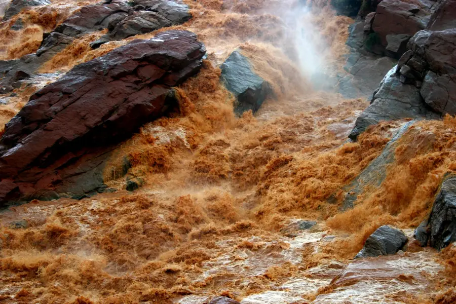
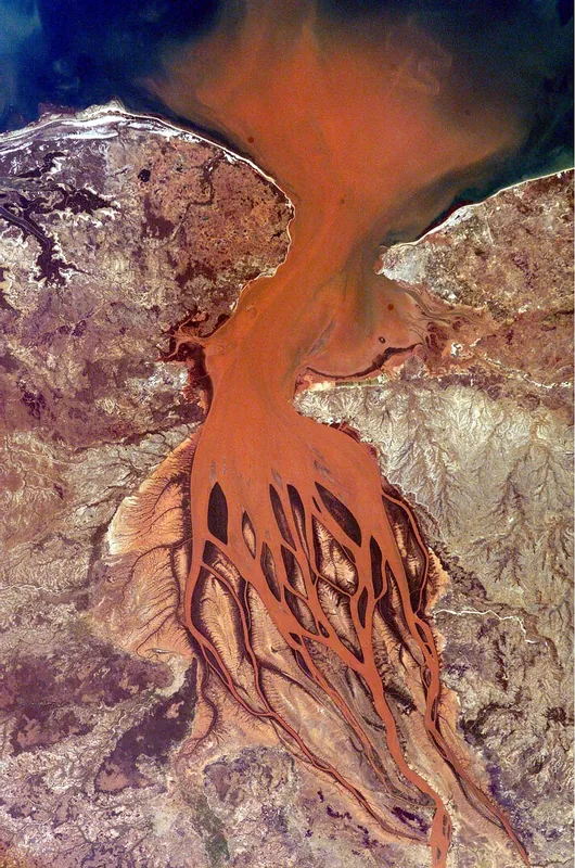
Bombetoka Bay is a vast estuary in northwestern Madagascar where the Betsiboka River meets the Mozambique Channel. It is renowned for its massive sediment deposits carried down from the central highlands, which give the bay its characteristic deep red color. This sedimentation has created numerous new islands and sandbanks over the decades that constantly shift their shape. The estuary hosts some of Madagascar's largest contiguous mangrove forests, which act as a buffer against coastal erosion and provide vital spawning grounds for fish and crustaceans. Geographically, the bay covers an area of approximately 300 square kilometers and is bordered by the port city of Mahajanga on its northern side. Historically, the bay was a significant hub for the slave trade and the export of agricultural products. Today, it is an important research area for geologists and ecologists studying the effects of inland deforestation on coastal morphology. The rich avifauna includes rare species such as the Madagascar ibis, which nests in the protected mangrove areas.
- Location: Madagascar
- Top sights: Village touristique · Plage du Village Touristique · Sôma Beach
- Nearby: Amborovy (5 km)
Best time to visit & climate
The most pleasant time to visit is Jun–Aug.
| Jan | Feb | Mar | Apr | May | Jun | Jul | Aug | Sep | Oct | Nov | Dec | |
|---|---|---|---|---|---|---|---|---|---|---|---|---|
| Avg °C | 28 | 28 | 28 | 28 | 27 | 25 | 25 | 25 | 26 | 27 | 28 | 28 |
| Rain mm | 470 | 281 | 204 | 70 | 18 | 15 | 18 | 11 | 11 | 27 | 108 | 225 |
📋 Practical info
Geography
Facts
- The bay is approximately 17 kilometers wide at its broadest point.
- The Betsiboka River carries millions of tons of sediment annually.
- The mangrove area of the bay is estimated at over 40,000 hectares.
- Significant morphological changes were documented in the bay in 2004.
- It is a major center for the export of shrimp.
- The bay is part of the Marovoay basin, a key rice-producing region.
Explore nearby
Notable places around
Route planner — Car & Motorhome
Where do you start? We build the route here, with stops and country notes along the way.
© OpenStreetMap contributors · OpenRouteService
Sights in the town Bombetoka Bay (9)
Petite Plage
A small sandy beach with calm water, convenient for relaxing.
Banja Toalaza
A theatre hosting local performances and cultural events.
Maison de la Culture
A cultural centre with exhibitions, workshops, and concerts.
Alliance Française de Mahajanga
A French cultural institute offering language courses and a library.
Porte Indo-Arabe
A historic gate recalling the Indo-Arab trade.
Sights nearby
Frequently asked questions
How do I get to Bombetoka Bay?
Is the bay suitable for families?
What is the best time to visit?
Are there dining options nearby?
Can I take photos there?
Bombetoka Bay: where is it located?
Bombetoka Bay: what is there to see?
Bombetoka Bay: when is the best time to visit?
Bombetoka Bay: why is it worth visiting?

Nearby cities

History & landmarks
Nature
More places