Plizio Visual Lab
Bourbon Plateau
Plizio editorial teamData Sources
Landmark
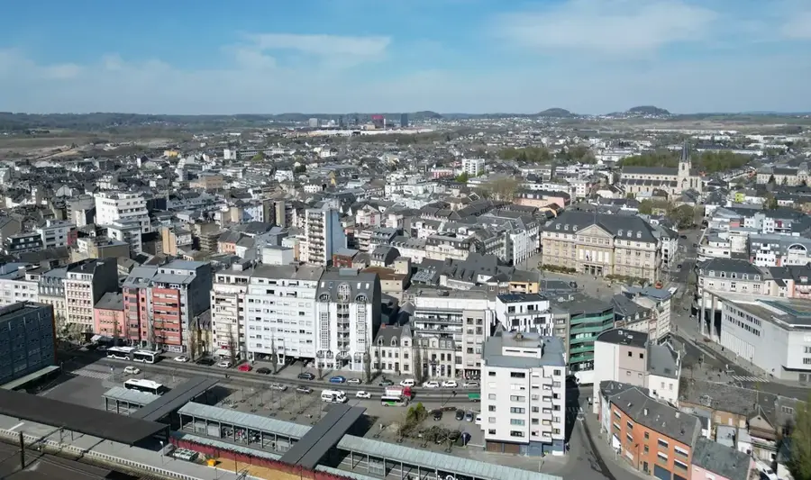
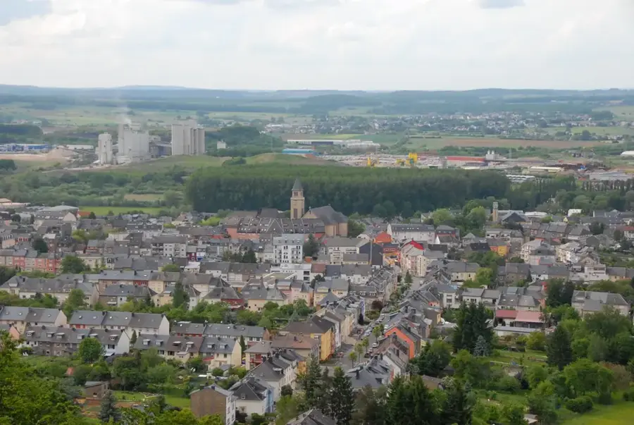
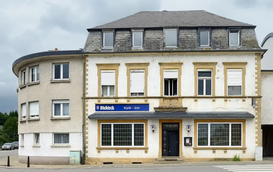
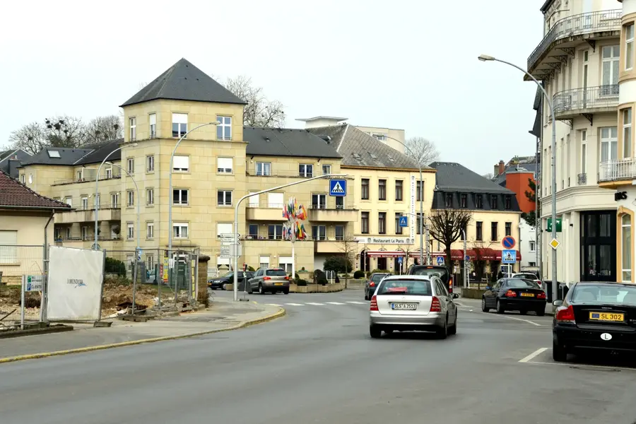
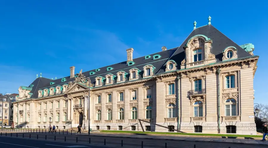
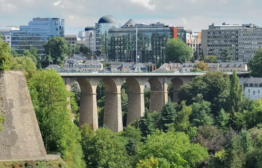
The Bourbon Plateau forms the southern part of Luxembourg City's upper town and is best known today as the district surrounding the central railway station. Geographically, it is separated from the historic old town by the deep Pétrusse valley, to which it is connected by the monumental Adolphe Bridge. The development of the plateau only began after the dismantling of the Luxembourg fortress in 1867 following the Treaty of London. The name is derived from the former Fort Bourbon, a defensive work of the fortress that was located on this site. The district's architecture is characterized by spacious boulevards and representative buildings in the historicist style, erected in the late 19th and early 20th centuries. Today, the plateau serves as a central economic hub, housing numerous banks, international corporations, and state institutions. It also forms the country's most important transport hub for rail and bus services.
- Location: Luxembourg
- Top sights: 1:1 · Sacred-Heart Church · Fort Élisabeth
- Nearby: Strassen (4 km)
Best time to visit & climate
The most pleasant time to visit is Jun–Aug.
| Jan | Feb | Mar | Apr | May | Jun | Jul | Aug | Sep | Oct | Nov | Dec | |
|---|---|---|---|---|---|---|---|---|---|---|---|---|
| Avg °C | 1 | 1 | 5 | 9 | 13 | 17 | 19 | 19 | 15 | 10 | 5 | 2 |
| Rain mm | 67 | 57 | 57 | 46 | 70 | 68 | 65 | 72 | 56 | 65 | 68 | 79 |
📋 Practical info
Visiting
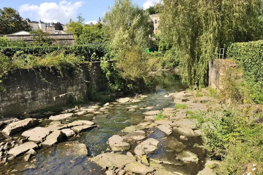
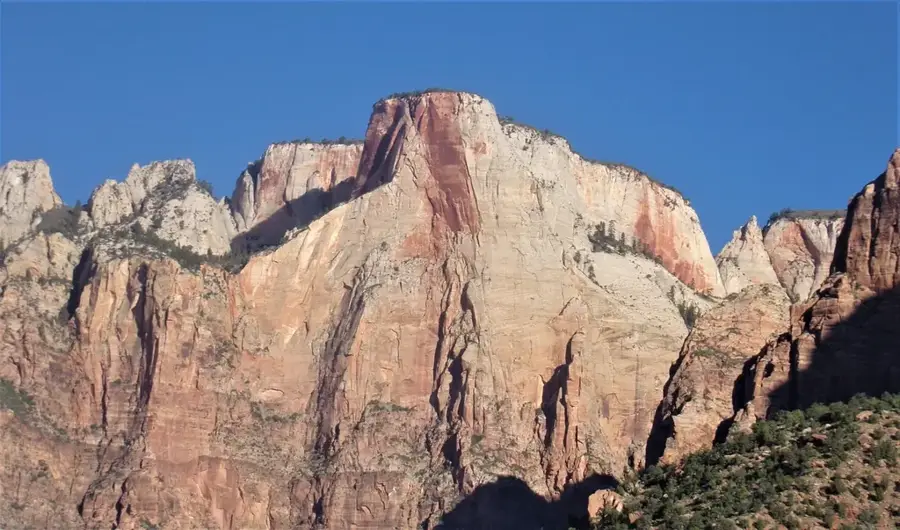
The Bourbon Plateau is a freely accessible sandstone plain that can be visited at any time. It lies south of the Pétrusse Valley and features nice views of the surroundings.
Typical hours
As an open area, the plateau is accessible around the clock. There are no opening hours since it is a public space.
Photography
Photography is allowed anytime without restrictions. Panoramic shots from the plateau, showing the railway district and the old town, are especially worthwhile.
Time needed
A visit to the Bourbon Plateau usually takes 20 to 30 minutes. Those wanting to enjoy the view and take photos should allow a bit more time.
Combine with
The plateau combines well with a walk through the Pétrusse Valley. The nearby railway district with its representative architecture is also worth a visit.
Getting there
From Luxembourg City center, the plateau is easily reached on foot in about 15 minutes. Alternatively, bus lines 2, 3, and 4 go to the stop „Rue Goethe”.
Insider tip
Come in the late afternoon when the light is particularly beautiful. From here you have an excellent view of the sunset over the city.
Geography
Facts
- The plateau was named after Fort Bourbon, which was expanded by Vauban in 1685.
- Development began in 1867 after the withdrawal of the Prussian garrison.
- The Adolphe Bridge (1903) was the world's largest stone arch bridge when it opened.
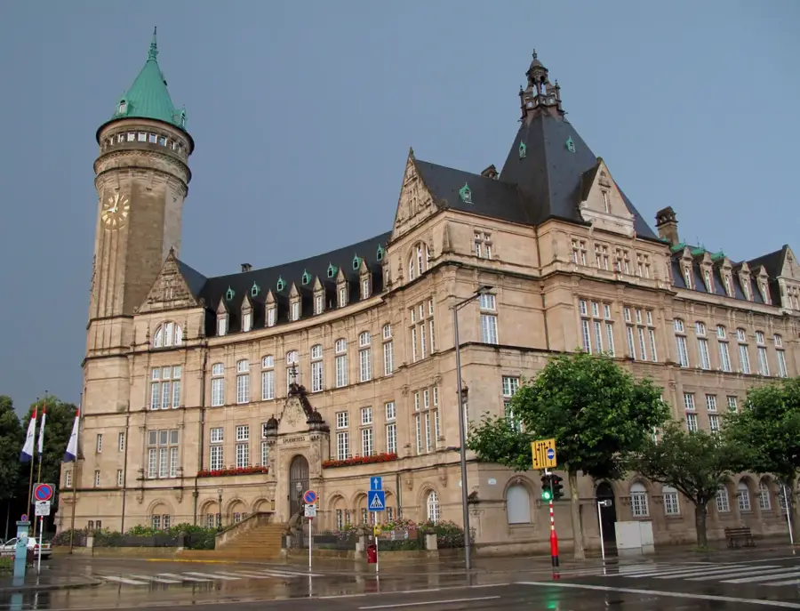
- The central railway station was built on the plateau in 1907 in Neo-Baroque style.
- Avenue de la Liberté is the central transport artery of the Bourbon Plateau.
- Numerous buildings of ARBED (now ArcelorMittal) are located in this district.
Explore nearby
Notable places around
Route planner — Car & Motorhome
Where do you start? We build the route here, with stops and country notes along the way.
Vehicle
Only stops with (optional):
© OpenStreetMap contributors · OpenRouteService
Sights in the town Bourbon Plateau (10)
Den Atelier
Den Atelier is a theatre in Luxembourg.
Fort Wedell
Fort Wedell is a fort in Luxembourg.
Fort Wallis
Fort Wallis is part of the Luxembourg Fortress.
Black Box
Black Box is a theatre in Luxembourg.
Parc Heintz🌳 park
Parc Heintz is a park in Luxembourg.
Rotondes
Cultural centre in two former railway roundhouses in Luxembourg City.
Sights nearby
Frequently asked questions
Where is Plateau Bourbon located?
In Luxembourg City, south of the Adolphe Bridge.
What characterizes its architecture?
Historicist style and grand 19th-century villas.
Can the district be explored on foot?
Yes, it features wide boulevards and flat sidewalks.
Are there any parks there?
Yes, the rose garden has relaxation in the greenery.
How is the connection to the train station?
The main train station is just a few minutes' walk away.
Bourbon Plateau: where is it located?
Bourbon Plateau is located in Luxembourg.
Bourbon Plateau: what is there to see?
Highlights include 1:1, Sacred-Heart Church, Fort Élisabeth.
Bourbon Plateau: when is the best time to visit?
The most pleasant time to visit is Jun, Aug.
Bourbon Plateau: why is it worth visiting?
The Bourbon Plateau forms the southern part of Luxembourg City's upper town and is best known today as the district surrounding the central railway station.

Explore with Plizio
Discover more places in Europe
More places in Luxembourg →
Nearby cities
Esch-sur-Alzette
The second largest city in Luxembourg is located in the southwest of the country.
Dudelange
Dudelange is located in the far south of the country, right on the border with France.
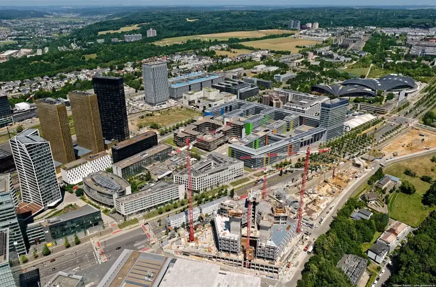
Kirchberg Financial District
The Kirchberg district is the economic heart of Luxembourg and one of the world's most important financial centers.
Schifflange
Schifflange is located in the canton of Esch-sur-Alzette and is a classic industrial municipality.

Walferdange
Walferdange is located north of the capital in the Alzette valley.
Bettembourg
Bettembourg is an important municipality in southern Luxembourg.
Strassen
Strassen is a wealthy municipality directly west of the capital.
Bertrange
Bertrange is a suburban municipality west of the capital.
Mamer
Mamer is located west of Luxembourg City and is one of the fastest-growing municipalities in the country.
Bascharage
Bascharage is part of the Käerjeng municipality in the southwest of the country.
Kayl
Kayl is located in southern Luxembourg in the canton of Esch-sur-Alzette.

Mersch
The geographical center of Luxembourg, located in the Valley of the Seven Castles, combining Roman history with modern infrastructure.
Schiplange
Schiplange is a village in the south of Luxembourg.
Mondercange
Mondercange is located in the southwest of the country and is a rapidly growing residential municipality.
Mondorf-les-Bains
Mondorf-les-Bains is a famous spa town in southeastern Luxembourg.
History & landmarks
Luxembourg City Hall
The neoclassical administrative building on Place Guillaume II is the hub of the capital's local government.
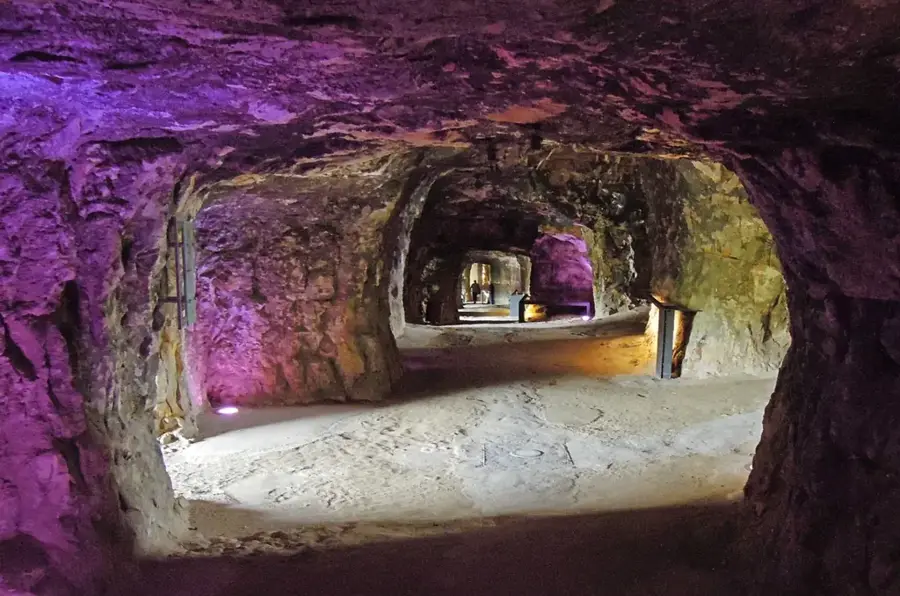
Petrusse Casemates
A vast system of underground tunnels and defensive fortifications in the rock above the Pétrusse valley.
Citadel of the Holy Spirit
The Citadel of the Holy Spirit was reinforced by the famous fortress builder Vauban in the 17th century after the French conquest.
More places
Petruss Park
This expansive park lies in the deep Petruss valley, directly below the city's fortress walls.
Pétrusse Valley
The Pétrusse Valley is a steep gorge in central Luxembourg City, separating the Upper Town from the railway station district with sandsto…
Passerelle (Old Bridge)
This historic viaduct, also known as the Old Bridge, spans the Pétrusse valley with 24 stone arches.
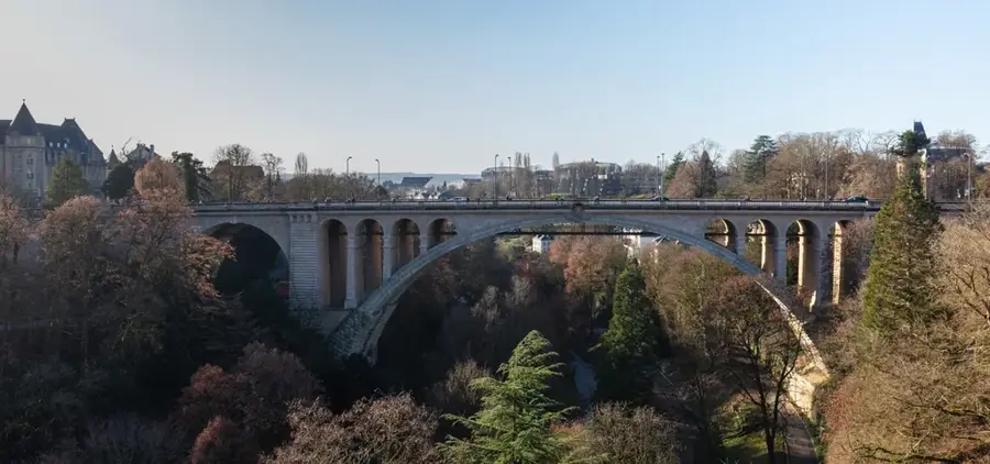
Adolphe Bridge
This iconic stone arch bridge connects Luxembourg's city center with the railway station district over the Pétrusse valley.
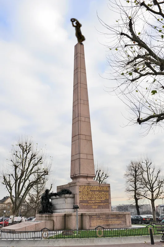
Gëlle Fra (Monument of Remembrance)
Gëlle Fra is a monument in Luxembourg City, originally erected in 1923 to commemorate volunteers of World War I.
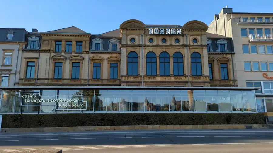
Casino Luxembourg
A forum for contemporary art located in a former upper-class casino building.
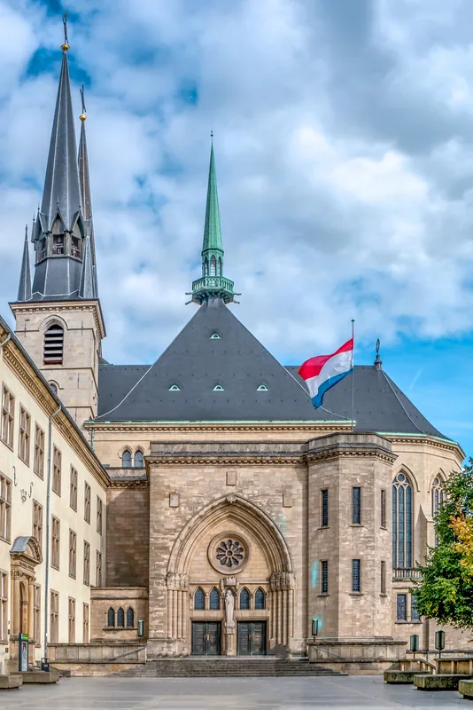
Notre-Dame Cathedral
The Cathedral of Luxembourg was originally built as a Jesuit church in the 17th century.
Altar of National Sacrifice
A symbolic outdoor altar, part of the National Monument of Solidarity in Luxembourg City.