Plizio Visual Lab
St. Paul River Gorge
Weather…
Water temperature…
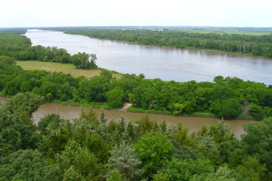
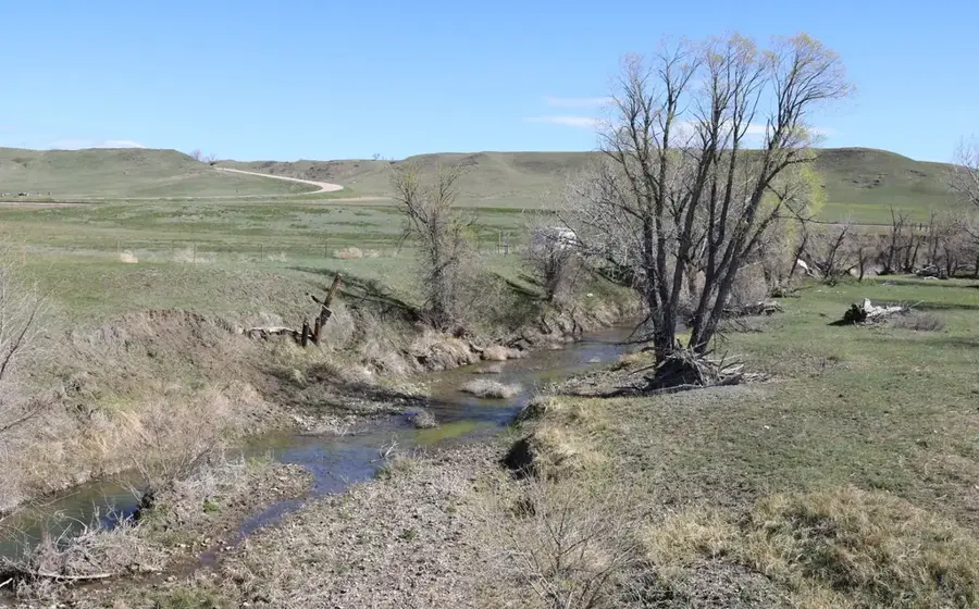
The St. Paul River is one of Liberia's major waterways, and its gorge in the interior forms a striking geological feature where the river has carved through ancient rock formations. The narrowing of the riverbed creates powerful currents and rapids that have historically hindered navigation but present significant opportunities for hydroelectric development. Surrounded by dense tropical greenery, the steep rock walls offer a dramatic contrast to the relatively flat coastal plains found further downstream. During the rainy season, the volume of water increases substantially, making the gorge a powerful display of natural forces. For those exploring the Liberian hinterland, the area provides a glimpse into the country's untouched wilderness and the rugged terrain that defines its middle reaches, marking a clear transition toward the hilly interior.
- Location: Liberia
- Nearby: Totota (20 km)
Best time to visit & climate
The most pleasant time to visit is Jan, Feb, Dec.
| Jan | Feb | Mar | Apr | May | Jun | Jul | Aug | Sep | Oct | Nov | Dec | |
|---|---|---|---|---|---|---|---|---|---|---|---|---|
| Avg °C | 26 | 27 | 27 | 27 | 27 | 26 | 25 | 24 | 25 | 26 | 26 | 26 |
| Rain mm | 10 | 23 | 46 | 65 | 114 | 251 | 344 | 510 | 319 | 234 | 77 | 32 |
📋 Practical info
Geography
Facts
- The St. Paul River Gorge is 200 m deep.
- Width at narrowest point is 20 m.
- The gorge extends 5 km.
- Walls are sandstone and quartzite.
- Surrounding hills rise to 300 m.
- River discharge during rainy season is 1,000 m³/s.
Explore nearby
Notable places around
Route planner — Car & Motorhome
Where do you start? We build the route here, with stops and country notes along the way.
© OpenStreetMap contributors · OpenRouteService
Sights nearby
Frequently asked questions
What is the St. Paul Gorge?
Is there a dam there?
Can you go rafting in the gorge?
What is the best way to reach the gorge?
Is photography allowed there?
St. Paul River Gorge: where is it located?
St. Paul River Gorge: when is the best time to visit?

Nearby cities


History & landmarks
Nature
More places