Plizio Visual Lab
Sanniquellie

ℹ️Practical info — Sanniquellie
▾
🌤 Weather — 5 days
📍 Nearby
Sights nearby
💡 Tips
- Being close to the borders of Guinea and Ivory Coast, carry your passport even for short trips around the outskirts.
- The city is a historical landmark where the idea of the OAU (now African Union) was first discussed in 1959.
- The weather can be significantly cooler and rainier due to the high elevation; pack layers.
- Mobile money networks are heavily used here for transactions, sometimes more reliably than physical banks.
🍽 Food
A spicy, bitter, and rich Liberian stew made with palm oil, typical of Nimba County; find it in traditional local diners.
Widely consumed in this region; ask clearly at local cookshops to ensure you know what you are ordering.
In season, look for street vendors selling fire-roasted corn on the cob along the main avenues.
🛍 Shopping · 🧘 Quiet spots
A spirited hub where goods from Liberia, Guinea, and Ivory Coast converge.
Keep an eye out for handmade clay pots and bowls sold by artisans near the market fringes.
The surrounding hilly landscape provides quiet hiking trails; ask a local guide to show you the safe paths.
A quiet spot in town marking the historic 1959 summit, surrounded by trees.
Water temperature…
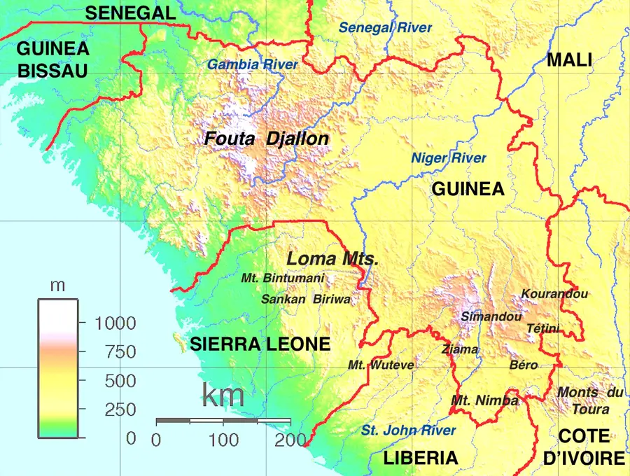
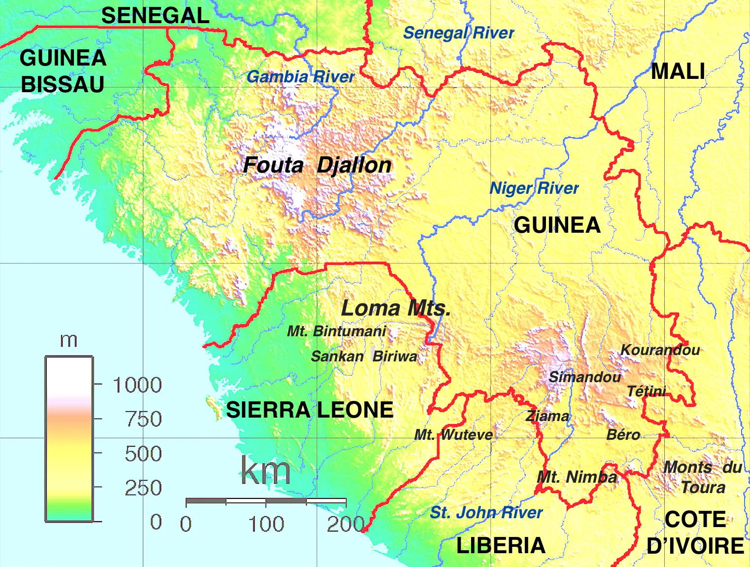
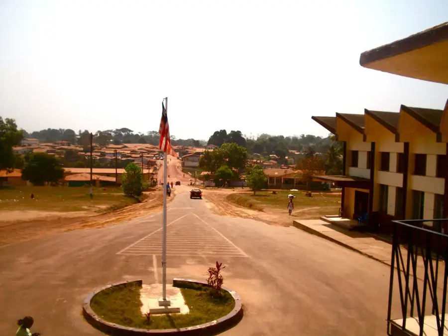
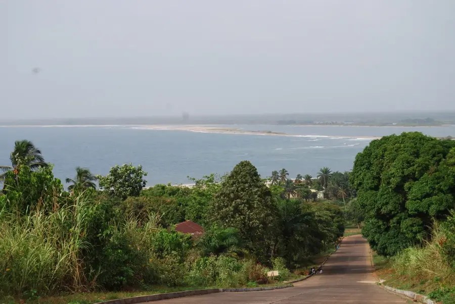
Sanniquellie serves as the energetic capital of Nimba County in northern Liberia, positioned as a major economic hub in one of West Africa’s most mineral-rich regions. Strategically located near the borders with Guinea and Ivory Coast, the city is a vital center for cross-border trade and regional administration. Historically, Sanniquellie holds a prestigious place in continental politics as the "birthplace of African unity"; it was here in 1959 that the leaders of Liberia, Guinea, and Ghana met to lay the foundational stones for the Organization of African Unity (now the African Union). The city is set against the backdrop of the majestic Nimba Range, famous not only for its vast iron ore deposits but also for its exceptional biodiversity and lush rainforests, which attract researchers and nature enthusiasts alike. The urban landscape is a blend of bustling traditional markets and governmental offices, reflecting its role as a beacon of progress for the northern provinces. For travelers, Sanniquellie gives a unique window into Liberian civic life and a starting point for exploring the panoramic mountain ecosystems that define this ruggedly beautiful region.
- Location: Liberia
- Nearby: Ganta Trade Terminal (15 km)
- Population: ~17.895 (2026)
Best time to visit & climate
The most pleasant time to visit is Jan, Feb, Dec.
| Jan | Feb | Mar | Apr | May | Jun | Jul | Aug | Sep | Oct | Nov | Dec | |
|---|---|---|---|---|---|---|---|---|---|---|---|---|
| Avg °C | 25 | 26 | 26 | 26 | 25 | 24 | 23 | 23 | 24 | 24 | 25 | 24 |
| Rain mm | 11 | 46 | 100 | 142 | 187 | 257 | 216 | 299 | 288 | 189 | 85 | 26 |
Geography
Facts
- Population: 20,000 (2022 estimate).
- Coordinates: 6°59′N 8°44′W.
- Elevation: 400 meters (1,312 feet).
- Annual rainfall: 2,800 mm (110 inches).
- Distance to Mount Nimba Reserve: 30 km (19 miles).
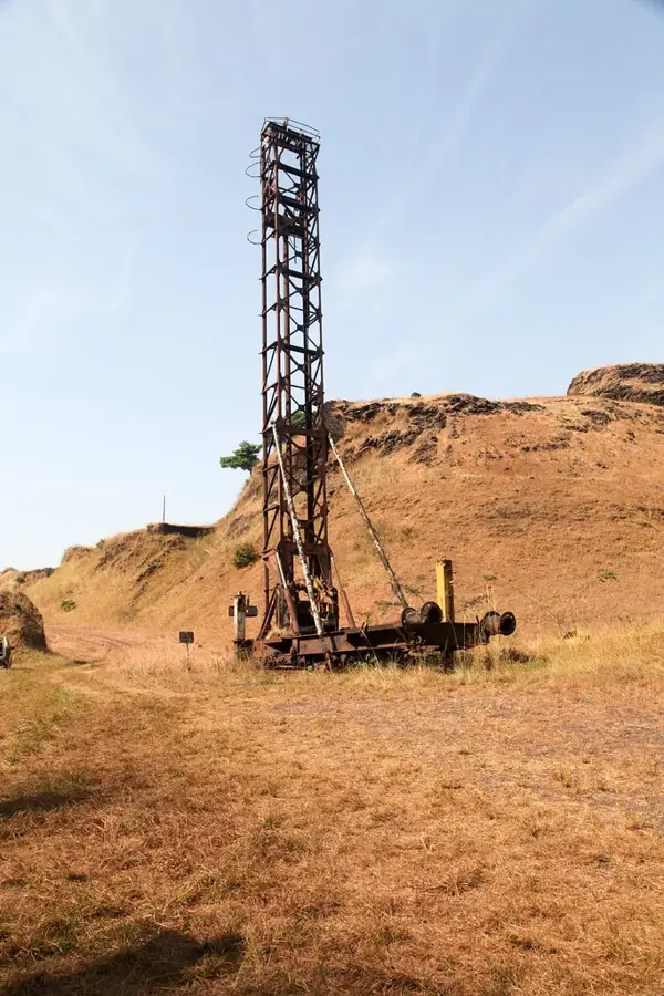
- Iron ore mining by Lamco ceased in 1990 after producing over 200 million tons.
Explore nearby
Notable places around
Route planner — Car & Motorhome
Where do you start? We build the route here, with stops and country notes along the way.
© OpenStreetMap contributors · OpenRouteService
Sights in the town Sanniquellie (1)
Frequently asked questions
What is the historical significance of Sanniquellie?
In which region is the city located?
Are there mountains in the area?
Can you visit mining sites?
When does the market take place?
Sanniquellie: where is it located?
Sanniquellie: when is the best time to visit?
Sanniquellie: why is it worth visiting?

Nearby cities


History & landmarks
Nature
More places