Plizio Visual Lab
Cestos River
Weather…
Water temperature…
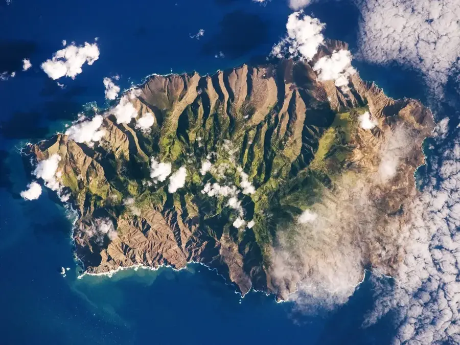
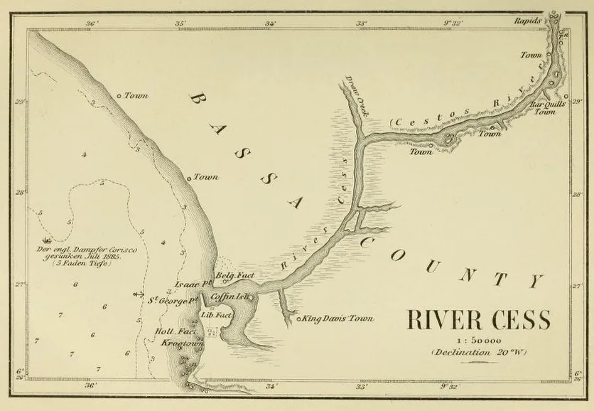
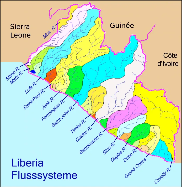
The Cestos River, also known as the River Cess, is a major waterway in Liberia that carves its way through dense primary rainforests before emptying into the Atlantic Ocean at Cestos City. Its name originates from the Portuguese word for "baskets," as early European explorers noted the local inhabitants using intricate baskets for fishing. The lower reaches of the river are particularly scenic, where the massive canopy of the Upper Guinean forest meets the water's edge, creating a pristine habitat for a wealth of wildlife. This ecologically critical area is one of the last strongholds for the elusive pygmy hippopotamus and various endangered primate species. At its mouth, the river forms extensive mangrove estuaries that are vital breeding grounds for Atlantic fish species. Historically and economically, the river has served as a transport route for goods and timber, though its flow can be treacherous during the heavy tropical rains. For those exploring Liberia's natural heritage, the Cestos River features a glimpse into a truly wild and untouched West African river system.
- Location: Liberia
- Nearby: Tutu (72 km)
Best time to visit & climate
The most pleasant time to visit is Jan, Feb, Dec.
| Jan | Feb | Mar | Apr | May | Jun | Jul | Aug | Sep | Oct | Nov | Dec | |
|---|---|---|---|---|---|---|---|---|---|---|---|---|
| Avg °C | 27 | 27 | 27 | 27 | 27 | 26 | 25 | 25 | 25 | 26 | 26 | 26 |
| Rain mm | 40 | 72 | 115 | 140 | 213 | 282 | 142 | 162 | 212 | 227 | 146 | 76 |
📋 Practical info
Geography
Facts
- Length: 180 km
- Basin area: 5,000 km²
- Discharge: 60 m³/s
- Mangrove area: 30 km²
- Fisheries yield: 500 tons/year
- Estuary width: 1 km
Explore nearby
Notable places around
Route planner — Car & Motorhome
Where do you start? We build the route here, with stops and country notes along the way.
© OpenStreetMap contributors · OpenRouteService
Sights in the town Cestos River (1)
Sights nearby
Frequently asked questions
Where does the Cestos River empty?
Are there manatees there?
Is the river suitable for canoes?
When is the best time for birdwatching?
Are there local restaurants on the banks?
Cestos River: where is it located?
Cestos River: when is the best time to visit?
Cestos River: why is it worth visiting?

Nearby cities


History & landmarks


Nature
More places