Plizio Visual Lab
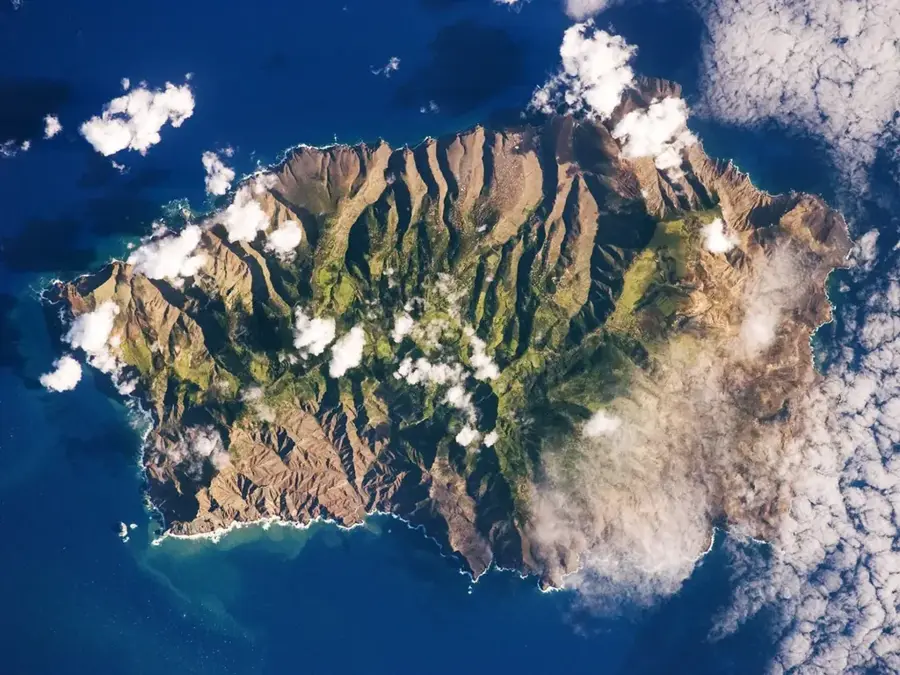
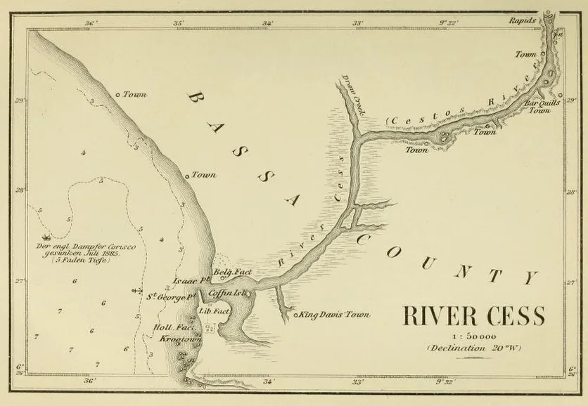
Cestos River Valley

Weather…
Water temperature…
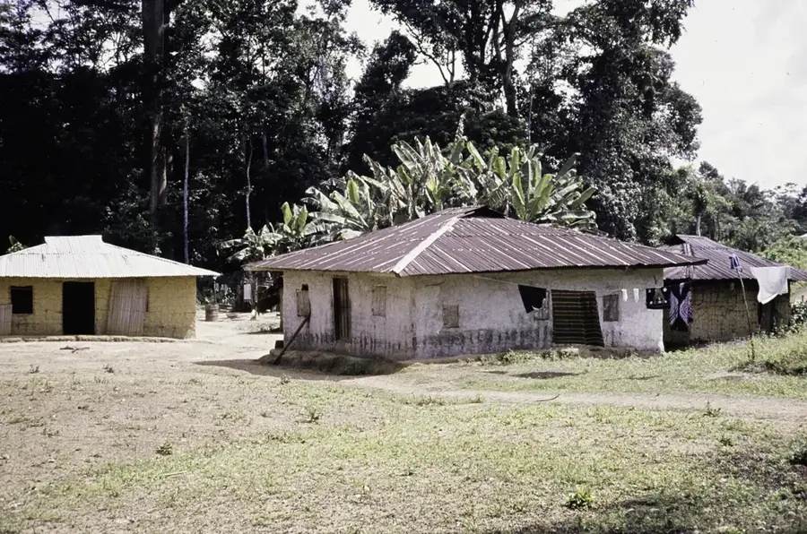
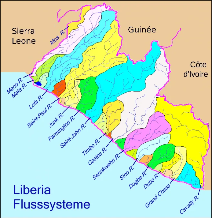
The Cestos River Valley in southeastern Liberia encompasses a vast floodplain system stretching over 200 km inland. The river drains an area of 15,000 km² and experiences seasonal flooding that sustains swamp forests, oxbow lakes, and alluvial plains. This hydromorphic habitat supports West African manatees, Nile crocodiles, and over 300 bird species. The fertile soils enable intensive rice cultivation, particularly by the Kru and Grebo communities who rely on the river for transport and fisheries. The valley faces environmental pressures from industrial logging, rubber plantations, and artisanal gold mining. Despite its ecological significance, only fragmentary conservation measures exist. Efforts to designate it as a Ramsar site are ongoing.
- Location: Liberia
- Nearby: Tutu (72 km)
Best time to visit & climate
The most pleasant time to visit is Jan, Feb, Dec.
| Jan | Feb | Mar | Apr | May | Jun | Jul | Aug | Sep | Oct | Nov | Dec | |
|---|---|---|---|---|---|---|---|---|---|---|---|---|
| Avg °C | 27 | 27 | 27 | 27 | 27 | 26 | 25 | 25 | 25 | 26 | 26 | 26 |
| Rain mm | 40 | 72 | 115 | 140 | 213 | 282 | 142 | 162 | 212 | 227 | 146 | 76 |
📋 Practical info
Geography
Facts
- Valley length: over 200 km.
- Catchment area: approximately 15,000 km².
- Annual rainfall: 2,500–3,500 mm.
- Agriculture: 40% of area used for rice paddies.
- Manatee population: estimated 200–300 individuals.
- Threat: deforestation affects 15% of floodplain forests per decade.
Explore nearby
Notable places around
Route planner — Car & Motorhome
Where do you start? We build the route here, with stops and country notes along the way.
© OpenStreetMap contributors · OpenRouteService
Sights in the town Cestos River Valley (1)
Sights nearby
Frequently asked questions
What makes the Cestos River Valley special?
Can you go canoeing on the river?
What animals live in the river valley?
How do you get there?
Are there settlements there?
Cestos River Valley: where is it located?
Cestos River Valley: when is the best time to visit?
Cestos River Valley: why is it worth visiting?

Nearby cities


History & landmarks


Nature
More places