Plizio Visual Lab
Monte Falterona
Monte Falterona is a prominent peak in the Northern Apennines, reaching an elevation of 1654 meters above sea level on the border of the Florence, Arezzo, and Forlì-Cesena provinces. It is a central feature of the Foreste Casentinesi, Monte Falterona, and Campigna National Park, which protects ancient beech and silver fir forests. Geographically, it is famous for housing the Capo d'Arno at 1358 meters, the source of the Arno River, which flows through Florence and Pisa. The mountain is also an important archaeological site due to the Lago degli Idoli, where hundreds of Etruscan bronze votive figures were discovered in 1838, indicating its status as a sacred site in antiquity. From its summit, hikers can enjoy a panoramic view that, on exceptionally clear days, spans from the Adriatic Sea to the Tyrrhenian Sea. The mountain remains a key location for biodiversity studies and historical research in the Casentino region.
- Location: Italy
- Top sights: Museo forestale di Campigna · Museo del Parco · Lago degli Idoli
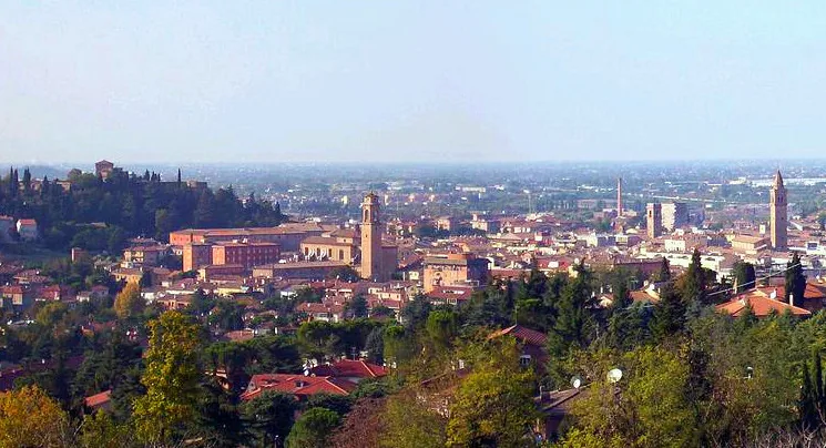
- Nearby: Scandicci (43 km)
Best time to visit & climate
The most pleasant time to visit is Jun–Aug.
| Jan | Feb | Mar | Apr | May | Jun | Jul | Aug | Sep | Oct | Nov | Dec | |
|---|---|---|---|---|---|---|---|---|---|---|---|---|
| Avg °C | 2 | 3 | 6 | 10 | 15 | 20 | 23 | 22 | 17 | 13 | 8 | 3 |
| Rain mm | 55 | 66 | 63 | 57 | 63 | 44 | 33 | 40 | 66 | 84 | 96 | 70 |
📋 Practical info
Geography
Facts
- The summit reaches a total elevation of 1654 meters above sea level.
- The source of the Arno River, Capo d'Arno, is located at 1358 meters on the south side.
- More than 600 Etruscan bronze artifacts were recovered from the Lake of the Idols in 1838.
- The mountain is a core zone of the Casentinesi Forests National Park, established in 1993.
- On clear days, both the Adriatic and Tyrrhenian seas are visible from the top.
- Dante Alighieri references the mountain and the Arno's source in his Divine Comedy.
Explore nearby
Notable places around
Route planner — Car & Motorhome
Where do you start? We build the route here, with stops and country notes along the way.
© OpenStreetMap contributors · OpenRouteService
Sights in the town Monte Falterona (7)
Sights nearby
Frequently asked questions
Where is Monte Falterona located?
Which river rises there?
What is the name of the Arno source site?
What is 'Lago degli Idoli'?
How high is the mountain?
Monte Falterona: where is it located?
Monte Falterona: what is there to see?
Monte Falterona: when is the best time to visit?
Monte Falterona: why is it worth visiting?

Nearby cities
History & landmarks

More places