Plizio Visual Lab
Almannagjá
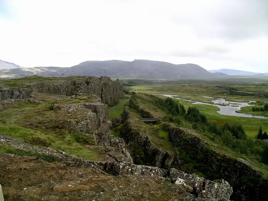
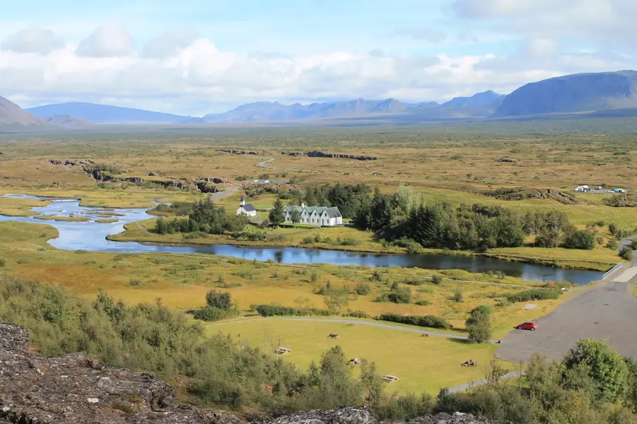
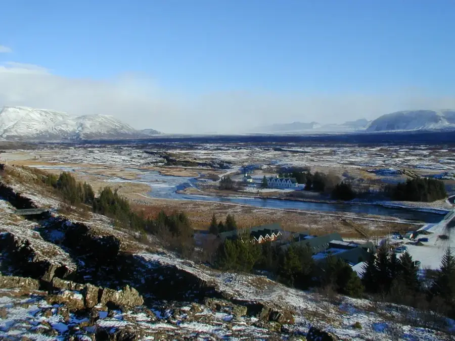
Almannagjá is a spectacular gorge and rift valley located within the Þingvellir National Park in southwestern Iceland. It serves as a visible boundary of the Mid-Atlantic Ridge, where the North American and Eurasian tectonic plates are actively pulling apart at a rate of approximately two centimeters per year. The gorge extends for nearly 8 kilometers and is characterized by steep basaltic walls that rise dozens of meters above the valley floor. Historically, Almannagjá is of immense national importance as the site of the Alþingi, the oldest surviving parliament in the world, which first convened here in 930 AD. The Lögberg, or Law Rock, situated within the rift, was the focal point where laws were recited and major announcements were made to the gathered assembly. Geologically, the formation of the gorge is linked to a series of seismic events and volcanic activity that have shaped the Reykjanes peninsula over millennia. The Öxarárfoss waterfall cascades into the gorge, its course having been artificially diverted in the 10th century to provide water for the parliamentary gatherings. Today, it is a UNESCO World Heritage site, recognized for both its unique tectonic features and its deep cultural heritage.
- Location: Iceland
- Top sights: Þingvellir Exhibition: Heart of Iceland · Biskupshólar · Gálgaklettar
- Nearby: Laugarvatn (20 km)
Best time to visit & climate
The most pleasant time to visit is Jun–Aug.
| Jan | Feb | Mar | Apr | May | Jun | Jul | Aug | Sep | Oct | Nov | Dec | |
|---|---|---|---|---|---|---|---|---|---|---|---|---|
| Avg °C | -4 | -4 | -3 | 1 | 4 | 9 | 10 | 9 | 6 | 1 | -2 | -3 |
| Rain mm | 160 | 148 | 141 | 111 | 87 | 77 | 92 | 101 | 155 | 123 | 129 | 159 |
📋 Practical info
Geography
Facts
- The gorge marks the edge of the North American tectonic plate.
- It was the founding site of the Alþingi parliament in 930 AD.
- The tectonic plates drift apart here by about 2 centimeters per year.
- The total length of the rift valley is approximately 7.7 kilometers.
- The Öxarárfoss waterfall was artificially diverted into the gorge in the 900s.
- Almannagjá is a key feature of the UNESCO-listed Þingvellir National Park.
Explore nearby
Notable places around
Route planner — Car & Motorhome
Where do you start? We build the route here, with stops and country notes along the way.
© OpenStreetMap contributors · OpenRouteService
Sights in the town Almannagjá (4)
Sights nearby
Frequently asked questions
What is the geological significance of the canyon?
What was the 'Lögberg'?
Can you walk inside the canyon?
Was Game of Thrones filmed here?
Is access free?
Almannagjá: where is it located?
Almannagjá: what is there to see?
Almannagjá: when is the best time to visit?
Almannagjá: why is it worth visiting?

Nearby cities