Plizio Visual Lab
Doumera
ℹ️Practical info — Doumera
▾
🌤 Weather — 5 days
📍 Nearby
Sights nearby
💡 Tips
- Access is highly restricted due to the military and border nature of the area; secure all necessary permits from authorities in Djibouti City before attempting to travel.
- Bring plenty of drinking water, sunscreen, and shade, as the barren coastal climate is extremely hot and unforgiving.
- There is virtually no tourist infrastructure; you must be completely self-sufficient with food, fuel, and supplies.
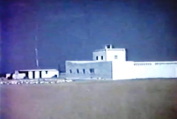
- Do not photograph any military installations, border posts, or personnel under any circumstances.
- A 4x4 vehicle with an experienced local guide and driver is strictly required to navigate the rough terrain.
🍽 Food
If visiting local nomadic encampments along the coast, you might be offered a simple, spicy stew made from fresh Red Sea catch.
A Djiboutian lamb and rice dish; you won't find restaurants here, so have your guide prepare it at a campsite.
Sweetened black tea is a staple of hospitality among the local Afar people; accept it graciously if offered.
🛍 Shopping · 🧘 Quiet spots
There are no shops in Doumera. Buy all necessary supplies in the town of Obock or Djibouti City before heading north.
The stark, empty beaches looking out towards the Bab el-Mandeb strait offer unparalleled, isolated tranquility.
Simply walk a short distance from your camp to experience the profound, absolute silence of the rocky coastal desert.
Water temperature…
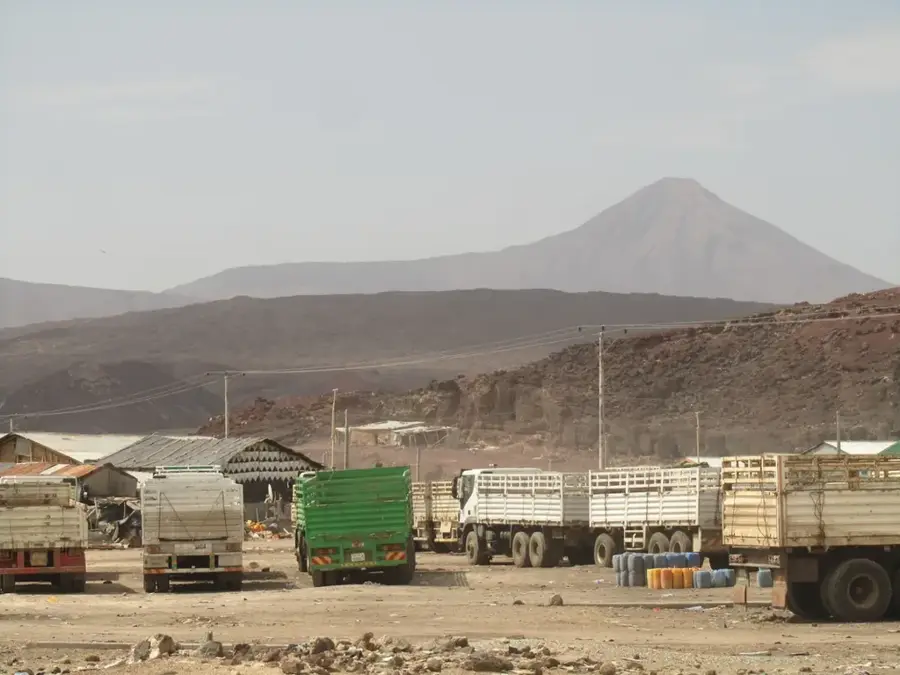
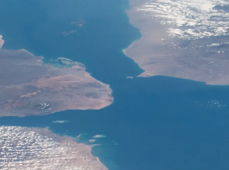
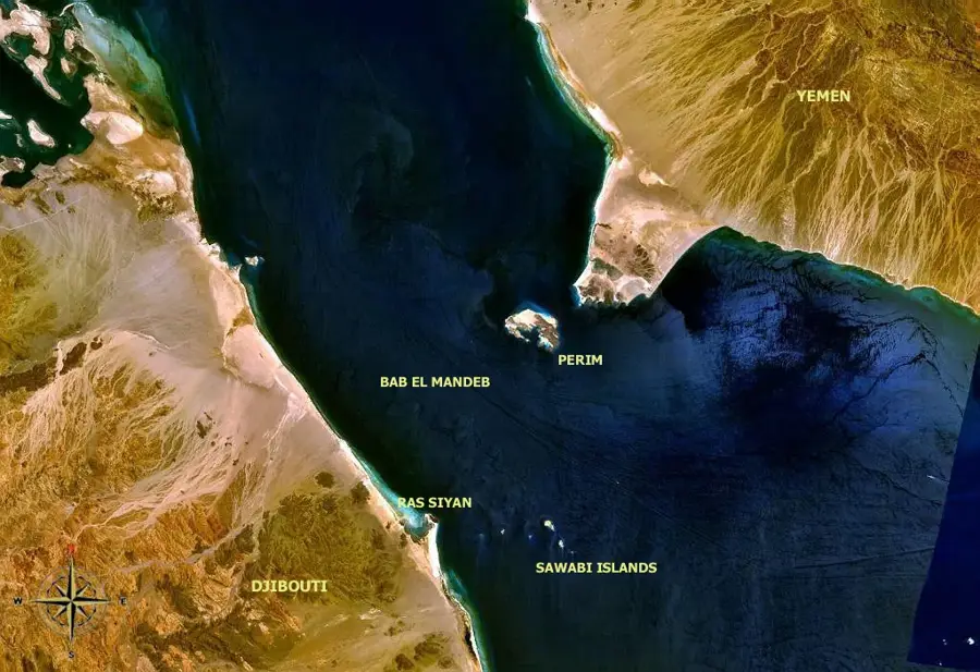
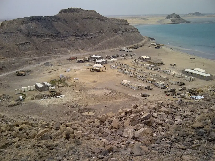
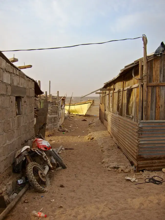
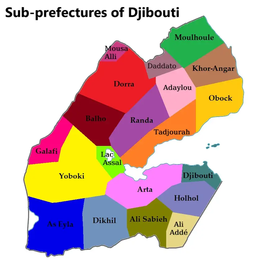
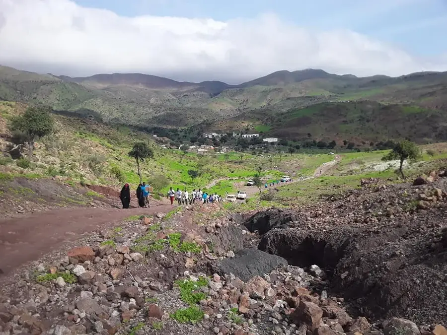
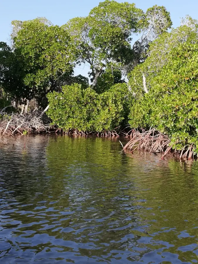
Doumeira is a settlement and a cape on the Red Sea coast, at the northernmost tip of Djibouti, right on the border with Eritrea. The area, including the small offshore island of Doumeira, is of great strategic importance as it overlooks the southern entrance to the Red Sea at the Bab-el-Mandeb strait. This location has led to border disputes between Djibouti and Eritrea in the past, notably in 2008. The landscape around Doumeira is extremely barren and volcanic, with black rocks and minimal vegetation. The population is very sparse, consisting mainly of Afar fishermen and herders. Life is harsh, marked by the severe conditions of the desert climate and isolation. There is a small military presence in the region due to its strategic nature. Access to Doumeira is difficult, primarily by sea or via unpaved tracks along the coast. The offshore waters are rich in marine life, but development is hindered by the political instability and remoteness of the area.
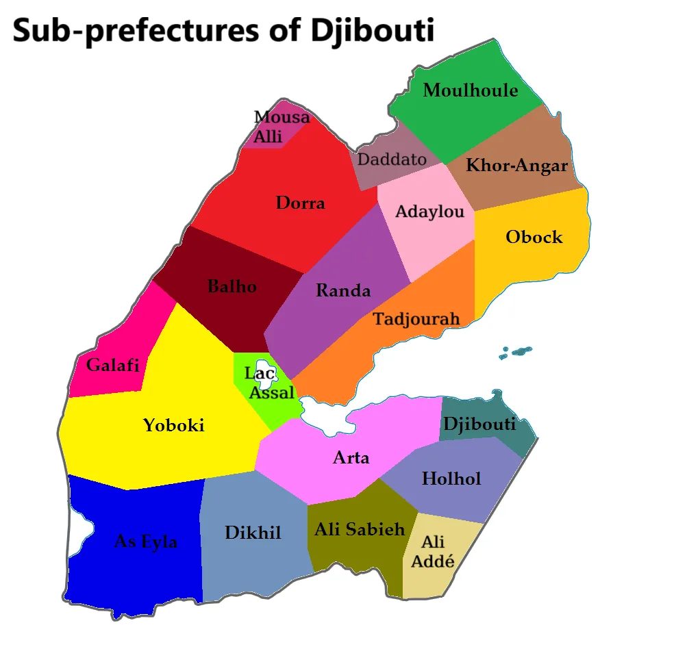
- Location: Djibouti
- Nearby: Moulhoule (26 km)
Best time to visit & climate
The most pleasant time to visit is Jan, Feb, Dec.
| Jan | Feb | Mar | Apr | May | Jun | Jul | Aug | Sep | Oct | Nov | Dec | |
|---|---|---|---|---|---|---|---|---|---|---|---|---|
| Avg °C | 24 | 25 | 27 | 29 | 31 | 33 | 33 | 33 | 32 | 29 | 27 | 25 |
| Rain mm | 4 | 5 | 12 | 39 | 24 | 13 | 28 | 39 | 37 | 18 | 5 | 11 |
Geography
Facts
- Located on the Djibouti-Eritrea border.
- Overlooks the Bab-el-Mandeb strait.
- The region was the site of a border conflict in 2008.
- The landscape is barren and volcanic.
- Mainly inhabited by Afar fishermen.
- Includes the strategic island of Doumeira.
Explore nearby
Notable places around
Route planner — Car & Motorhome
Where do you start? We build the route here, with stops and country notes along the way.
© OpenStreetMap contributors · OpenRouteService
Frequently asked questions
Why is Doumera important?
Can you visit the island?
What does the coast look like?
Are there settlements there?
Is it open to tourists?
Doumera: where is it located?
Doumera: when is the best time to visit?
Doumera: why is it worth visiting?

Nearby cities
History & landmarks
More places