Plizio Visual Lab

Mols Bjerge

Plizio editorial teamData Sources
Mountain
—°4
Mols Bjerge (Denmark)

Weather…

Mols Bjerge is a spectacular hilly landscape in Djursland that today forms the core of the national park of the same name. These formations were created during the last advance of the Weichselian ice sheet about 12,000 years ago as massive terminal moraine arcs. The landscape is characterized by extreme topographical contrasts, ranging from steep hills like Agri Bavnehøj (137 meters) to deep 'dead-ice holes' formed by melting ice blocks. The vegetation consists of a unique combination of heather, juniper bushes, and dry meadows, hosting high biodiversity. Historically, the area was used for grazing, which has preserved the open character of the landscape to this day. From the ridges, visitors enjoy unobstructed views over the bays of Ebeltoft and Kalø. Mols Bjerge is considered one of Denmark's most geologically interesting areas and is a magnet for hikers and naturalists alike.

Best time to visit & climate

The most pleasant time to visit is Jul–Sep.

JanFebMarAprMayJunJulAugSepOctNovDec
Avg °C223711151718151174
Rain mm604843395171788364797065

📋 Practical info

🧭
Getting there
Reaching these prominent elevations is generally straightforward by navigating the regional roads of East Jutland, which directly intersect the heart of the moraine landscape.
📅
Best season
Spring through early autumn represents the optimal window to hike the hills, offering clear skies that maximize the expansive panoramic views over the glacial formations.
⛰️
Terrain & paths
The terrain is characterized by distinctive, undulating slopes and occasional steep ascents shaped by ancient glacial movements, demanding a moderate level of physical endurance.
🎒
What to bring
Sturdy hiking boots with strong grip are absolutely necessary to safely handle the uneven, sometimes slippery glacial soils, along with reliable weather protection.
🅿️
Parking
Trailhead parking spots are frequently situated at the base of the most popular hiking routes, providing convenient access for visitors looking to conquer the main viewpoints.
⚠️
Safety
Hikers must pay close attention to the often changeable weather patterns, remain on marked pathways to prevent severe erosion, and carry adequate personal navigation tools.
⏱️
Time needed
Fully traversing this prominent hilly landscape usually takes between three and five hours, factoring in the demanding ascents and ample time taken for resting and photography.

Geography

Coordinates
56.20550, 10.55220

Facts

  • National Park Mols Bjerge was officially inaugurated in 2009.
  • Agri Bavnehøj is the highest point in the region at 137 meters.
  • Features 'Trehøje', three prominent burial mounds from the Bronze Age.
  • The area covers approximately 180 square kilometers of protected nature.
  • Formed as the terminal moraine of a glacier advance from the Baltic Sea.
  • Home to rare butterfly species and specialized plants like the pasqueflower.

Explore nearby

Notable places around

Route planner — Car & Motorhome

Where do you start? We build the route here, with stops and country notes along the way.

Vehicle
Only stops with (optional):

© OpenStreetMap contributors · OpenRouteService

Sights in the town Mols Bjerge (4)

Bogens Strand🎡 recreation

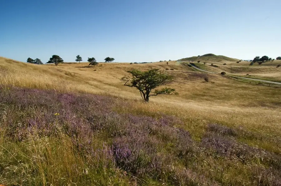
Set in the beautiful landscape of Mols Bjerge in Denmark, Bogens Strand awaits your visit. This idyllic stretch of coastline invites guests to take walks surrounded by nature or simply relax by the water. Especially in late spring or summer, this is a great excursion destination for nature lovers.

Svinhøj🏺 historical

Burial mound in a meadow in the Mols Bjerge hills.

Poskær Stenhus🏺 historical

The largest dolmen in Denmark, a significant prehistoric site.

Agri Dyssen🏺 historical

Agri Dyssen, a Neolithic burial mound in the Mols Bjerge hills.

Sights nearby

Frequently asked questions

What is Mols Bjerge?
It is a national park in Jutland, known for its glacial hilly landscape.
How high are the hills?
The highest point, Agri Baunehøj, reaches an elevation of 137 meters above sea level.
What activities are available?
Hiking, cycling, and visiting the Kalø castle ruins are popular activities.
Are there parking lots?
Yes, there are several parking lots at main entrances, such as Trehøje or the visitor center.
Which animals live there?
You can see deer, various bird species, and often grazing horses or cows.
Mols Bjerge: where is it located?
Mols Bjerge is located in Denmark.
Mols Bjerge: what is there to see?
Highlights include Bogens Strand, Svinhøj, Poskær Stenhus.
Mols Bjerge: when is the best time to visit?
The most pleasant time to visit is Jul, Sep.
Mols Bjerge: why is it worth visiting?
Mols Bjerge is a spectacular hilly landscape in Djursland that today forms the core of the national park of the same name.
View on map → The Top 50 Attractions → Most beautiful beaches → OpenStreetMap →
Europe
Explore with Plizio Discover more places in Europe
More places in Denmark →

Nearby cities

History & landmarks

More places