Plizio Visual Lab
Ibenga River
Weather…
Water temperature…
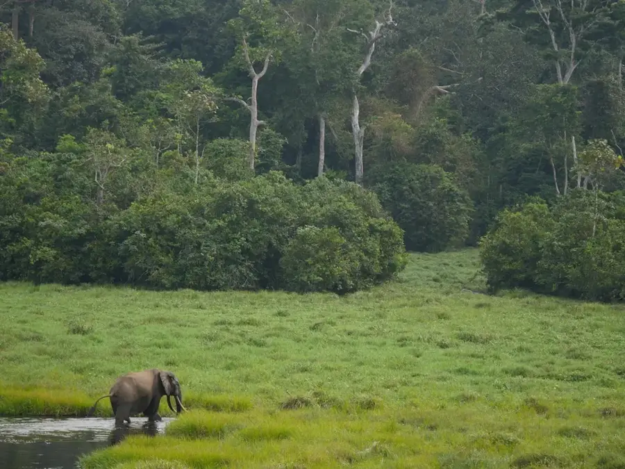
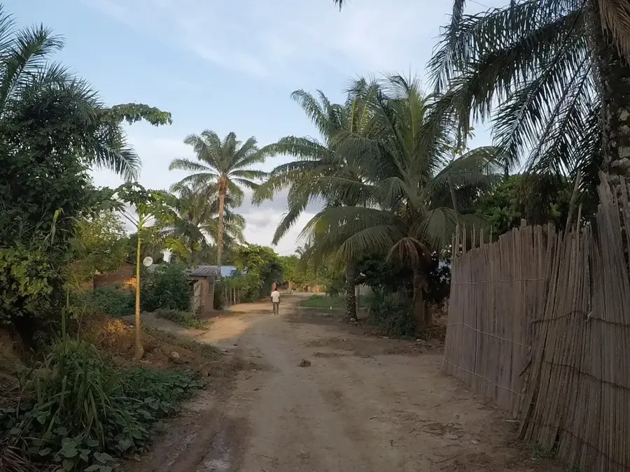
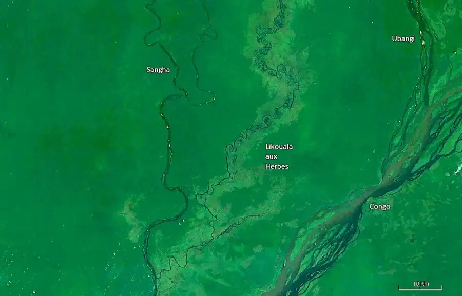
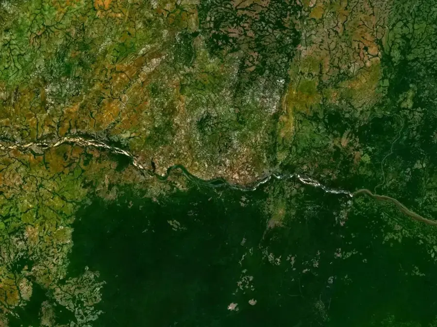
The Ibenga River is a prominent watercourse in the northern Republic of the Congo, serving as a significant right-bank tributary of the Ubangi River. Flowing primarily through the Likouala Department, it traverses one of Africa's most extensive and inaccessible swamp forest regions. The river originates in the densely forested highlands near the Central African Republic border and follows a meandering path through pristine primary rainforest. The Ibenga is a vital artery for the local population, providing the only viable means of transportation for goods and people in a region where the marshy terrain precludes road construction. Its ecosystem is a critical component of the Congo Basin's biodiversity, supporting vast numbers of forest elephants, gorillas, and specialized wetland flora. The river's hydrology is defined by the equatorial rainfall pattern, leading to significant seasonal flooding that fertilizes the surrounding floodplains. As part of the 'Grands Affluents' Ramsar site, the Ibenga is recognized internationally for its importance in conserving global freshwater resources and tropical peatlands.
- Location: Congo - Brazzaville
- Nearby: Dongou (47 km)
Best time to visit & climate
The most pleasant time to visit is Jan, Feb, Dec.
| Jan | Feb | Mar | Apr | May | Jun | Jul | Aug | Sep | Oct | Nov | Dec | |
|---|---|---|---|---|---|---|---|---|---|---|---|---|
| Avg °C | 26 | 27 | 27 | 26 | 26 | 25 | 25 | 25 | 25 | 25 | 25 | 26 |
| Rain mm | 30 | 102 | 158 | 156 | 163 | 164 | 199 | 179 | 196 | 230 | 154 | 54 |
📋 Practical info
Geography
Facts
- The Ibenga River flows into the Ubangi north of the regional capital, Impfondo.
- The river basin contains some of the world's most extensive tropical peatlands.
- It forms part of the 'Grands Affluents' Ramsar site, protecting over 5 million hectares.
- Water levels can fluctuate significantly between the wet and dry equatorial seasons.
- The river is a major source of protein for local villagers through seasonal fishing.
- The surrounding swamps are a known refuge for the elusive forest elephant population.
Explore nearby
Notable places around
Route planner — Car & Motorhome
Where do you start? We build the route here, with stops and country notes along the way.
© OpenStreetMap contributors · OpenRouteService
Sights nearby
Frequently asked questions
Where does the Ibenga flow?
What is the characteristic feature of the river?
Can you see elephants there?
How is the access to the region?
Are there research projects there?
Ibenga River: where is it located?
Ibenga River: when is the best time to visit?
Ibenga River: why is it worth visiting?

Nearby cities
Nature


More places