Plizio Visual Lab
Dongou

ℹ️Practical info — Dongou
▾
🌤 Weather — 5 days
📍 Nearby
Sights nearby
💡 Tips
- River travel is the main way to get around; expect delays depending on water levels.
- The town has limited infrastructure, so bring enough cash for your stay.
- The wet season brings heavy rains; ensure your luggage is waterproof.
- Local transport across the wetlands is mainly by pirogue (dugout canoe).
🍽 Food
Best found at small local eateries near the waterway.
Traditional cassava bread, a staple side dish in the region.
Buy fresh bananas and papayas directly from street vendors.
🛍 Shopping · 🧘 Quiet spots
The place to find local produce and daily necessities.
The freshest catch of the day and basic artisanal fishing gear.
Watch the slow-moving waterways in peace.
Peaceful nature spots just outside the town.
Water temperature…
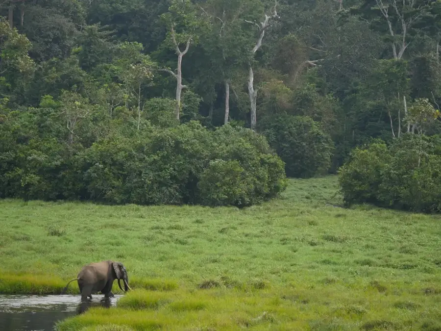
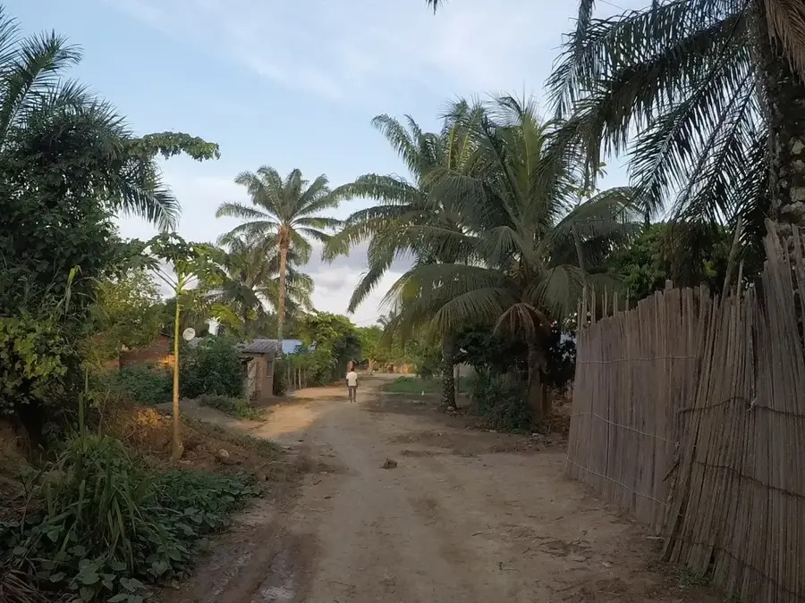
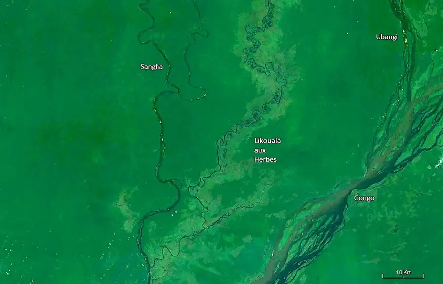
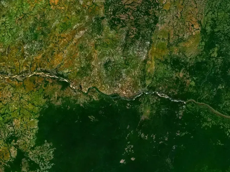
Dongou is a historically rich small town in the Likouala Department of northeastern Republic of Congo, situated on the right bank of the Ubangi River. Prior to the establishment of Impfondo, Dongou served as the region's first administrative capital under French colonial rule, granting the town significant historical weight. Geographically, the settlement is located amidst the vast swamp forests of the Likouala Basin, one of Africa's most water-rich and wetland-dense regions. The Ubangi River is the town's primary lifeblood, serving as a critical transportation route for trade with the Central African Republic and the DR Congo, as well as providing abundant fishing grounds. The local economy is traditionally based on timber, fish, and agricultural products, while colonial architecture still visible in parts of the town recalls its former prominence. Despite the relocation of the administrative seat, Dongou remains an important strategic point for border traffic and the protection of the unique Likouala ecosystem.
- Location: Congo - Brazzaville
- Nearby: Impfondo (66 km)
- Population: ~10.188 (2023)
Geography
Facts
- Dongou served as the capital of the Likouala region until the early 20th century.
- The town is located on the Ubangi, the largest right-bank tributary of the Congo River.
- It is the administrative headquarters of the Dongou District.
- The settlement is located in one of the most sparsely populated areas of the Congo.
- Transportation is almost entirely river-based due to the lack of permanent roads.
- The surrounding forests are home to one of the world's largest populations of lowland gorillas.
Explore nearby
Notable places around
Route planner — Car & Motorhome
Where do you start? We build the route here, with stops and country notes along the way.
© OpenStreetMap contributors · OpenRouteService
Frequently asked questions
What is the function of Dongou?
How do you travel to Dongou?
What products are traded?
Can you see wildlife there?
Is Dongou suitable for tourists?
Dongou: where is it located?
Dongou: why is it worth visiting?

Nearby cities
Nature


More places