Plizio Visual Lab
Laguna del Laja National Park
Weather…
Water temperature…
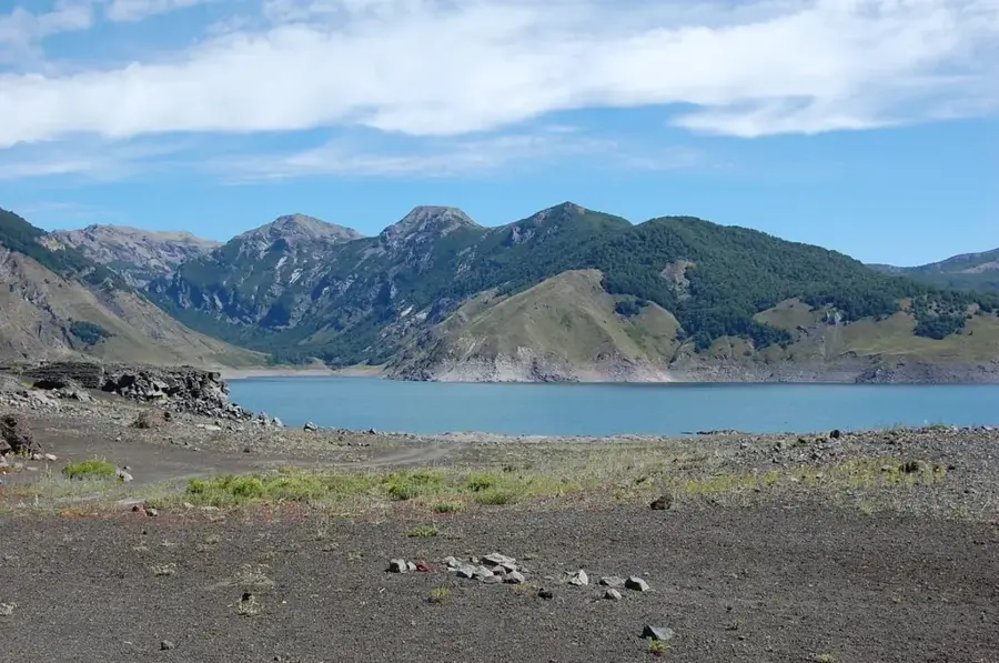
Laguna del Laja National Park is located in the Biobío region in the Andes of central Chile and covers an area of approximately 11,600 hectares. The park's geography is shaped by the massive massif of the Antuco volcano and the Laguna del Laja, which is considered the country's largest natural water reservoir. The landscape is the result of intense volcanic activity, with solidified lava flows and volcanic ash covering large parts of the area. Historically, the area is known for the Antuco tragedy in 2005, in which a military patrol lost their lives in a snowstorm. The flora is adapted to the extreme conditions and includes species such as the Chilean cedar and the Cordillera cypress. The wildlife hosts birds of prey like the condor as well as rare duck species on the shores of the lagoon. The park serves not only nature conservation but is also significant for energy production, as the lagoon's water is used for several hydroelectric power plants in the Laja River system.
- Location: Chile
- Top sights: Salto Las Chilcas · Mirador Chacay · Parque Nacional Laguna del Laja
- Nearby: Termas de Chillán (24 km)
Best time to visit & climate
The most pleasant time to visit is Jan, Feb, Dec.
| Jan | Feb | Mar | Apr | May | Jun | Jul | Aug | Sep | Oct | Nov | Dec | |
|---|---|---|---|---|---|---|---|---|---|---|---|---|
| Avg °C | 14 | 14 | 12 | 7 | 4 | 1 | 0 | 1 | 4 | 6 | 9 | 12 |
| Rain mm | 18 | 24 | 24 | 43 | 76 | 113 | 99 | 84 | 52 | 51 | 36 | 24 |
📋 Practical info
Geography
Facts
- The Antuco volcano has a height of 2,979 meters.
- Laguna del Laja is located at an altitude of 1,360 meters above sea level.
- The park was officially founded in 1958.
- Laguna del Laja is approximately 125 square kilometers in size.
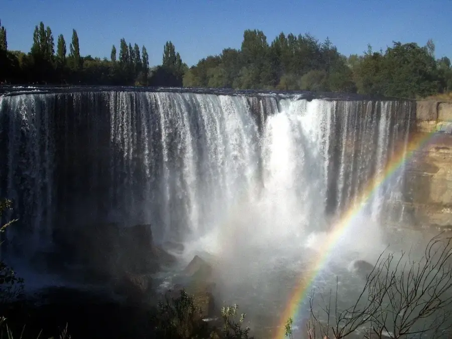
- The impressive Salto del Chilco waterfalls are located within the park.
- The annual average temperature in the park is about 11 degrees Celsius.
Explore nearby
Notable places around
Route planner — Car & Motorhome
Where do you start? We build the route here, with stops and country notes along the way.
© OpenStreetMap contributors · OpenRouteService
Sights in the town Laguna del Laja National Park (3)
Sights nearby
Frequently asked questions
What can you see in Laguna del Laja Park?
Can you ski there?
Are there waterfalls?
What is the vegetation like?
Is the park windy?
Laguna del Laja National Park: where is it located?
Laguna del Laja National Park: what is there to see?
Laguna del Laja National Park: when is the best time to visit?
Laguna del Laja National Park: why is it worth visiting?

Nearby cities
More places