Plizio Visual Lab
Tarso Emissti
Weather…
Water temperature…
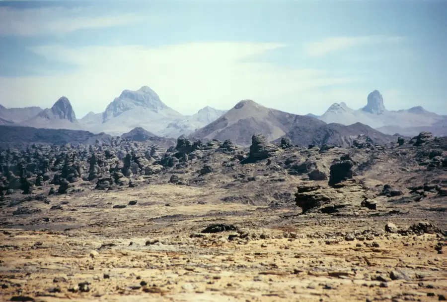
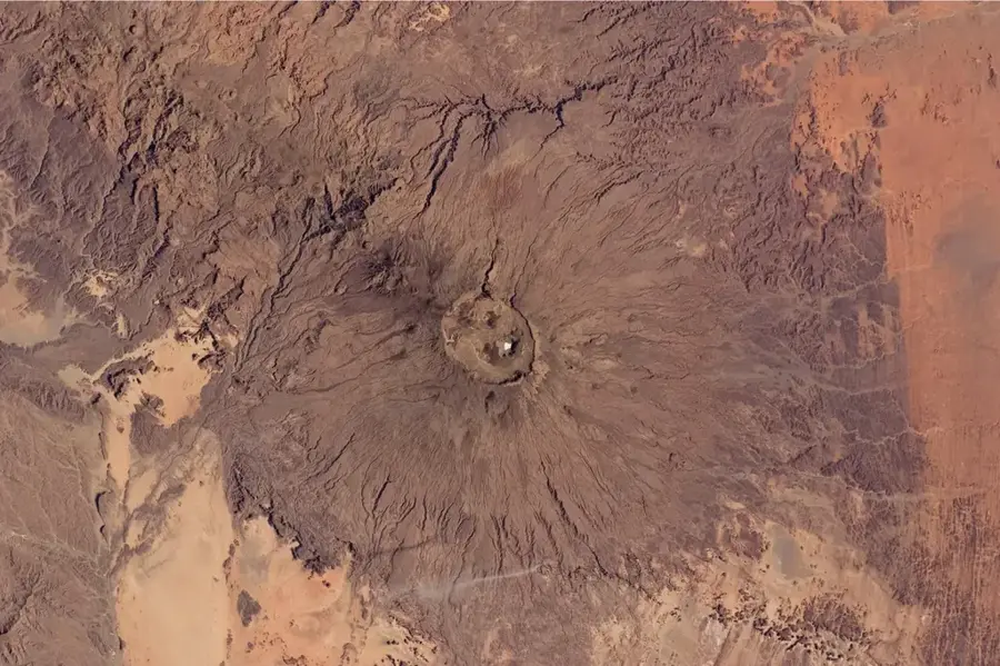
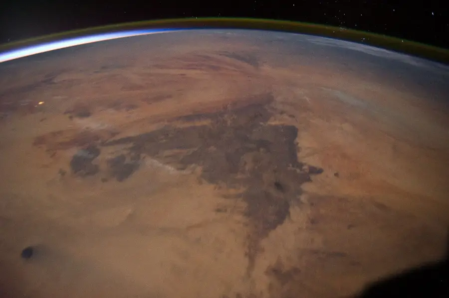
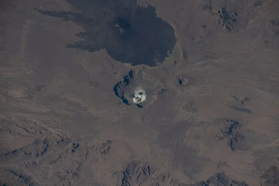
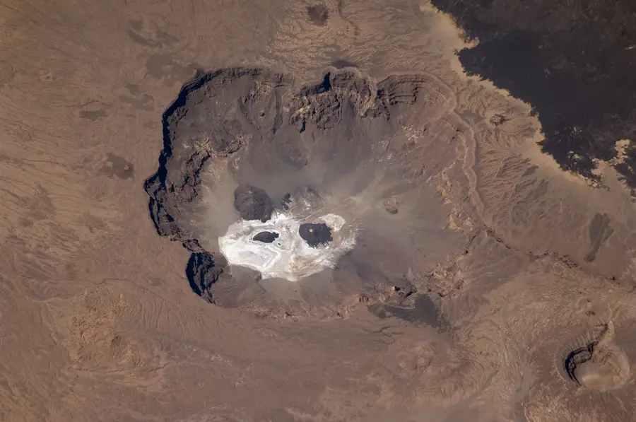
Tarso Emissti is a significant volcanic complex in the northern Tibesti Mountains of Chad, reaching an elevation of approximately 3,376 meters. This massif is distinguished by its extensive lava plateaus and the characteristic dark coloration of its volcanic rocks, which contrast sharply with the lighter desert sands. Geologically, Tarso Emissti is part of the vast Tibesti volcanic province, where activity spanned millions of years, leaving behind complex structures. The landscape is marked by deep erosion gullies and vast plains, testifying to the power of the elements in one of Earth's driest regions. Its isolation and extreme aridity have kept the ecosystem largely pristine, with only highly specialized organisms capable of survival. For geologists, the region features a unique opportunity to study the development of shield volcanoes in a continental setting. Archaeologically, rock engravings are often found nearby, indicating human presence during prehistoric pluvial periods. The area is difficult to access, requiring meticulous planning for any scientific expedition.
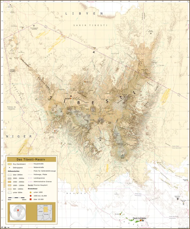
- Location: Chad
- Nearby: Trou au Natron (8 km)
Best time to visit & climate
The most pleasant time to visit is Feb, Mar, Nov.
| Jan | Feb | Mar | Apr | May | Jun | Jul | Aug | Sep | Oct | Nov | Dec | |
|---|---|---|---|---|---|---|---|---|---|---|---|---|
| Avg °C | 15 | 18 | 22 | 26 | 29 | 31 | 31 | 30 | 29 | 25 | 20 | 16 |
| Rain mm | 0 | 0 | 0 | 0 | 2 | 2 | 2 | 12 | 3 | 0 | 0 | 0 |
📋 Practical info
Geography
Facts
- Peak elevation of approximately 3,376 meters.
- Composed of massive Tertiary-age lava flows.
- Located within the Tibesti volcanic field in northern Chad.
- Characterized by dark basalt and trachyte rock formations.
- Hyper-arid climate with less than 20 mm of annual rainfall.
- Prehistoric rock engravings found in the surrounding valleys.
Explore nearby
Notable places around
Route planner — Car & Motorhome
Where do you start? We build the route here, with stops and country notes along the way.
© OpenStreetMap contributors · OpenRouteService
Sights nearby
Frequently asked questions
What is Tarso Emissti?
Can one climb Tarso Emissti?
What is the best time to visit the area?
Are there hiking maps for the area?
How dangerous is a tour to Tarso Emissti?
Tarso Emissti: where is it located?
Tarso Emissti: when is the best time to visit?
Tarso Emissti: why is it worth visiting?

Nearby cities

History & landmarks

More places