Plizio Visual Lab
Emi Koussi
Weather…
Water temperature…
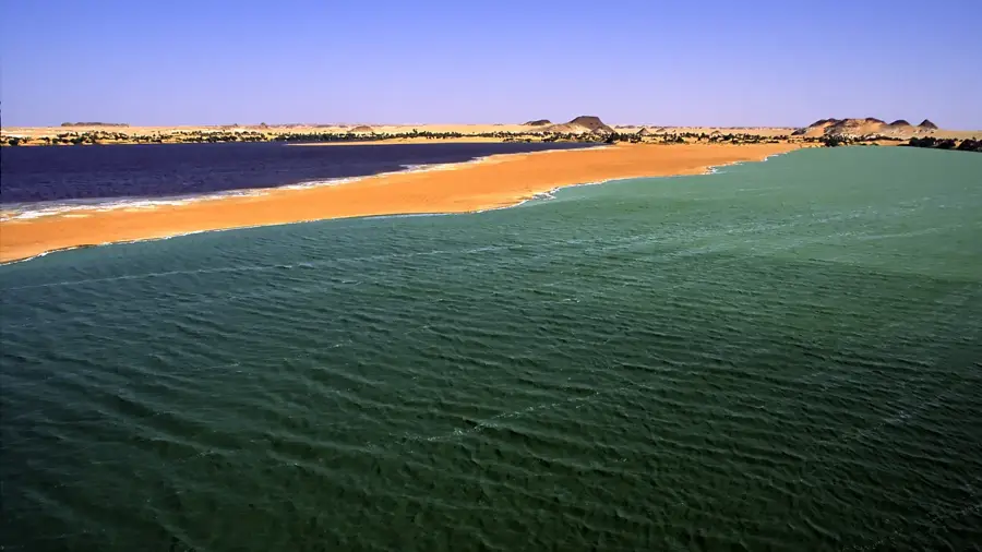
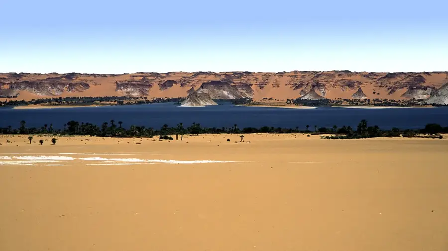
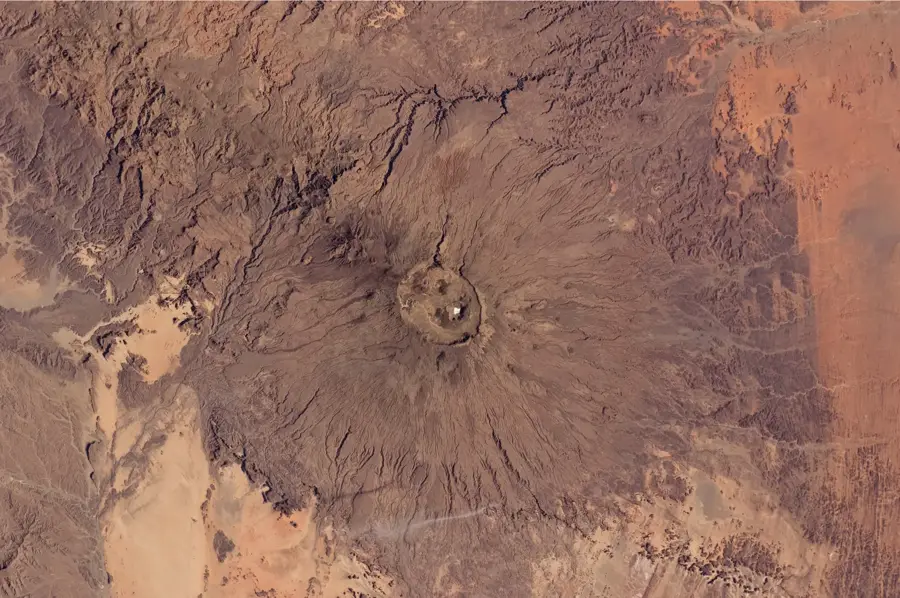
Emi Koussi is a massive dormant volcano in the Tibesti Mountains and, at 3,415 meters above sea level, is the highest mountain in Chad and the entire Sahara. This pyroclastic shield volcano occupies an area of approximately 60 by 80 kilometers, defining the desert landscape in the north of the country with its massive silhouette. Two large calderas are located on its summit, the larger one having a diameter of nearly 15 kilometers. A striking geological feature is the 'Trou au Natron,' a deep crater with white natron salt crusts contrasting with the dark volcanic rock. Historically, the mountain was first climbed in 1938 by Wilfred Thesiger, but for local Toubou nomads, it has been a sacred site for millennia. Extreme conditions on the mountain, with temperatures dropping far below freezing at night, make expeditions a logistical challenge. Vegetation is sparse and restricted to resilient high-mountain plants surviving in protected crevices of the caldera. Geologically, Emi Koussi is part of a chain of volcanic centers created by a hotspot beneath the African plate. Today, the mountain is a symbol of the pristine and wild nature of the central Sahara.
Best time to visit & climate
The most pleasant time to visit is Feb, Mar, Nov.
| Jan | Feb | Mar | Apr | May | Jun | Jul | Aug | Sep | Oct | Nov | Dec | |
|---|---|---|---|---|---|---|---|---|---|---|---|---|
| Avg °C | 16 | 19 | 24 | 29 | 32 | 33 | 33 | 33 | 32 | 28 | 21 | 17 |
| Rain mm | 0 | 0 | 0 | 0 | 0 | 0 | 2 | 5 | 0 | 0 | 0 | 0 |
📋 Practical info
Geography
Facts
- Emi Koussi is the highest point in the entire Saharan desert belt.
- The caldera at the summit is approximately 12 by 15 kilometers wide.
- The 'Trou au Natron' crater basin is located on the southern side of the volcano.
- The first documented ascent took place in September 1938.
- Traces of prehistoric hunter-gatherers have been found on the mountain.
- Temperatures at the summit can drop to as low as -15 degrees in winter.
Explore nearby
Notable places around
Route planner — Car & Motorhome
Where do you start? We build the route here, with stops and country notes along the way.
© OpenStreetMap contributors · OpenRouteService
Sights nearby
Frequently asked questions
How strenuous is climbing the Emi Koussi?
Do I need a guide?
Which season is safest?
Are there water sources on the mountain?
Is the mountain volcanic?
Emi Koussi: where is it located?
Emi Koussi: when is the best time to visit?
Emi Koussi: why is it worth visiting?