Plizio Visual Lab
Bahr el Ghazal Depression
Weather…
Water temperature…
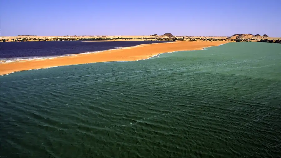
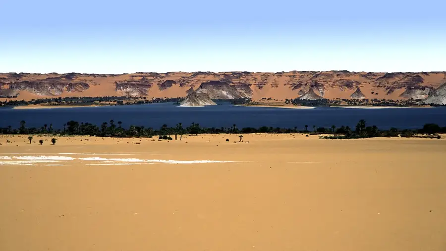
The Bahr el Ghazal Depression is an ancient fossil riverbed in Chad that stretches from Lake Chad northeastward toward the Bodélé Depression. During wetter climatic periods of the Holocene, roughly 5,000 years ago, it functioned as an overflow channel for the prehistoric Lake Mega-Chad. Today, the area is mostly dry and dominated by sand dunes and alluvial plains, yet it remains one of the lowest geographical points in the country. Its name translates from Arabic as River of Gazelles, a nod to its former ecological richness when water was abundant. Geologically, the depression is noted for its thick deposits of diatomite, which are the remains of ancient lacustrine organisms. These fine sediments are a primary source of mineral dust that is carried by winds across the Atlantic to fertilize the Amazon rainforest. Currently, the depression serves as a vital corridor for pastoralist transhumance and the local trade of salt and natron. Important paleontological sites, such as those where Abel (Australopithecus bahrelghazali) was found, are located in this region.
Best time to visit & climate
The most pleasant time to visit is Jan, Feb, Dec.
| Jan | Feb | Mar | Apr | May | Jun | Jul | Aug | Sep | Oct | Nov | Dec | |
|---|---|---|---|---|---|---|---|---|---|---|---|---|
| Avg °C | 19 | 23 | 27 | 31 | 34 | 34 | 33 | 31 | 31 | 29 | 24 | 20 |
| Rain mm | 0 | 0 | 0 | 0 | 4 | 8 | 48 | 77 | 19 | 3 | 0 | 0 |
📋 Practical info
Geography
Facts
- The depression connects the Lake Chad basin with the Bodélé hollow.
- Bahr el Ghazal means River of Gazelles in the Arabic language.
- It acted as an outlet for Lake Mega-Chad about 5,000 years ago.
- The area contains massive deposits of diatomite and lacustrine clay.
- The hominid fossil Australopithecus bahrelghazali was discovered here in 1995.
- Fine dust from this depression is carried by winds across the Atlantic.
Explore nearby
Notable places around
Route planner — Car & Motorhome
Where do you start? We build the route here, with stops and country notes along the way.
© OpenStreetMap contributors · OpenRouteService
Sights nearby
Frequently asked questions
What is the Bahr-el-Ghazal Depression?
Is the depression interesting for tourists?
How can one visit it?
What preparations are necessary?
Is the climate on site extreme?
Bahr el Ghazal Depression: where is it located?
Bahr el Ghazal Depression: when is the best time to visit?
Bahr el Ghazal Depression: why is it worth visiting?