Plizio Visual Lab
Kwando River
Weather…
Water temperature…
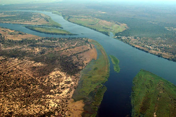
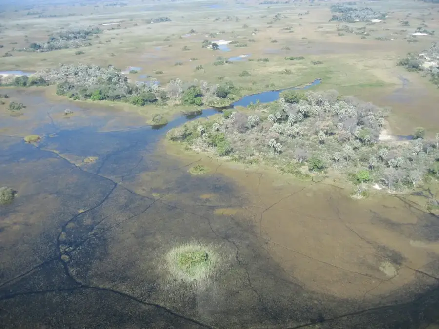
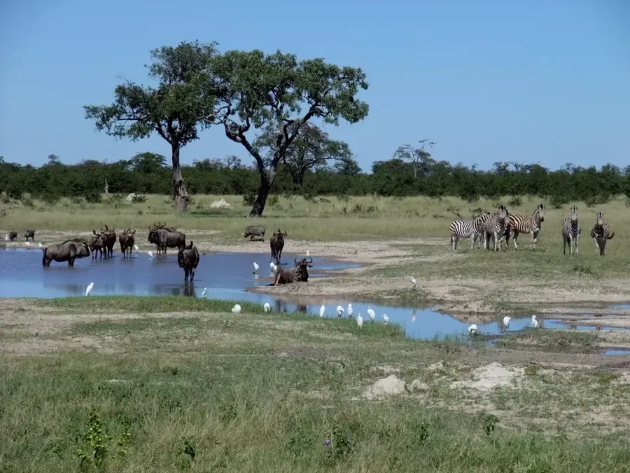
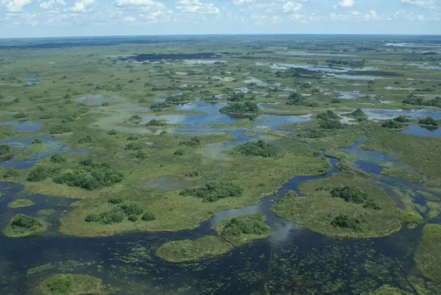
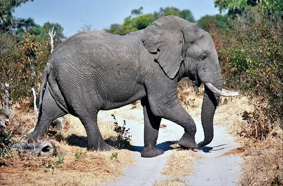
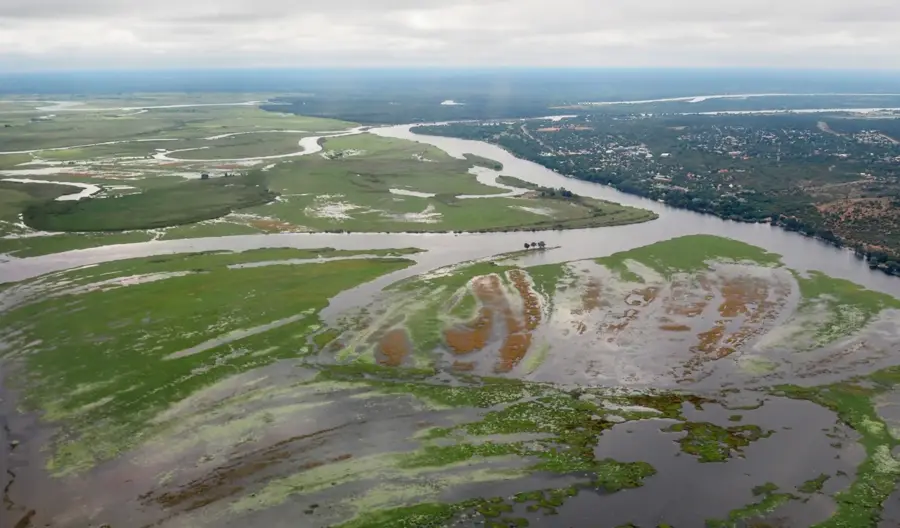
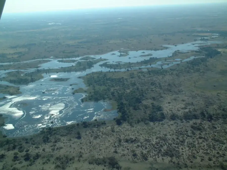
The Kwando River is a perennial and ecologically significant watercourse in south-central Africa, flowing through Angola, Namibia, and Botswana. It originates in the central highlands of Angola and travels over 735 kilometers in a southeasterly direction. After crossing Namibia's Caprivi Strip, it enters Botswana, where its course is dramatically altered by tectonic fault lines. At this point, the river turns sharply northeast and is renamed the Linyanti, eventually becoming the Chobe River. Geomorphologically, the Kwando creates a vast wetland system known as the Linyanti Swamps, which supports immense biodiversity. The river is a permanent source of water, making it an oasis in the semi-arid landscape for elephants, hippos, and rare antelopes such as the sitatunga. It serves as a natural border between Namibia and Botswana and is a cornerstone of the KAZA Transfrontier Conservation Area.
- Location: Botswana
- Top sights: Maziba Waterhole · Balyerwa Conservancy
Best time to visit & climate
The most pleasant time to visit is May, Jun, Aug.
| Jan | Feb | Mar | Apr | May | Jun | Jul | Aug | Sep | Oct | Nov | Dec | |
|---|---|---|---|---|---|---|---|---|---|---|---|---|
| Avg °C | 26 | 25 | 25 | 24 | 21 | 18 | 18 | 21 | 26 | 29 | 29 | 27 |
| Rain mm | 163 | 125 | 108 | 42 | 3 | 2 | 0 | 0 | 2 | 8 | 62 | 149 |
📋 Practical info
Geography
Facts
- The Kwando originates in the highlands of Angola.
- Its total length is approximately 735 kilometers.
- The river changes names to Linyanti and then Chobe.
- It forms part of the international border with Namibia.
- The Linyanti Swamps are primarily fed by the Kwando's waters.
- It is one of the few perennial river systems in the region.
Explore nearby
Notable places around
Route planner — Car & Motorhome
Where do you start? We build the route here, with stops and country notes along the way.
© OpenStreetMap contributors · OpenRouteService
Sights in the town Kwando River (2)
Sights nearby
Frequently asked questions
Where does the Kwando River originate?
In which region of Botswana does it flow?
Which national parks are on the Kwando?
Can you see elephants there?
Does the river change its name?
Kwando River: where is it located?
Kwando River: what is there to see?
Kwando River: when is the best time to visit?
Kwando River: why is it worth visiting?

History & landmarks
More places