Plizio Visual Lab
Chobe River

Weather…
Water temperature…
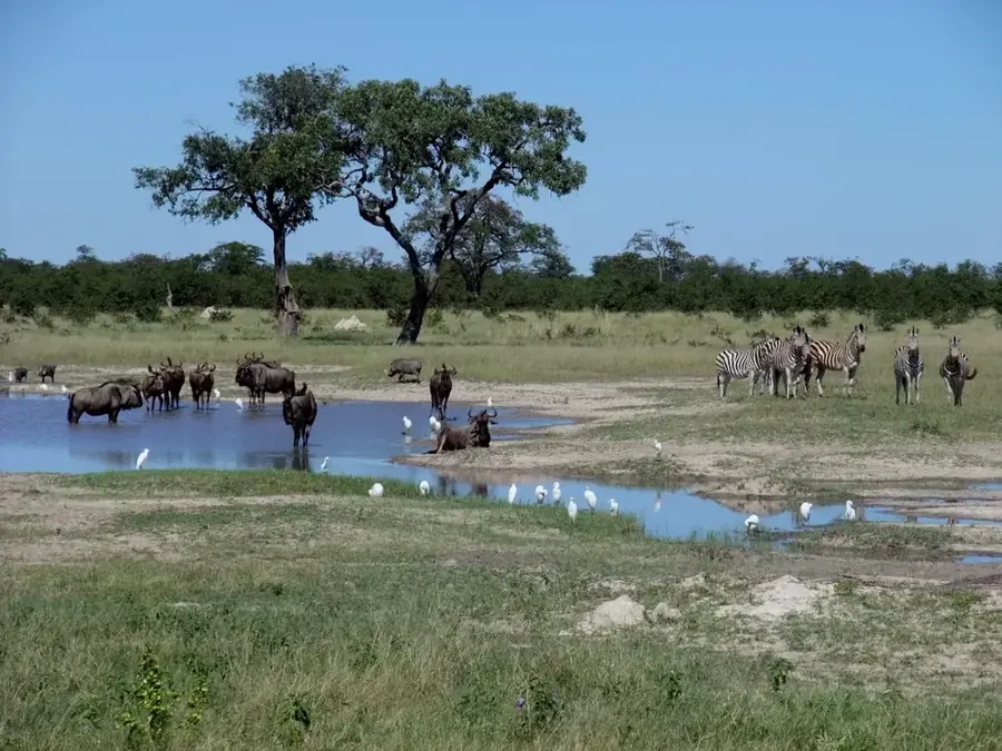
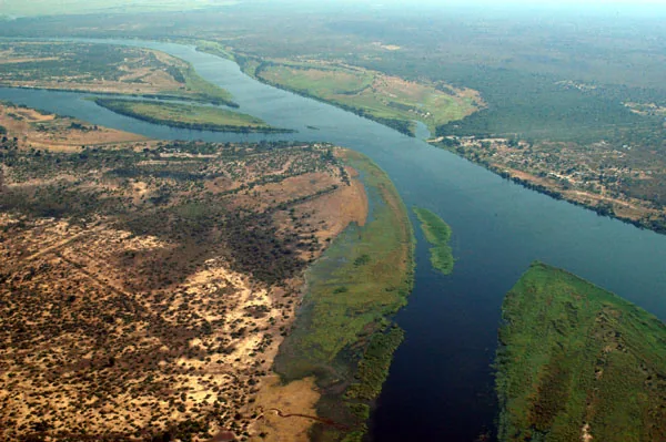
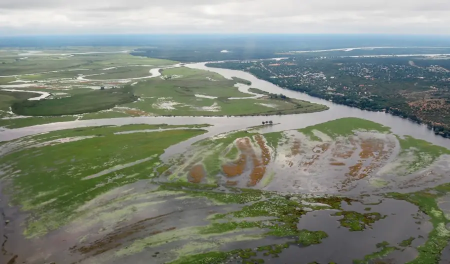
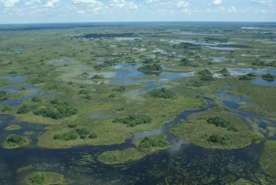
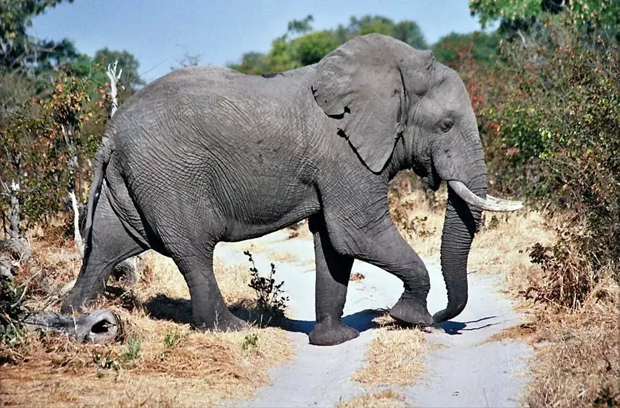
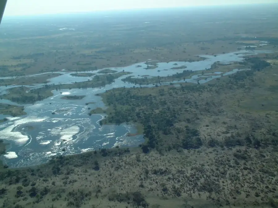
The Chobe River in northern Botswana is one of the region's most spectacular and perennial waterways, forming the natural border with Namibia's Caprivi Strip. Originating as the Cuando in the Angolan highlands, it flows as the Linyanti through swamps before finally becoming the Chobe and joining the Zambezi at Kazungula. The river is world-renowned for its extraordinary wildlife density, particularly hosting one of Africa's largest elephant populations, which congregates along its banks during the dry season. The landscape along the river features lush floodplains, dense woodlands, and expansive marshlands that provide habitat for hundreds of bird species, buffalo, hippos, and lions. A unique characteristic of the Chobe is its ability to reverse its flow direction when the Zambezi River is in high flood, creating distinct hydrological conditions. For tourists, the river is best explored via boat safaris, offering close encounters with wildlife with minimal disturbance to the environment. The adjacent Chobe National Park, established in 1967, is Botswana's third-largest park and ensures the permanent protection of this fragile ecosystem.
Best time to visit & climate
The most pleasant time to visit is May, Jun, Aug.
| Jan | Feb | Mar | Apr | May | Jun | Jul | Aug | Sep | Oct | Nov | Dec | |
|---|---|---|---|---|---|---|---|---|---|---|---|---|
| Avg °C | 26 | 25 | 25 | 23 | 21 | 18 | 18 | 21 | 26 | 29 | 29 | 27 |
| Rain mm | 181 | 135 | 106 | 44 | 3 | 2 | 0 | 0 | 2 | 10 | 70 | 163 |
📋 Practical info
Geography
Facts
- The Chobe River changes its name multiple times, known as the Cuando, Linyanti, and Itenge.
- The Chobe National Park is home to an estimated population of up to 120,000 elephants.
- Kazungula is the point where the borders of Botswana, Namibia, Zambia, and Zimbabwe meet.
- The river system is famous for hosting over 450 different species of birds.
- Sedudu Island in the river was the subject of a long-standing territorial dispute with Namibia.
- Boat safaris on the Chobe are considered among the premier wildlife viewing experiences in Africa.
Explore nearby
Notable places around
Route planner — Car & Motorhome
Where do you start? We build the route here, with stops and country notes along the way.
© OpenStreetMap contributors · OpenRouteService
Sights nearby
Frequently asked questions
Which countries border the Chobe River?
Does the Chobe flow into the Zambezi?
Why is the river so popular with tourists?
Are there houseboats available?
When is high water on the Chobe?
Chobe River: where is it located?
Chobe River: when is the best time to visit?
Chobe River: why is it worth visiting?

History & landmarks
More places