Plizio Visual Lab
Hawar
Weather…
Water temperature…
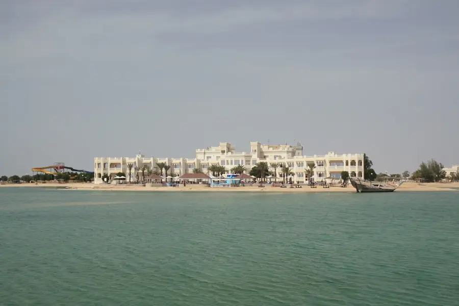
The Hawar Islands are an archipelago of 16 desert islands situated in the Gulf of Bahrain, characterized by a distinct topography and immense ecological value. The main island, Hawar, is defined by a low central limestone ridge that stretches from north to south, acting as a topographic backbone against the surrounding coastal flats. Historically, the archipelago was the subject of a long-standing territorial dispute with neighboring Qatar, which was only resolved in 2001 by the International Court of Justice in favor of Bahrain. Today, the islands are a tentative UNESCO World Heritage site, recognized primarily for their status as a global sanctuary for wildlife. They host one of the world's largest breeding colonies of the Socotra cormorant and serve as a vital habitat for dugongs in the crystal-clear shallow waters. The islands offer a stark, beautiful landscape where the arid desert meets the turquoise sea, providing a critical stopover for migratory birds and a quiet destination for eco-conscious travelers.
- Location: Bahrain
- Nearby: Jaww (29 km)
Best time to visit & climate
The most pleasant time to visit is Feb, Mar, Dec.
| Jan | Feb | Mar | Apr | May | Jun | Jul | Aug | Sep | Oct | Nov | Dec | |
|---|---|---|---|---|---|---|---|---|---|---|---|---|
| Avg °C | 18 | 19 | 22 | 27 | 32 | 35 | 36 | 36 | 34 | 30 | 25 | 20 |
| Rain mm | 6 | 5 | 4 | 5 | 0 | 0 | 0 | 0 | 0 | 2 | 10 | 9 |
📋 Practical info
Geography
Facts
- Area: 41 km²
- Highest elevation: 5 m
- Number of cormorant pairs: >100,000
- Distance from mainland: 20 km
- Year of ICJ ruling: 2001
- Length of airstrip: 1.2 km
Explore nearby
Notable places around
Route planner — Car & Motorhome
Where do you start? We build the route here, with stops and country notes along the way.
© OpenStreetMap contributors · OpenRouteService
Sights in the town Hawar (1)
Sights nearby
Frequently asked questions
How do you get to the Hawar Islands?
Can you stay overnight?
What animals can be seen?
Is it a nature reserve?
Is a passport required?
Hawar: where is it located?
Hawar: when is the best time to visit?
Hawar: why is it worth visiting?

History & landmarks

Nature


More places
