Plizio Visual Lab
Rubud al-Sharqiyah

Weather…
Water temperature…
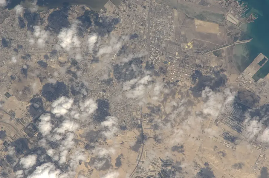
Rubud al-Sharqiyah is one of the eastern islands in the Hawar archipelago, situated in the shallow turquoise waters of the Persian Gulf between Bahrain and Qatar. Geologically, the island is part of an elevated marine shelf, characterized by its remarkably flat and low-lying limestone topography. This unique coastal landscape makes the island a critical sanctuary for biodiversity, particularly as a nesting ground for migratory and resident birds. It is internationally recognized for hosting vast colonies of Socotra cormorants, which find safety on its uninhabited shores. The vegetation is sparse, consisting mainly of salt-tolerant halophytes that thrive in the arid, saline environment. While Rubud al-Sharqiyah remains untouched by commercial development, it is a focal point for Bahrain's environmental conservation efforts. The surrounding seagrass beds and shallow reefs are rich feeding grounds for marine life, including endangered dugongs and sea turtles. As part of a UNESCO-nominated site, the island represents a pristine example of the Gulf's delicate marine ecosystem, preserved by its isolation and protected status.
- Location: Bahrain
- Nearby: Hawar Islands (7 km)
Best time to visit & climate
The most pleasant time to visit is Feb, Mar, Dec.
| Jan | Feb | Mar | Apr | May | Jun | Jul | Aug | Sep | Oct | Nov | Dec | |
|---|---|---|---|---|---|---|---|---|---|---|---|---|
| Avg °C | 18 | 19 | 22 | 26 | 30 | 33 | 35 | 35 | 33 | 30 | 26 | 21 |
| Rain mm | 10 | 7 | 6 | 6 | 0 | 0 | 0 | 1 | 0 | 2 | 11 | 12 |
📋 Practical info
Geography
Facts
- Area: 0.1 km²
- Diameter: 300 m
- Max elevation: 2 m
- Average depth: 0.8 m
- Nesting gull pairs: approx. 100
- Distance from Rubud al-Gharbiyah: 0.3 km
Explore nearby
Notable places around
Route planner — Car & Motorhome
Where do you start? We build the route here, with stops and country notes along the way.
© OpenStreetMap contributors · OpenRouteService
Sights nearby
Frequently asked questions
What is Rubud al-Sharqiyah?
What birds can be found here?
How do you reach the island?
Are there beaches there?
Is the water deep?
Rubud al-Sharqiyah: where is it located?
Rubud al-Sharqiyah: when is the best time to visit?
Rubud al-Sharqiyah: why is it worth visiting?

History & landmarks

Nature


More places
