Plizio Visual Lab
Santa Cruz River
Weather…
Water temperature…
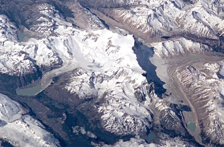
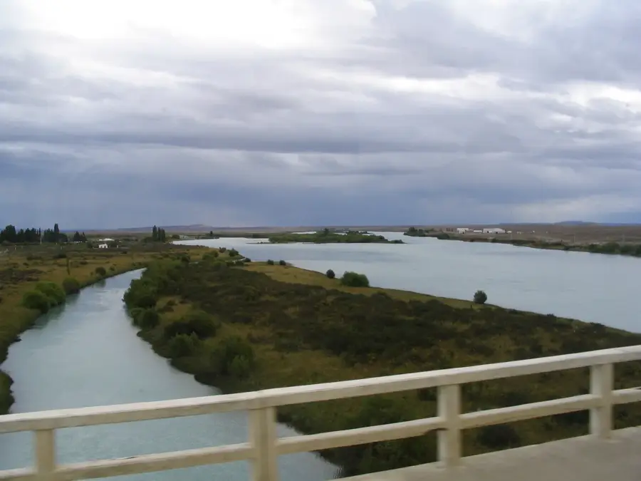
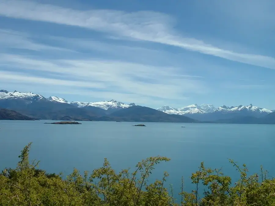
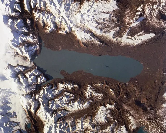
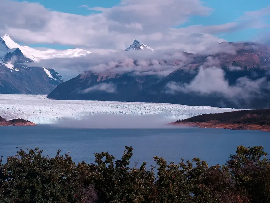
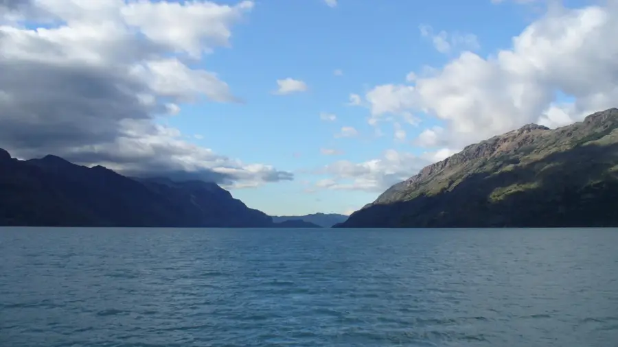
The Santa Cruz River is one of the most significant waterways in Patagonia, originating from Lake Argentino at an altitude of 187 meters above sea level. It flows across the Santa Cruz Province from west to east for approximately 385 kilometers before emptying into the Atlantic Ocean near Puerto Santa Cruz. The river possesses a distinct glacial character, as it is primarily fed by the meltwater from the vast Patagonian ice fields. Its drainage basin covers about 25,000 square kilometers and plays a crucial role in the regional ecosystem of the arid steppe. In recent years, the river has gained international attention due to the construction of two massive hydroelectric dams, Condor Cliff and La Barrancosa. These projects are designed to significantly boost Argentina's energy capacity but remain controversial due to their potential environmental impact on nearby glaciers and biodiversity. The water often exhibits a milky turquoise hue caused by the high concentration of fine glacial sediment.
Best time to visit & climate
The most pleasant time to visit is Jan, Feb, Dec.
| Jan | Feb | Mar | Apr | May | Jun | Jul | Aug | Sep | Oct | Nov | Dec | |
|---|---|---|---|---|---|---|---|---|---|---|---|---|
| Avg °C | 15 | 15 | 12 | 8 | 4 | 1 | 0 | 2 | 6 | 9 | 12 | 14 |
| Rain mm | 23 | 24 | 28 | 23 | 28 | 28 | 29 | 24 | 20 | 28 | 20 | 38 |
📋 Practical info
Geography
Facts
- The river originates from Lake Argentino, the largest freshwater lake in Argentina.
- The average discharge rate is approximately 790 cubic meters per second.
- The Santa Cruz River was the last large undammed river in Patagonia until 2015.
- Charles Darwin explored the river in 1834 during his voyage on the HMS Beagle.
- The river mouth forms an estuary that is vital for regional commercial fishing.
- The two hydroelectric dam projects are designed to generate a total of 1,310 MW.
Explore nearby
Notable places around
Route planner — Car & Motorhome
Where do you start? We build the route here, with stops and country notes along the way.
© OpenStreetMap contributors · OpenRouteService
Sights nearby
Frequently asked questions
What characterizes the Río Santa Cruz?
Is the river a popular fishing destination?
Can you go boating there?
What is the climate like there?
What is the best travel time?
Santa Cruz River: where is it located?
Santa Cruz River: when is the best time to visit?
Santa Cruz River: why is it worth visiting?

Nature
More places