Plizio Visual Lab
Helmand River
Weather…
Water temperature…
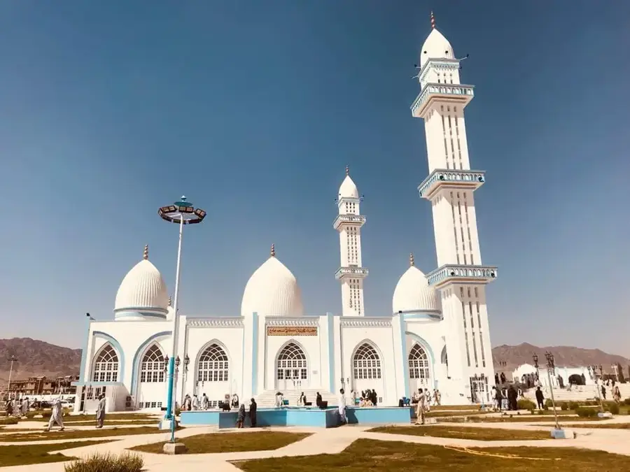
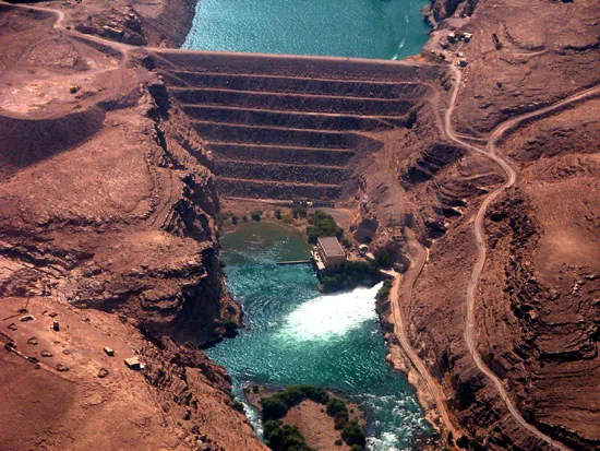
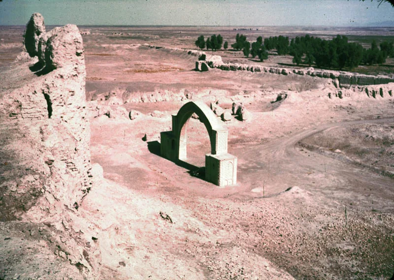
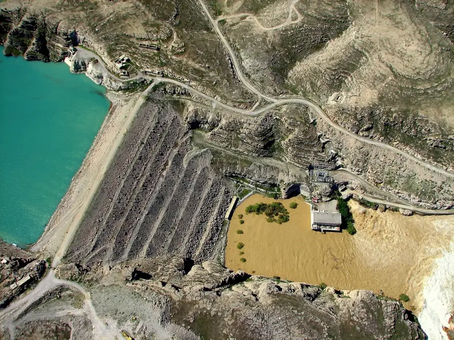
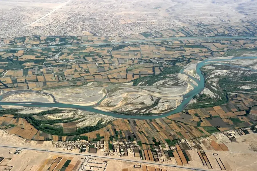
The Helmand River is the longest river in Afghanistan and serves as a vital lifeline for the country's arid southern regions. Originating in the Sanglakh Range of the Hindu Kush mountains west of Kabul, it flows for over 1,150 kilometers in a southwestern direction before emptying into the Hamun Lake in the Sistan Basin on the Iranian border. As the Helmand does not flow into an ocean, it forms an endorheic basin. The river is of immense importance to Afghan agriculture, providing irrigation for vast stretches of land in the Helmand and Kandahar provinces. Key structures along the river include the Kajaki Dam, used for both hydroelectric power generation and water regulation. Historically, the Helmand Valley was a hub for ancient civilizations and played a central role in regional dynamics. Water distribution between Afghanistan and Iran has been a source of diplomatic tension for decades, governed by the 1973 Helmand River Water Treaty. Ecologically, the river supports wetlands that are crucial for migratory birds within the otherwise barren desert landscape.
Best time to visit & climate
The most pleasant time to visit is Mar, Apr, Oct.
| Jan | Feb | Mar | Apr | May | Jun | Jul | Aug | Sep | Oct | Nov | Dec | |
|---|---|---|---|---|---|---|---|---|---|---|---|---|
| Avg °C | 9 | 12 | 18 | 24 | 30 | 33 | 35 | 33 | 28 | 22 | 15 | 9 |
| Rain mm | 10 | 9 | 13 | 5 | 2 | 4 | 0 | 3 | 0 | 2 | 10 | 5 |
📋 Practical info
Geography
Facts
- The Helmand River drains approximately 40% of Afghanistan's land area.
- It is one of the few major rivers in the world that does not drain into an ocean.
- The Kajaki Dam was originally constructed in the 1950s.
- The name 'Helmand' comes from the Avestan word 'Haetumant', meaning 'having bridges'.
- In low-rainfall years, the river's lower reaches can dry up almost completely.
- The Sistan Basin, where the river terminates, is one of the driest regions on Earth.
Explore nearby
Notable places around
Route planner — Car & Motorhome
Where do you start? We build the route here, with stops and country notes along the way.
© OpenStreetMap contributors · OpenRouteService
Sights in the town Helmand River (1)
Sights nearby
Frequently asked questions
What is the Helmand River?
When is the river most scenic?
Is the river suitable for recreation?
Why is the Helmand important?
How much time do you need for a visit?
Helmand River: where is it located?
Helmand River: when is the best time to visit?
Helmand River: why is it worth visiting?