Plizio Visual Lab
Shahr-e Zuhak
Weather…
Water temperature…
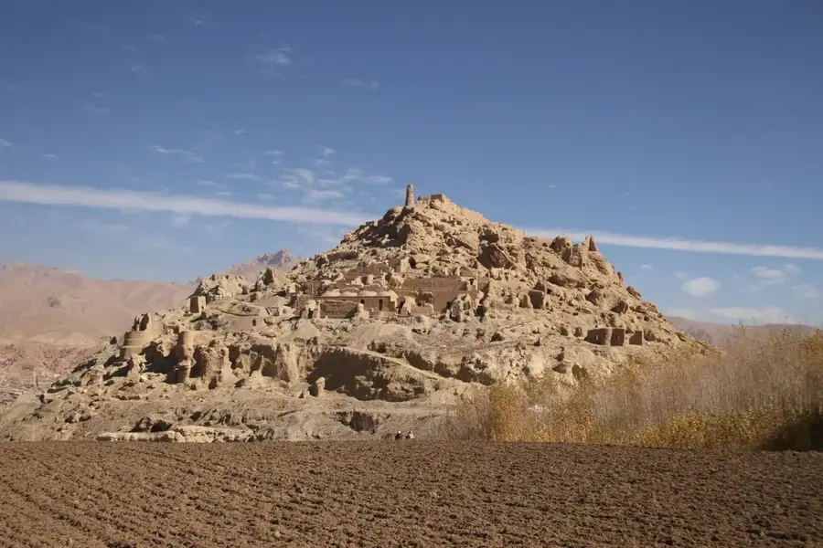
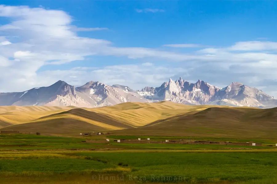
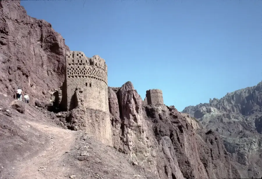
Shahr-e Zuhak, also known as the 'Red City,' is an imposing fortress ruin at the confluence of the Bamiyan and Kalu rivers. Its strategic location allowed for control over the entrance to the Bamiyan Valley. The fortress consists of a series of towers and walls perched dramatically on red mud-brick cliffs, which gives it its name. The fortress's origins are ancient, but it was significantly expanded by the Shi'ite Islamic rulers of the Shansabani dynasty in the 12th and 13th centuries. Like its neighboring city, Shahr-e Gholghola, Shahr-e Zuhak also fell victim to the Mongol invaders under Genghis Khan in 1221 and was razed to the ground. The ruins, though heavily eroded, are still impressive. Visitors can explore the remains of watchtowers, barracks, and other buildings clinging to the steep cliffs. The site not only gives a glimpse into Afghanistan's medieval military architecture but also spectacular views of the surrounding landscape.
- Location: Afghanistan
- Top sights: Butah Zarin · Shahr-e Zuhak
Best time to visit & climate
The most pleasant time to visit is Jun–Aug.
| Jan | Feb | Mar | Apr | May | Jun | Jul | Aug | Sep | Oct | Nov | Dec | |
|---|---|---|---|---|---|---|---|---|---|---|---|---|
| Avg °C | -9 | -8 | -2 | 4 | 8 | 12 | 14 | 13 | 10 | 5 | -1 | -6 |
| Rain mm | 38 | 45 | 56 | 53 | 31 | 15 | 13 | 14 | 16 | 15 | 28 | 22 |
📋 Practical info
Geography
Facts
- Known as the 'Red City'.
- Controlled the entrance to the Bamiyan Valley.
- Built on red cliffs.
- Expanded by the Shansabani dynasty.
- Destroyed in 1221 by Genghis Khan's army.
- Located at the confluence of two rivers.
- Ruins are now heavily eroded.
- Offers spectacular views.
Explore nearby
Notable places around
Route planner — Car & Motorhome
Where do you start? We build the route here, with stops and country notes along the way.
© OpenStreetMap contributors · OpenRouteService
Sights in the town Shahr-e Zuhak (2)
Sights nearby
Frequently asked questions
What is Schahr-e Zuhak?
How difficult is access?
How long should I plan for?
When is the weather best?
What is the site known for?
Shahr-e Zuhak: where is it located?
Shahr-e Zuhak: what is there to see?
Shahr-e Zuhak: when is the best time to visit?
Shahr-e Zuhak: why is it worth visiting?

Nearby cities
More places