Plizio Visual Lab
Bamyan

ℹ️Practical info — Bamyan
▾
🌤 Weather — 5 days
📍 Nearby
Sights nearby
💡 Tips
- The altitude is high (around 2,550m), so give yourself time to acclimatize to avoid mountain sickness.
- Spring (May-June) and Autumn (September-October) offer the best weather and visibility for the Buddha niches.
- Security situations can change; always check with local guides and guesthouses.
- Modest dress is strictly required for all visitors.
🍽 Food
Leek-filled dumplings topped with garlic yogurt and meat sauce, found in traditional eateries.
Rice with lamb, carrots, and raisins, available at main bazaar restaurants.
Stuffed flatbread, usually with potatoes or leeks, a great street food snack.
🛍 Shopping · 🧘 Quiet spots
Buy local dried fruits, nuts, and traditional Afghan clothing.
Look for beautifully embroidered textiles and rugs made by the local Hazara community.
A short drive away, these deep blue lakes offer striking, peaceful mountain scenery.
The Red City ruins provide a quiet, historical hike with commanding views of the valley.
Water temperature…
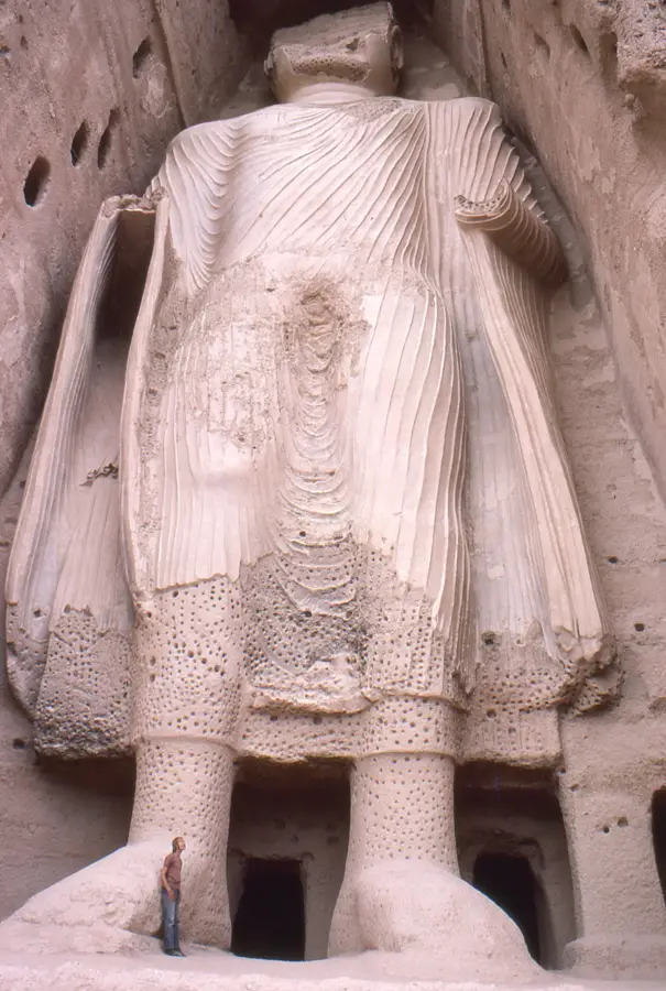
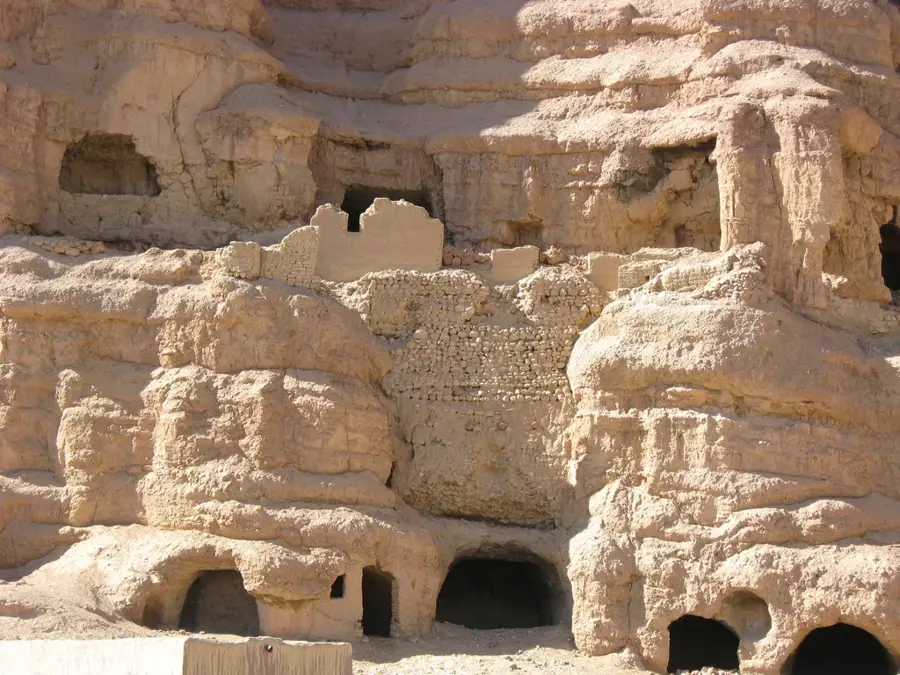
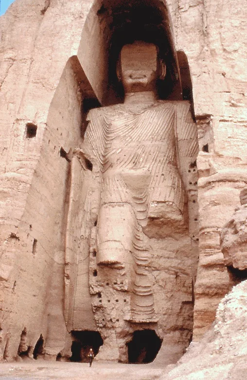
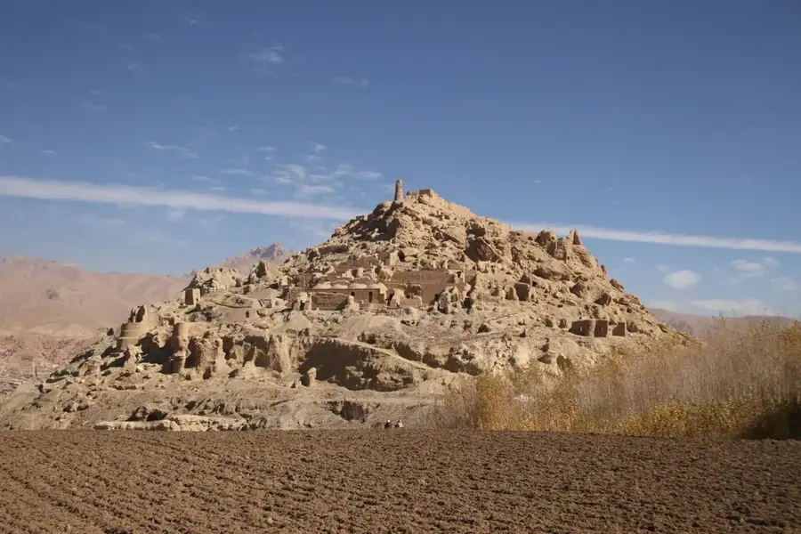
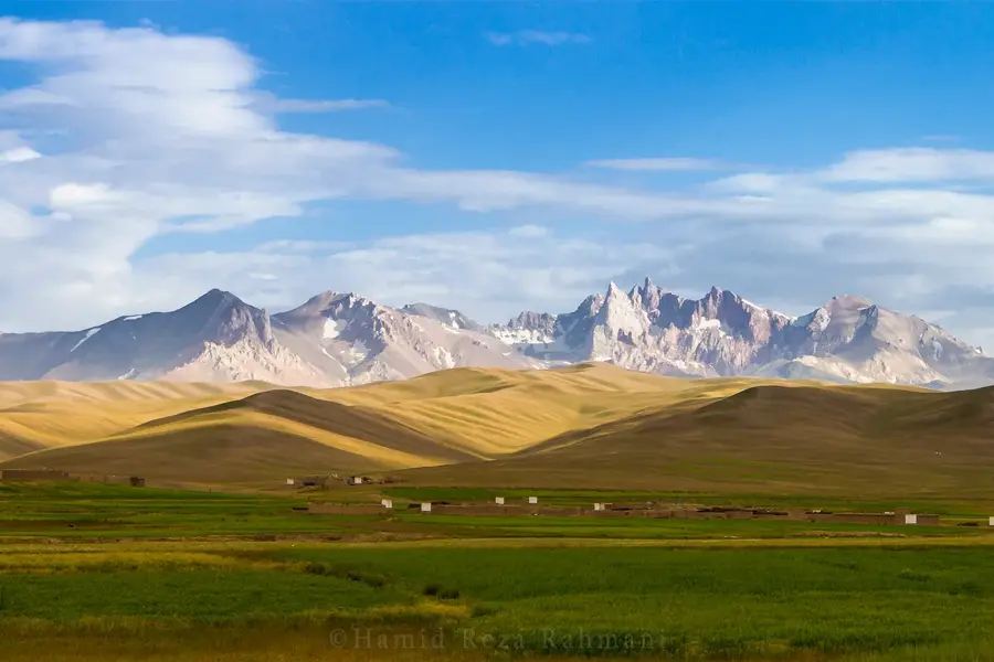
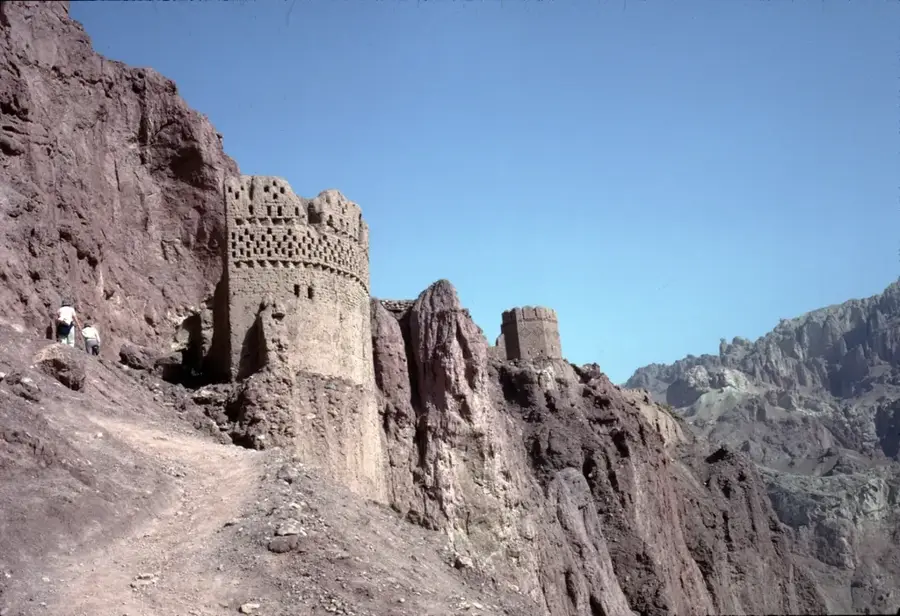
Bamyan is the administrative capital of Bamyan Province in central Afghanistan, situated in a high-altitude valley at approximately 2,550 meters above sea level. The city is globally recognized for its profound historical significance as a major center of Buddhism along the ancient Silk Road, bridging the cultures of China and India with the West. It is most famous for the Buddhas of Bamyan, two colossal statues carved into the sandstone cliffs in the 6th century, which were tragically destroyed in 2001. The cultural landscape of the Bamyan Valley is a UNESCO World Heritage site, featuring an extensive network of cave monasteries and the ruins of ancient citadels such as Shahr-e Gholghola (the City of Screams) and Shahr-e Zohak (the Red City). Geographically, the city is located between the Hindu Kush and the Koh-i-Baba mountains, providing a dramatic backdrop and a harsh continental climate characterized by cold, snowy winters. The local economy is primarily driven by agriculture, with Bamyan being Afghanistan's leading producer of potatoes. The population is predominantly composed of the Hazara ethnic group, who follow Shia Islam and possess a unique cultural identity and linguistic dialect known as Hazaragi. In recent years, Bamyan has emerged as a hub for eco-tourism and cultural preservation, being close to the striking blue travertine lakes of Band-e Amir, the country's first national park. Despite the regional instability, the city has maintained a reputation for being relatively peaceful and focused on education, supported by the presence of Bamyan University. The ongoing efforts to stabilize and restore the archaeological sites reflect the city's importance as a beacon of Afghan heritage and a potential gateway for international scientific collaboration and sustainable development.
- Location: Afghanistan
- Population: ~61.863 (2026)
Best time to visit & climate
The most pleasant time to visit is Jun–Aug.
| Jan | Feb | Mar | Apr | May | Jun | Jul | Aug | Sep | Oct | Nov | Dec | |
|---|---|---|---|---|---|---|---|---|---|---|---|---|
| Avg °C | -9 | -8 | -2 | 4 | 8 | 12 | 14 | 13 | 10 | 5 | -1 | -6 |
| Rain mm | 38 | 45 | 56 | 53 | 31 | 15 | 13 | 14 | 16 | 15 | 28 | 22 |
Geography
Facts
- Bamyan sits at an elevation of 2,550 meters in the central highlands.
- The two colossal Buddha statues were carved in 507 AD and 544 AD.
- The cultural landscape was designated a UNESCO World Heritage site in 2003.
- Bamyan is the primary source of potatoes for much of Afghanistan.
- Shahr-e Zohak is known as the 'Red City' due to its distinct soil color.
- The city served as a key transit point for the Silk Road for over a millennium.
- The nearby Band-e Amir National Park consists of six deep blue lakes.
- The local dialect, Hazaragi, is a variant of the Persian language.
Explore nearby
Notable places around
Route planner — Car & Motorhome
Where do you start? We build the route here, with stops and country notes along the way.
© OpenStreetMap contributors · OpenRouteService
Sights in the town Bamyan (1)
Frequently asked questions
What is Bamiyan?
What makes it so special?
When should one visit Bamiyan?
Is it suitable for travelers?
What is there to see?
Bamyan: where is it located?
Bamyan: when is the best time to visit?
Bamyan: why is it worth visiting?

More places