Plizio Visual Lab
Koh-e Baba
Weather…
Water temperature…
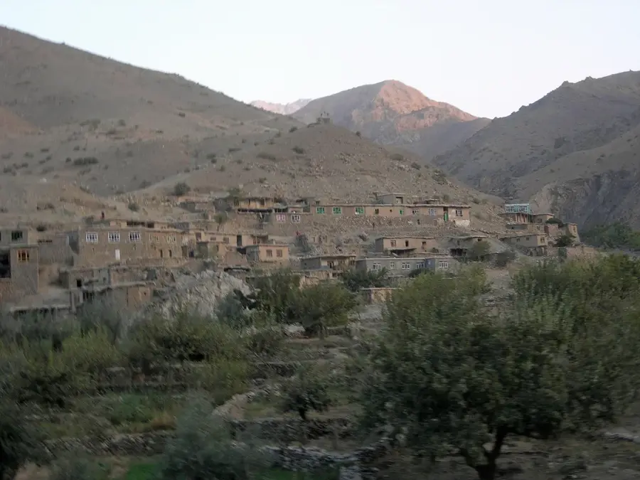
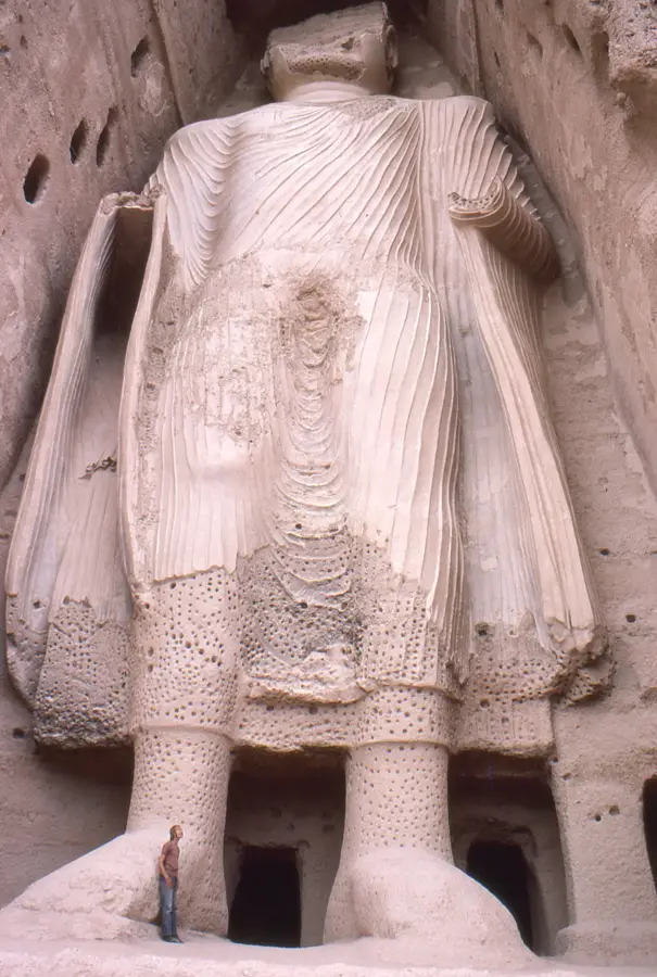
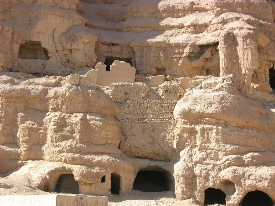
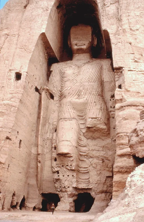
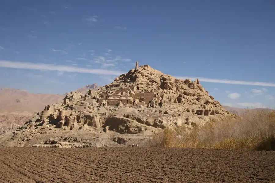
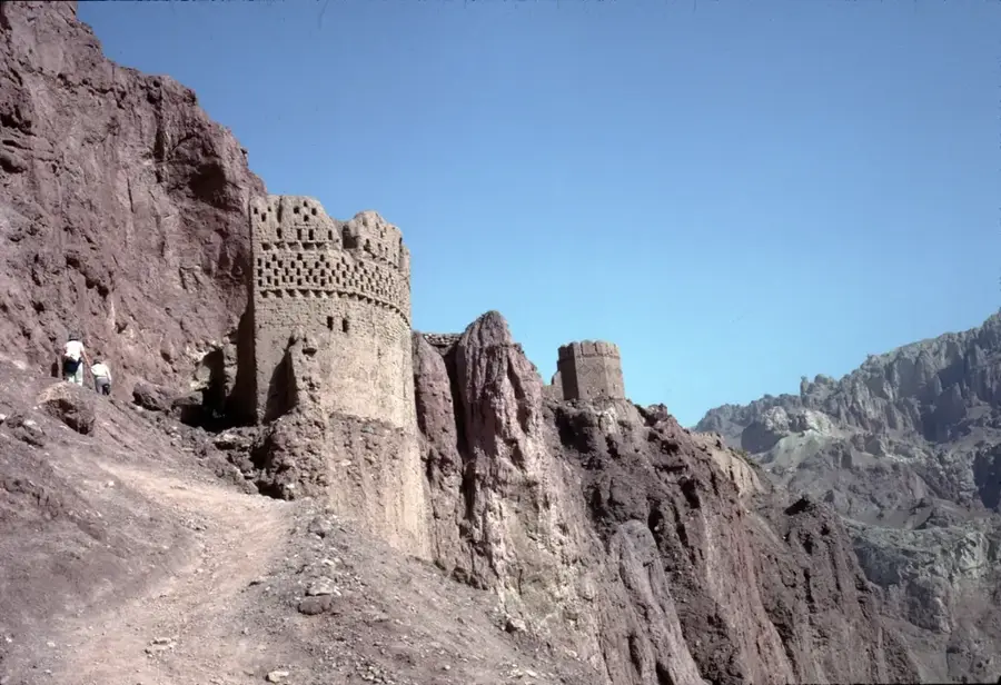
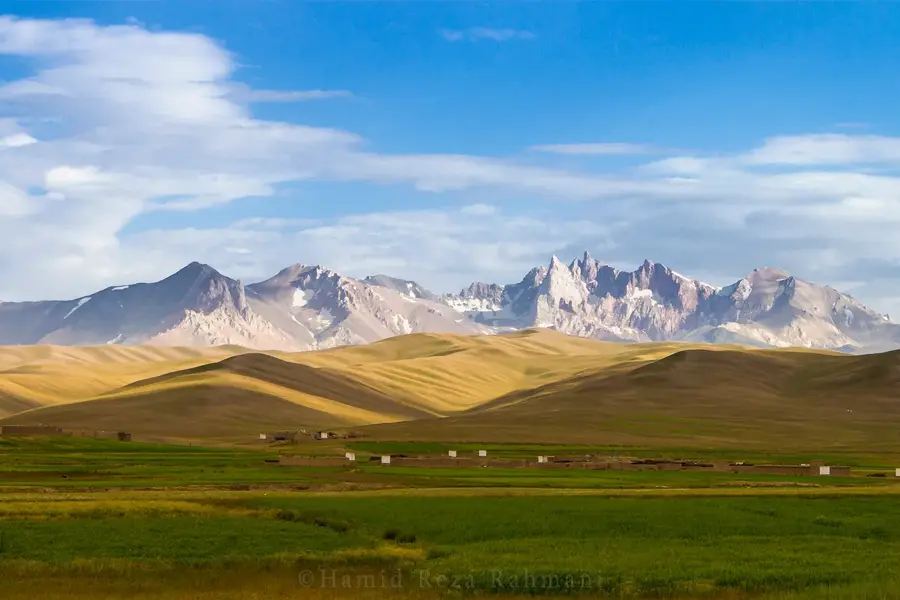
The Koh-e Baba range is a central mountain massif in Afghanistan, extending west of the capital Kabul and forming a crucial watershed for the country. It serves as a link between the massive Hindu Kush to the east and the western plateaus. Its highest peak, Shah Foladi, rises to 4,951 meters. The mountains are known for their rugged peaks, deep gorges, and the absence of dense vegetation in higher elevations. Koh-e Baba is geologically diverse and hosts significant mineral deposits. For Afghanistan's hydrology, the range is indispensable, as it contains the sources of major rivers such as the Helmand, Hari Rud, and Kabul River. Meltwater from glaciers and snowfields supplies vast portions of the dry lowlands with vital water. The Bamiyan region, situated at the foot of the mountains, is world-famous for its archaeological sites. The rugged beauty of Koh-e Baba makes it a symbol of the endurance and geographical identity of the Afghan heartland.
Best time to visit & climate
The most pleasant time to visit is Jun–Aug.
| Jan | Feb | Mar | Apr | May | Jun | Jul | Aug | Sep | Oct | Nov | Dec | |
|---|---|---|---|---|---|---|---|---|---|---|---|---|
| Avg °C | -10 | -9 | -2 | 3 | 8 | 12 | 14 | 14 | 10 | 4 | -2 | -7 |
| Rain mm | 38 | 47 | 63 | 64 | 38 | 20 | 18 | 19 | 19 | 16 | 29 | 22 |
📋 Practical info
Geography
Facts
- Highest peak: Shah Foladi (4,951 m)
- Location: Central Highlands of Afghanistan
- Watershed: Separates the drainage basins of northern and southern river systems
- Geology: Composed of metamorphic and volcanic rock
- Climate: Alpine conditions with permanent snow at high altitudes
- Specialty: Western continuation of the Hindu Kush range
Explore nearby
Notable places around
Route planner — Car & Motorhome
Where do you start? We build the route here, with stops and country notes along the way.
© OpenStreetMap contributors · OpenRouteService
Sights nearby
Frequently asked questions
How hard is the tour up Koh-e Baba?
When is the best time to go?
How do you get there?
Are there food stalls or toilets on site?
What should I watch for in the weather?
Koh-e Baba: where is it located?
Koh-e Baba: when is the best time to visit?
Koh-e Baba: why is it worth visiting?

Nearby cities
More places