Plizio Visual Lab
Kon Tum

ℹ️Practical info — Kon Tum
▾
🌤 Weather — 5 days
📍 Nearby
Sights nearby
💡 Tips
- Rent a motorbike to easily reach the surrounding Bahnar ethnic minority villages.
- Always ask for permission from the village elders before entering a communal Rong house.
- The Central Highlands get chilly in the evenings, so pack a light jacket.
- Visit the wooden church in the late afternoon for the best warm lighting for photos.
🍽 Food
A local breakfast specialty found around the central market.
A complex dish with over 40 types of leaves, served at specialized local restaurants.
Enjoy robusta coffee at cafes overlooking the Dak Bla River.
🛍 Shopping · 🧘 Quiet spots
Buy traditional textiles directly from artisans in the nearby villages.
Locally grown beans available in the town's markets and cafes.
A calm area for a walk, especially near the suspension bridge.
A peaceful green oasis right in the city center.
Water temperature…
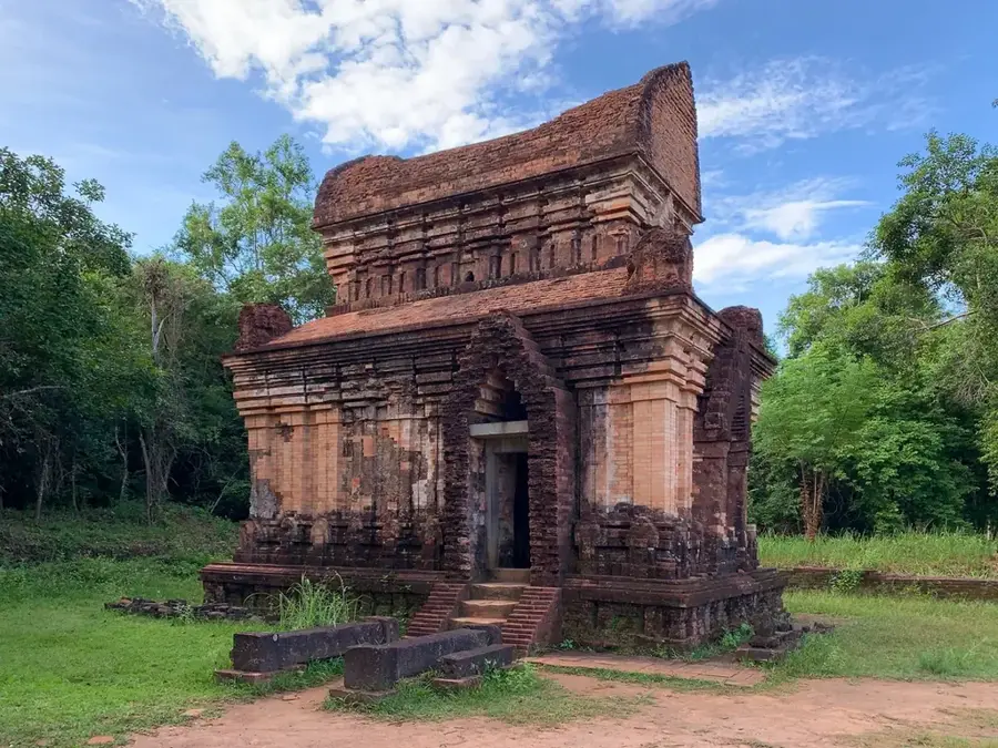
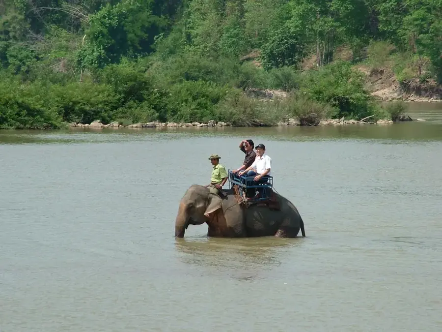
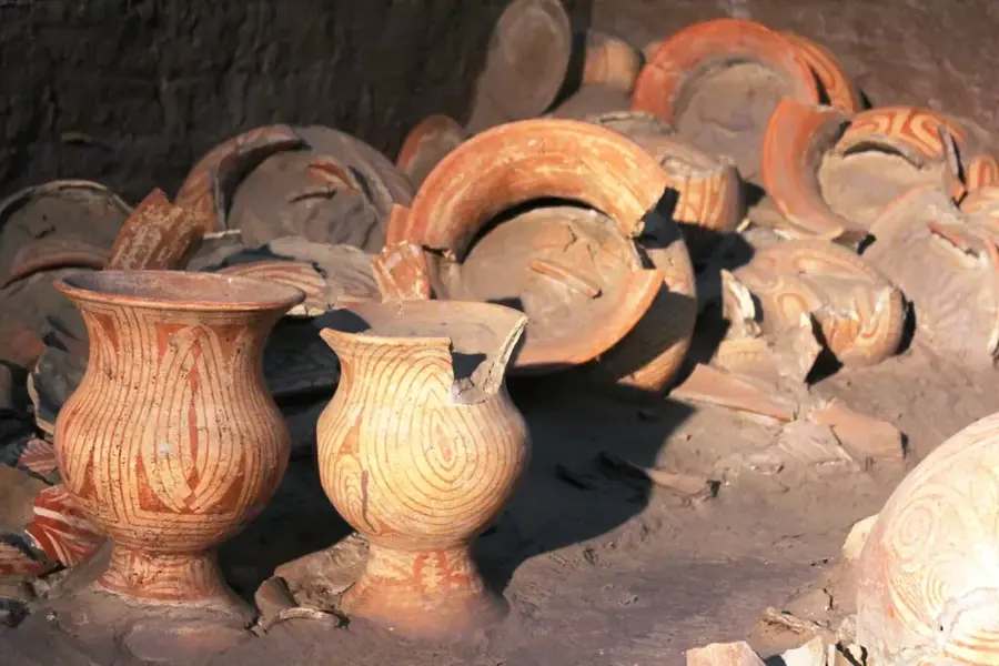
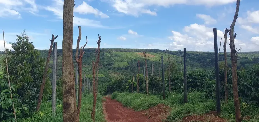
Kon Tum is located in the northern part of Vietnam's Central Highlands and is celebrated for its rich ethnic diversity and impressive sacred architecture. The city is profoundly shaped by the presence of the Ba Na and Jarai ethnic groups, whose traditional communal houses, known as Nha Rong, feature soaring, steep roofs that dominate the landscape. A premier architectural highlight is the famous Kon Tum Wooden Church, built in 1913 by French missionaries, representing a unique fusion of Romanesque style and local Ba Na architectural elements. Geographically, the city is bisected by the Dak Bla River, which possesses a rare characteristic: it flows from east to west, contrary to the typical direction of rivers in Vietnam. The region was a site of intense conflict during the Vietnam War, particularly during the Battle of Kon Tum in 1972, highlighting the city's strategic historical importance. Today, Kon Tum serves as a gateway to pristine national parks and is a vital center for coffee and rubber production.
- Location: Vietnam
- Top sights: Kon Tum Museum · Bishop of Kontum's Building · Highland Eco Tours
- Nearby: Pleiku (13 km)
- Population: ~205.762 (2025)
Best time to visit & climate
The most pleasant time to visit is Jan–Mar.
| Jan | Feb | Mar | Apr | May | Jun | Jul | Aug | Sep | Oct | Nov | Dec | |
|---|---|---|---|---|---|---|---|---|---|---|---|---|
| Avg °C | 19 | 21 | 23 | 25 | 25 | 25 | 24 | 24 | 23 | 22 | 21 | 19 |
| Rain mm | 26 | 10 | 17 | 21 | 51 | 68 | 86 | 131 | 167 | 228 | 175 | 87 |
Geography
Facts
- The Kon Tum Wooden Church was constructed entirely without the use of nails.
- The Dak Bla River is the only river in Vietnam that flows westward.
- The Kon Tum Museum houses over 2,000 distinct ethnological artifacts.
- The Battle of Kon Tum took place from May to June in 1972.
- Kon Tum was officially designated as a city (Class-3) in 2005.
- The province is home to more than 20 different ethnic minority groups.
Explore nearby
Notable places around
Route planner — Car & Motorhome
Where do you start? We build the route here, with stops and country notes along the way.
© OpenStreetMap contributors · OpenRouteService
Sights in the town Kon Tum (11)
Frequently asked questions
Where is Kon Tum located?
What is the most famous architectural sight?
Can you meet indigenous people?
What is the weather like in Kon Tum?
What are typical souvenirs?
Kon Tum: where is it located?
Kon Tum: what is there to see?
Kon Tum: when is the best time to visit?
Kon Tum: why is it worth visiting?

Nearby cities


History & landmarks

Nature
More places