Plizio Visual Lab

Đồng Văn Karst Plateau Geopark

Plizio editorial teamData Sources
national-park
—°10
Đồng Văn Karst Plateau Geopark (Vietnam)

Weather…

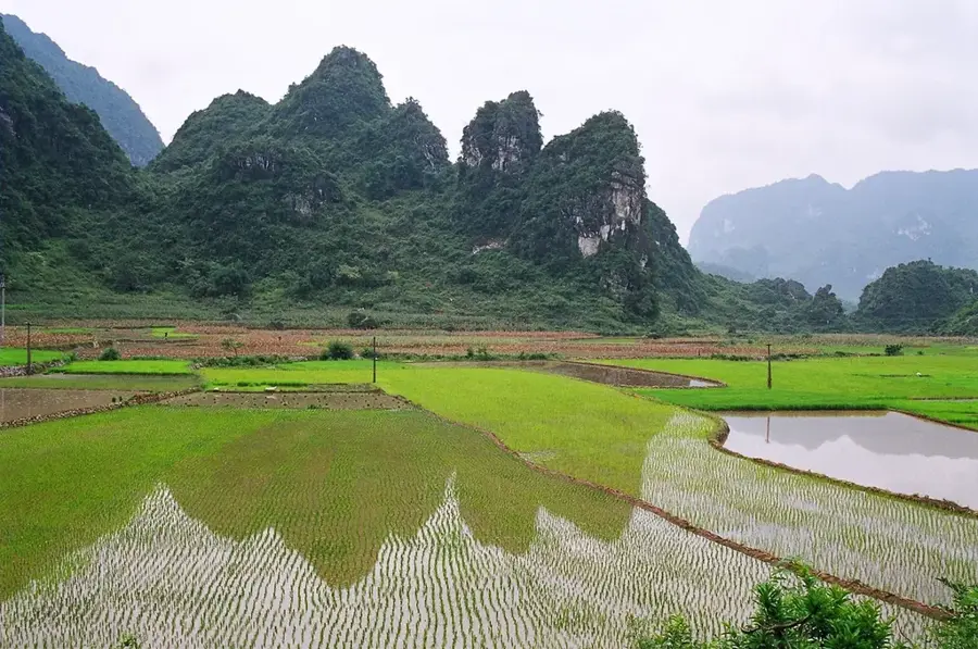
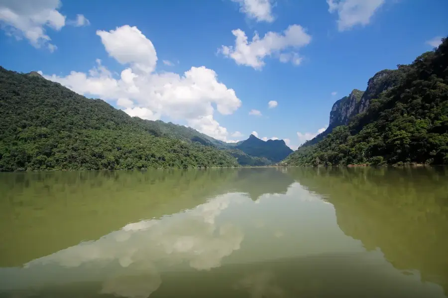
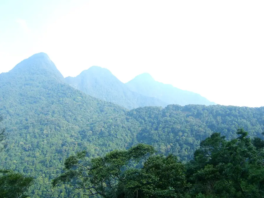
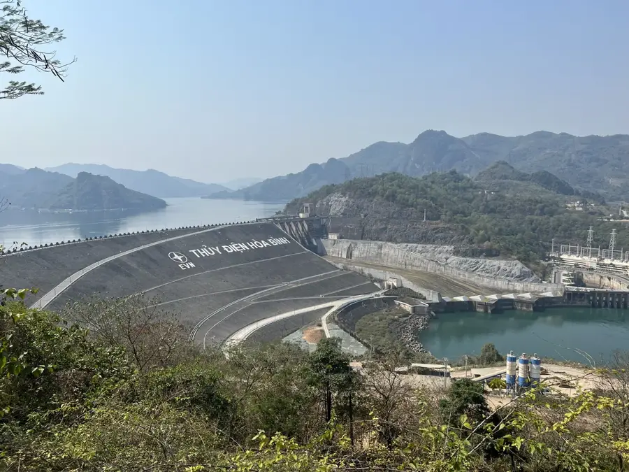
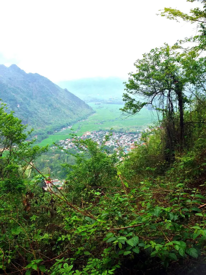
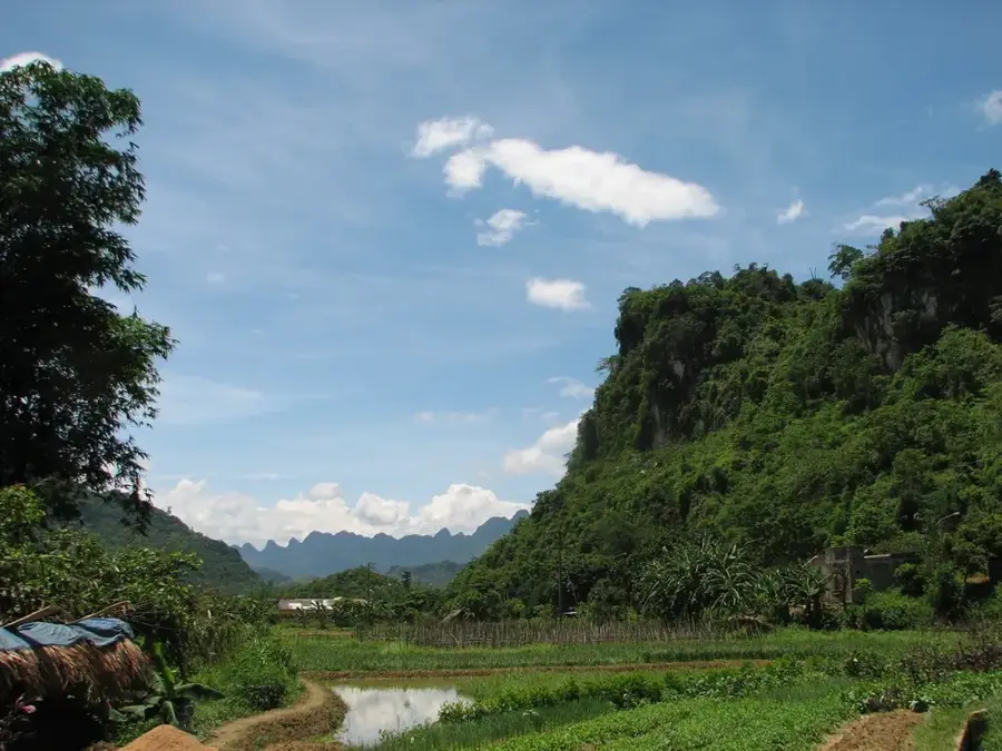
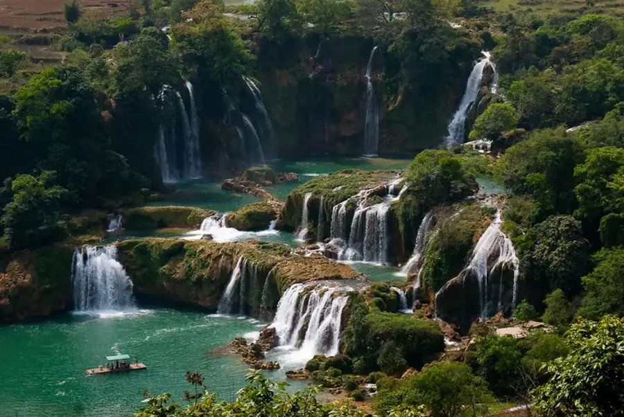
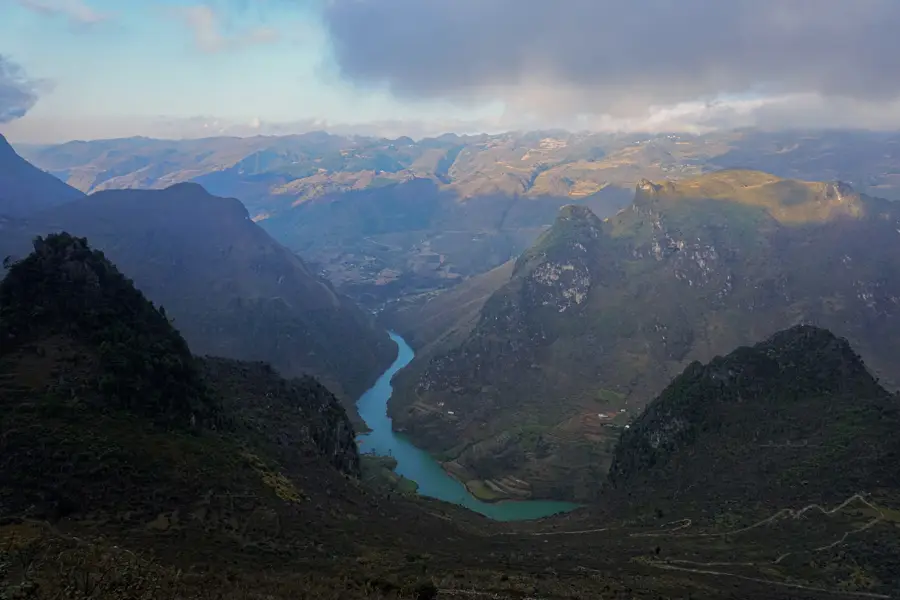
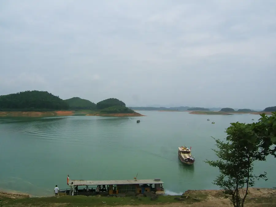
Đồng Văn Karst Plateau Geopark is a remarkable feature of the geography and culture of Vietnam. A UNESCO Global Geopark in Hà Giang province, known for its dramatic karst landscape, deep canyons, and the culture of local ethnic groups. 80% of the area is covered by limestone. The Ma Pi Leng Pass provides spectacular views. Home to 17 ethnic minorities. This natural area reflects the scenic diversity of Vietnam, from Ha Long Bay to the iconic rice terraces. Like many notable places in Vietnam, it combines regional character with the legacy of a millennia-old civilization and the French colonial era. Thus, this place contributes to the diverse profile of Vietnam, from the Mekong Delta and Ha Long Bay to the terraced rice fields.

📋 Practical info

🧭
Getting there
The geopark is typically accessed from Hà Giang city, requiring a multi-hour drive along winding mountain roads. Most visitors hire a motorbike or book a guided car tour from the provincial capital.
📅
Best season
The dry season, from October to April, is generally considered the best time to visit, avoiding the heavy summer rains. The spectacular buckwheat flower blooming typically occurs around October and November.
⛰️
Terrain & paths
Expect steep gradients, dramatic deep canyons, and rugged rocky limestone plateaus across the entire region. The landscape is visually striking but requires careful navigation on the narrow, winding paths.
🎒
What to bring
Warm layers are highly recommended as temperatures can drop significantly at high altitudes, especially at night. Sturdy walking shoes, rain protection, and a reliable camera are essential for this journey.
🅿️
Parking
Parking is typically available in larger towns like Đồng Văn and Mèo Vạc, or at designated viewpoints along the route. When stopping to admire the scenery, always ensure your vehicle is safely off the road.
⚠️
Safety
Exercise extreme caution when driving on mountain passes, as they can be narrow, misty, and prone to landslides after rain. Always respect local cultures and ask for permission before photographing residents.
⏱️
Time needed
A comprehensive exploration of the geopark usually takes three to four days to fully appreciate the vast distances and cultural sites. Shorter two-day trips are possible but require long hours on the road.

Geography

Coordinates
23.25000, 105.25000

Facts

  • A UNESCO Global Geopark in Hà Giang province, known for its dramatic karst landscape, deep canyons, and the culture of local ethnic groups.
  • Located within the Socialist Republic of Vietnam.
  • Plays a role in the local identity of the region.

Explore nearby

Notable places around

Route planner — Car & Motorhome

Where do you start? We build the route here, with stops and country notes along the way.

Vehicle
Only stops with (optional):

© OpenStreetMap contributors · OpenRouteService

Sights in the town Đồng Văn Karst Plateau Geopark (10)

Khe Lía🌿 nature

A viewpoint in the Dong Van Geopark offering a look at the deep valleys and rugged limestone cliffs.

Hoa Men Say🌿 nature

An elevated observation point overlooking the characteristic karst landscape and small Hmong villages of the region.

+ belle vue d’Ha Giang🌿 nature

A prized viewpoint in Ha Giang with a wide panorama over the winding mountain roads.

Sa Phin Rocky Desert📍 landmark

A bizarre landscape of grey limestone rocks in the Dong Van plateau, resembling a stone desert.

Pyramid shaped mountain📍 landmark

A distinctive, conical karst mountain rising alone from the rugged highlands of Ha Giang.

H'Mong King Palace🏛 museum

A grand residence featuring a blend of H'mong, French, and Chinese architecture built for a local leader.

Lũng Táo Pyramid📍 landmark

Conical limestone karst mountains that rise sharply from the northern Vietnamese landscape.

Pho Cao🎭 culture

A peaceful ethnic village known for its century-old earth houses and periodic market.

Pho Bang Market🎭 culture

A quiet border town featuring traditional clay-walled houses and a bustling ethnic market.

Phố Cáo Market🎭 culture

An animated ethnic market held every six days where local hill tribes trade goods and livestock.

Sights nearby

Frequently asked questions

Is the Geopark suitable for drivers?
Yes, the roads are spectacular but curvy and narrow in places.
What is the best season to visit?
Autumn has beautiful colors and pleasant temperatures.
How long does it take to explore?
You should plan for at least 2 to 3 days.
Is there a visitor center?
Yes, the main center is located in the town of Dong Van.
What is special about the landscape?
The unique karst formations and deep valleys are geologically rare.
Đồng Văn Karst Plateau Geopark: where is it located?
Đồng Văn Karst Plateau Geopark is located in Vietnam.
Đồng Văn Karst Plateau Geopark: what is there to see?
Highlights include Khe Lía, Hoa Men Say, + belle vue d’Ha Giang.
Đồng Văn Karst Plateau Geopark: why is it worth visiting?
Đồng Văn Karst Plateau Geopark is a remarkable feature of the geography and culture of Vietnam.
View on map → The Top 50 Attractions → OpenStreetMap →
Asia
Explore with Plizio Discover more places in Asia
More places in Vietnam →

Nearby cities

History & landmarks

Nature

More places