Plizio Visual Lab
Skuleskogen National Park
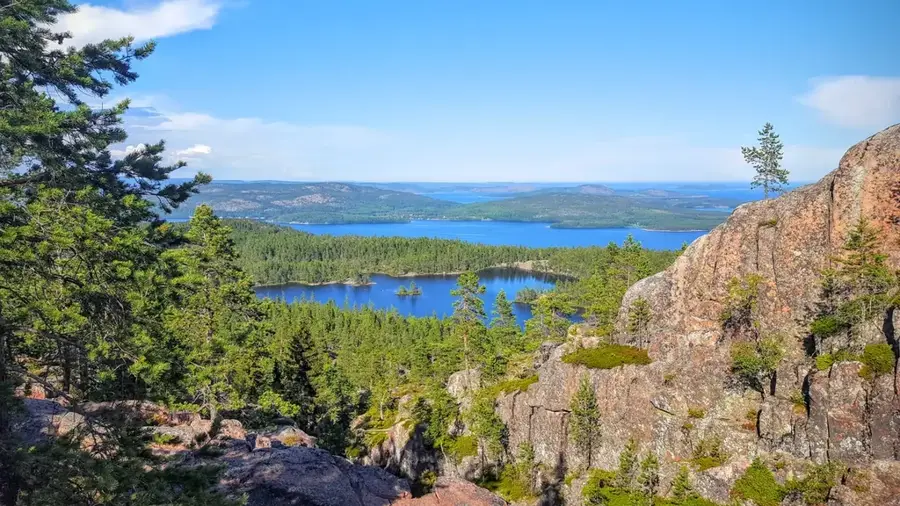
Skuleskogen National Park is located on the Baltic coast of Sweden in Västernorrland County and serves as the centerpiece of the High Coast (Höga Kusten) UNESCO World Heritage Site. Established in 1984, the park covers about 30 square kilometers and is world-renowned for showcasing post-glacial land uplift, which has been occurring since the ice retreated 10,000 years ago and currently measures about 8 millimeters annually. The topography is defined by rugged granite mountains rising steeply from the sea and deep, primeval forest-like valleys. Its most iconic landmark is the Slåttdalsskrevan, a narrow canyon approximately 200 meters long and 40 meters deep that splits the Slåttdalsberget mountain. The park's biodiversity is unique, featuring the northernmost natural occurrences of hazel trees alongside rare lichens like the wolf lichen. It gives panoramic views over the Bothnian Sea archipelago. Hikers can traverse the park via an extensive trail system, which is part of the famous High Coast Trail (Högakustenleden), leading through a landscape that is geologically alive and constantly rising.
- Location: Sweden
- Top sights: Barrows · Högsvedjeberget · Skuleskogen Entré Väst
- Nearby: Ulvön (13 km)
Best time to visit & climate
The most pleasant time to visit is Jun–Aug.
| Jan | Feb | Mar | Apr | May | Jun | Jul | Aug | Sep | Oct | Nov | Dec | |
|---|---|---|---|---|---|---|---|---|---|---|---|---|
| Avg °C | -4 | -4 | -2 | 2 | 7 | 12 | 16 | 15 | 11 | 6 | 2 | -2 |
| Rain mm | 58 | 42 | 40 | 44 | 57 | 53 | 69 | 90 | 72 | 80 | 65 | 67 |
📋 Practical info
Geography
Facts
- The national park was officially established in 1984.
- Covers approx. 30 km² and is a UNESCO World Heritage site since 2000.
- Current land uplift rate is approximately 8 mm per year.
- Slåttdalsskrevan canyon is 200 m long and 40 m deep.
- Features the northernmost natural growth of hazel trees.
- The highest elevation is Slåttdalsberget at 280 meters.
Explore nearby
Notable places around
Route planner — Car & Motorhome
Where do you start? We build the route here, with stops and country notes along the way.
© OpenStreetMap contributors · OpenRouteService
Sights in the town Skuleskogen National Park (4)
Sights nearby
Frequently asked questions
What is the park's most famous feature?
Is the park located on the coast?
How difficult are the hikes?
Are there entrances for cars?
Can you swim in the park?
Skuleskogen National Park: where is it located?
Skuleskogen National Park: what is there to see?
Skuleskogen National Park: when is the best time to visit?
Skuleskogen National Park: why is it worth visiting?

Nearby cities