Plizio Visual Lab
Kebnekaise
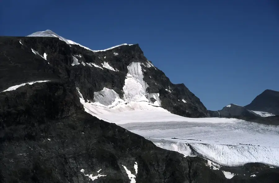
The Kebnekaise massif is the highest mountain range in Sweden, located in the Kiruna municipality of Swedish Lapland. It consists of two primary peaks: the glaciated southern peak (Sydtoppen) and the rocky northern peak (Nordtoppen). Historically, Sydtoppen was regarded as the highest point in the country due to its ice cap, but accelerated melting caused by climate change led to Nordtoppen officially becoming the highest point in 2019, with a fixed elevation of 2,096.8 meters. The massif is part of the Scandinavian Mountains and is surrounded by an arctic landscape featuring deep valleys and numerous glaciers, such as Storglaciären. The area is a significant hub for glaciological research, conducted at the Tarfala Research Station since 1946. For climbers, the western and eastern routes provide distinct challenges, with the latter requiring glacier travel experience. Culturally, the region has been part of the Sami people's ancestral lands for centuries, utilized primarily for reindeer husbandry.
- Location: Sweden
- Top sights: Kebnekaise sydtoppen · Tolpagorni · Vierranvárri
Best time to visit & climate
The most pleasant time to visit is Jun–Aug.
| Jan | Feb | Mar | Apr | May | Jun | Jul | Aug | Sep | Oct | Nov | Dec | |
|---|---|---|---|---|---|---|---|---|---|---|---|---|
| Avg °C | -13 | -12 | -10 | -5 | 1 | 6 | 11 | 9 | 4 | -3 | -8 | -11 |
| Rain mm | 78 | 73 | 76 | 69 | 90 | 113 | 152 | 116 | 111 | 90 | 81 | 89 |
📋 Practical info
Geography
Facts
- Nordtoppen is the highest point in Sweden at 2,096.8 meters above sea level.
- The southern peak, Sydtoppen, has lost more than 20 meters in height since the 1960s.
- The first recorded ascent of the mountain was made by Charles Rabot in 1883.
- The massif is located approximately 150 kilometers north of the Arctic Circle.
- Tarfala Research Station monitors some of the most studied glaciers in the world here.
- The name Kebnekaise is derived from the Sami language, meaning 'Kettle Top'.
Explore nearby
Notable places around
Route planner — Car & Motorhome
Where do you start? We build the route here, with stops and country notes along the way.
© OpenStreetMap contributors · OpenRouteService
Sights in the town Kebnekaise (3)
Sights nearby
Frequently asked questions
How high is Kebnekaise?
Is the climb suitable for beginners?
When is the best time for a climb?
Is there a mountain station?
How do you reach the starting point?
Kebnekaise: where is it located?
Kebnekaise: what is there to see?
Kebnekaise: when is the best time to visit?
Kebnekaise: why is it worth visiting?

Nearby cities