Plizio Visual Lab
El Dher

ℹ️Practical info — El Dher
▾
🌤 Weather — 5 days
📍 Nearby
Sights nearby
💡 Tips
- It is best to explore the afforested areas in the early morning when the native birds are most active.
- Talk to the locals about the tree planting projects; they are proud and happy to share their knowledge about these green miracles.
- Be absolutely sure to stay on the marked paths so as not to damage the young plants and seedlings.
- Since water scarcity can be an issue, always bring your own well-filled water bottle.
🍽 Food
This is often harvested by hand directly near the blossoming afforestation projects.
An absolute must-try when visiting, available in the small and cozy village cafes.
Often offered fresh by local nomads on the outskirts of the settlement.
🛍 Shopping · 🧘 Quiet spots
Buy these traditional handicrafts, made from local grasses by the village women.
Discover pure honey or fragrant tree resins at the small local market.
Enjoy a cool, shady spot created by the careful afforestation.
An absolutely peaceful place to observe the wonderful green transformation of the savanna.
Water temperature…
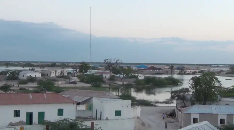
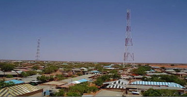
El Dher, known in Somali as Ceel Dheer, is a strategically located coastal town in the eastern Galguduud region of Somalia. Situated near the Indian Ocean, the town serves as a vital link between maritime trade routes and the pastoral interior. Historically, El Dher is renowned for its religious educational institutions, which have long attracted scholars from across central Somalia. The surrounding environment is characterized by sandy plains and scrubland, with the coast offering pristine beaches and abundant fishing grounds. Economically, the community relies on a mix of fishing, small-scale livestock rearing, and the trade of agricultural goods from more fertile southern regions. In recent years, El Dher has been a focal point for local reconciliation processes and the rebuilding of civil infrastructure. The town's architecture features a blend of simple dwellings and prominent mosques that underscore its religious heritage. As a regional hub, it facilitates the exchange of goods between the coast and distant grazing lands.
- Location: Somalia
- Nearby: Harardhere (70 km)
Best time to visit & climate
The most pleasant time to visit is Jan, Jul, Aug.
| Jan | Feb | Mar | Apr | May | Jun | Jul | Aug | Sep | Oct | Nov | Dec | |
|---|---|---|---|---|---|---|---|---|---|---|---|---|
| Avg °C | 26 | 26 | 28 | 29 | 28 | 26 | 25 | 26 | 26 | 27 | 27 | 27 |
| Rain mm | 2 | 3 | 13 | 84 | 29 | 8 | 7 | 17 | 20 | 71 | 77 | 13 |
Geography
Facts
- Geographic coordinates: 3°53' North and 47°11' East.
- A key coastal stronghold in the Galguduud region.
- Renowned as a significant center for Islamic scholarship.
- Located on the strategic coastal road between Mogadishu and Hobyo.
- Home to a growing fishing industry on the Indian Ocean.
- Was recaptured by government forces in January 2023.
Explore nearby
Notable places around
Route planner — Car & Motorhome
Where do you start? We build the route here, with stops and country notes along the way.
© OpenStreetMap contributors · OpenRouteService
Frequently asked questions
What characterizes Ceeldheer?
What is the environment like?
Are there tourists?
What is the best way to travel?
When to visit?
El Dher: where is it located?
El Dher: when is the best time to visit?
El Dher: why is it worth visiting?

Nearby cities