Plizio Visual Lab
Matanikau River
Weather…
Water temperature…
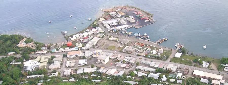
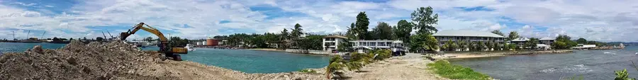
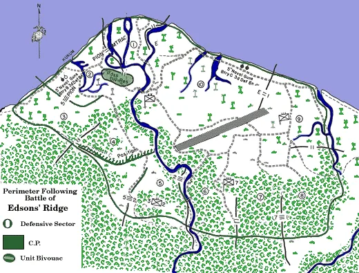
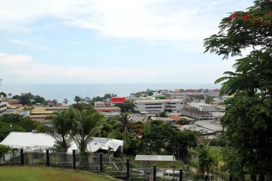
The Matanikau River, located just west of modern-day Honiara, served as a volatile front line for much of the Guadalcanal Campaign. Between September and November 1942, the river valley was the scene of continuous patrolling and several large-scale engagements as both American and Japanese forces struggled for control of the crossings. The steep ridges and dense foliage surrounding the river favored the defenders, leading to high casualties for any attacking force. Notable actions occurred in late September, where US Marines suffered a significant repulse, and again in early November when a coordinated US offensive finally pushed Japanese forces further west. The river mouth was also a primary landing point for Japanese reinforcements. Today, the Matanikau is a central feature of Honiara's landscape, but its steep banks remain a silent monument to the fierce jungle warfare that defined the struggle for the island.
- Location: Solomon Islands
- Top sights: Botanical Garden · RAMSI Memorial · World War II Memorials
- Nearby: Kokumbona (5 km)
Best time to visit & climate
The most pleasant time to visit is Jul–Sep.
| Jan | Feb | Mar | Apr | May | Jun | Jul | Aug | Sep | Oct | Nov | Dec | |
|---|---|---|---|---|---|---|---|---|---|---|---|---|
| Avg °C | 27 | 26 | 26 | 26 | 26 | 26 | 26 | 26 | 26 | 26 | 27 | 27 |
| Rain mm | 263 | 305 | 277 | 220 | 214 | 143 | 135 | 114 | 107 | 160 | 167 | 221 |
📋 Practical info
Geography
Facts
- The river acted as the western boundary of the US perimeter for several months.
- Signalman Douglas Munro is the only Coast Guardsman to receive the Medal of Honor for his actions here.
- A major Japanese tank attack was repulsed at the river's mouth in October 1942.
- The upper reaches of the river feature deep limestone gorges and caves.
- The battle for the Matanikau crossings was essential for the eventual US breakout.
- Remnants of foxholes can still be found by hikers on the ridges overlooking the river.
Explore nearby
Notable places around
Route planner — Car & Motorhome
Where do you start? We build the route here, with stops and country notes along the way.
© OpenStreetMap contributors · OpenRouteService
Sights in the town Matanikau River (10)
World War II Memorials
Multiple memorials in Honiara remembering fallen soldiers and events of World War II.
SDA⛪ church
Seventh-day Adventist church in Honiara, venue for worship services.
South Seas Evangelical Church
Evangelical church in Honiara, part of the South Seas Evangelical Church.
Wesley United Church
Methodist church in Honiara, belonging to the Wesley United Church.
Holy Cross Cathedral
Cathedral in Honiara, seat of the Catholic diocese.
White River SDA⛪ church
Adventist church in the White River neighborhood of Honiara.
Sights nearby
Frequently asked questions
What is the historical significance of the Matanikau River?
Are there memorials there?
How to get there?
Can one hike along the river?
What is the best time of day for photos?
Matanikau River: where is it located?
Matanikau River: what is there to see?
Matanikau River: when is the best time to visit?
Matanikau River: why is it worth visiting?

Nearby cities


History & landmarks


More places