Plizio Visual Lab
Turbacz Peak
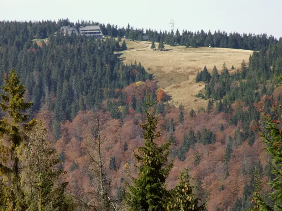
Turbacz rises as an incredibly massive and highly central hub within the Gorce Mountains, a densely forested mountain range gently elevating from the southern Polish foothills of the Tatras. As the absolute highest peak in the region, the mountain captivates visitors less with highly rugged, harsh rock faces and much more with its remarkably extensive, gently ascending ridges deeply covered with magnificent spruce and beech forests. The mountain serves entirely as the absolute focal point of a star-shaped network of highly popular hiking and mountain biking trails that reliably lead to the summit from literally all directions. Situated just slightly below the heavily wooded crest is the highly famous PTTK mountain hut on the highly pretty Hala Długa (Long Meadow), from whose terrace a truly spectacular, completely uninterrupted panorama of the majestic, snow-capped Tatra range dramatically unfolds on clear days. The surrounding alpine meadows, heavily shaped by traditional sheep grazing, display an enormous, deeply lively floral splendor in early summer, notably featuring numerous highly rare crocus and orchid species.
- Location: Poland
- Top sights: Turbacz · Widok na Tatry · Szałasowy ołtarz na Hali Turbacz
- Nearby: Nowy Targ (8 km)
Best time to visit & climate
The most pleasant time to visit is Jun–Aug.
| Jan | Feb | Mar | Apr | May | Jun | Jul | Aug | Sep | Oct | Nov | Dec | |
|---|---|---|---|---|---|---|---|---|---|---|---|---|
| Avg °C | -5 | -4 | 0 | 6 | 11 | 15 | 17 | 17 | 12 | 7 | 2 | -3 |
| Rain mm | 56 | 55 | 61 | 64 | 117 | 124 | 137 | 96 | 89 | 71 | 56 | 53 |
📋 Practical info
Geography
Explore nearby
Notable places around
Route planner — Car & Motorhome
Where do you start? We build the route here, with stops and country notes along the way.
© OpenStreetMap contributors · OpenRouteService
Sights in the town Turbacz Peak (7)
Rozdziele
A mountain peak in Poland.
Czoło Turbacza
A secondary peak of the Turbacz massif.
Gajówka Mikołaja🏛 museum
Former forester's lodge, now a museum of local history.
Sights nearby
Frequently asked questions
How high is Turbacz?
Is there a mountain shelter on the peak?
Where is the best place to start the hike?
How long does the ascent take?
Can you see the Tatra Mountains from the peak?
Turbacz Peak: where is it located?
Turbacz Peak: what is there to see?
Turbacz Peak: when is the best time to visit?
Turbacz Peak: why is it worth visiting?

Nearby cities