Plizio Visual Lab
Tumen River
Weather…
Water temperature…
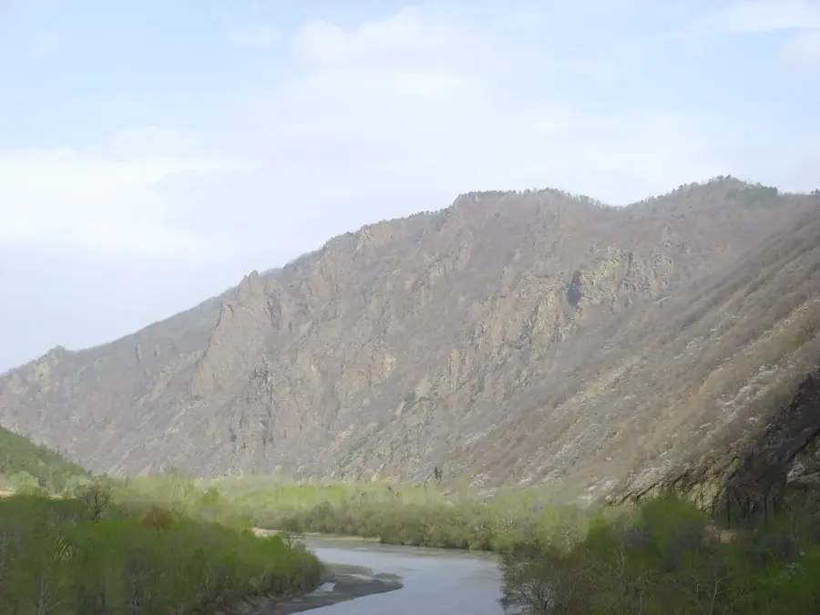
The Tumen River serves as a vital natural boundary between North Korea, China, and a short stretch of the Russian Federation near its mouth. With a total length of approximately 521 kilometers, it originates from the eastern slopes of Mount Paektu and flows into the Sea of Japan. Historically, the river has been a gateway for migration and trade, although its shallow waters often limit large-scale navigation compared to the Yalu River. The region surrounding the Tumen is characterized by extensive wetlands and forests, which provide habitats for various species, though environmental degradation has become a concern in recent decades. It is also the site of the Tumen River Area Development Program, an international effort to promote economic cooperation in Northeast Asia. The border crossings along the river, such as those at Onsong and Namyang, are essential for the limited local trade between North Korea and China. Due to its strategic location, the river is heavily monitored, yet it remains a central geographical feature defining the geopolitical dynamics of the Tumen River Basin.
- Location: North Korea
- Top sights: Rear Russia-Korea maritime boundary · Khasansky Nature Park · Korea–Russia Friendship Bridge
- Nearby: Rason (35 km)
Best time to visit & climate
The most pleasant time to visit is Jun, Jul, Sep.
| Jan | Feb | Mar | Apr | May | Jun | Jul | Aug | Sep | Oct | Nov | Dec | |
|---|---|---|---|---|---|---|---|---|---|---|---|---|
| Avg °C | -10 | -7 | 0 | 7 | 12 | 17 | 21 | 22 | 17 | 10 | 1 | -8 |
| Rain mm | 10 | 10 | 18 | 39 | 82 | 88 | 147 | 143 | 76 | 44 | 27 | 9 |
📋 Practical info
Geography
Facts
- The river's total length is approximately 521 kilometers.
- It borders North Korea, China, and the Russian Federation.
- The river originates from the eastern slopes of Mount Paektu.
- It flows into the Sea of Japan (East Sea of Korea).
- The area is part of the Tumen River Area Development Program.
- Major border crossings are located at Onsong and Namyang.
Explore nearby
Notable places around
Route planner — Car & Motorhome
Where do you start? We build the route here, with stops and country notes along the way.
© OpenStreetMap contributors · OpenRouteService
Sights in the town Tumen River (4)
Sights nearby
Frequently asked questions
Which countries border the Tumen River?
Is the river navigable?
Are there bridges to Russia?
How deep is the river on average?
What vegetation is found along the banks?
Tumen River: where is it located?
Tumen River: what is there to see?
Tumen River: when is the best time to visit?
Tumen River: why is it worth visiting?

Nearby cities

More places