Plizio Visual Lab
Choibalsan
ℹ️Practical info — Choibalsan
▾
🌤 Weather — 5 days
📍 Nearby
Sights nearby
💡 Tips
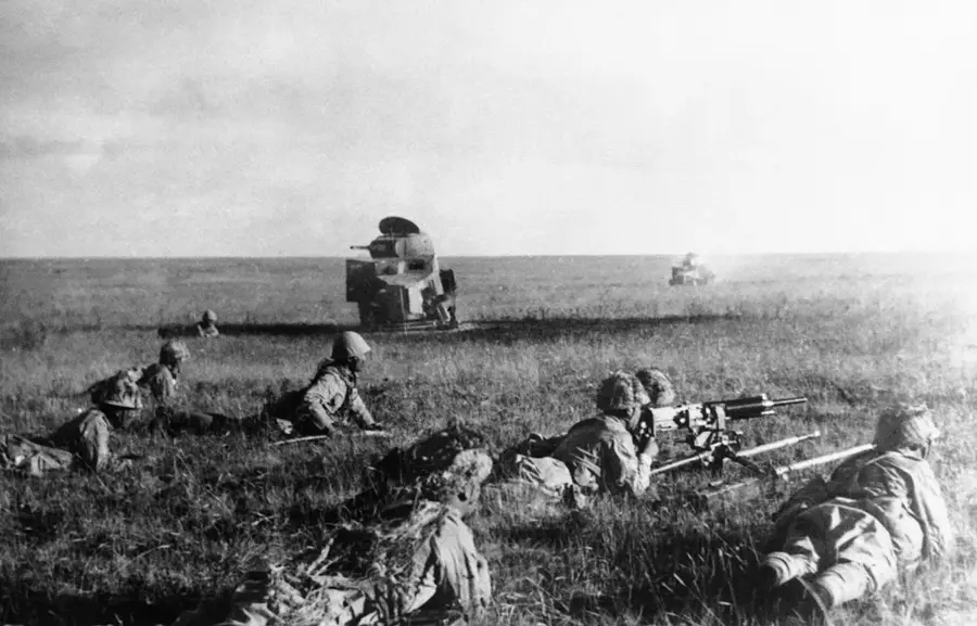
- The Zhukov Museum is essential for understanding the significant WWII history of the Khalkhin Gol battle.
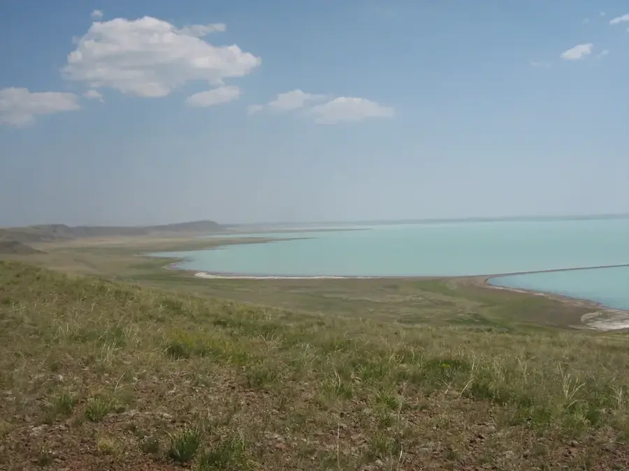
- The Kherlen River is the heart of the city; its wide banks are the best place for a long sunset stroll.
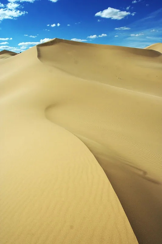
- You will definitely need a 4WD vehicle and a local driver if you plan to venture out into the Menen Steppe.
- Visit the 'Chinatown' section of the local market to find a unique mix of Mongolian and Chinese cross-border goods.
- Choibalsan serves as the main economic hub for Eastern Mongolia; it's the best place to resupply for steppe expeditions.
🍽 Food
A seasonal specialty made from wild spring onions and garlic found in the nearby steppe.
Juicy steamed dumplings, often made with high-quality meat from the eastern pastures.
The standard hearty stir-fried noodle dish, great for the cold eastern climate.
🛍 Shopping · 🧘 Quiet spots
Traditional dried curds, available in many shapes and flavors at the central market.
Durable items made by nomadic craftsmen in the province, known for their quality.
A unique section of the market where you can find a mix of Mongolian and Chinese imports.
The wide and untouched banks offer plenty of space for long, quiet walks at sunset.
A simple concrete park area near the river, providing a calm escape from the city center.
This massive monument on the outskirts is an impressive and usually very quiet site to visit.
Water temperature…
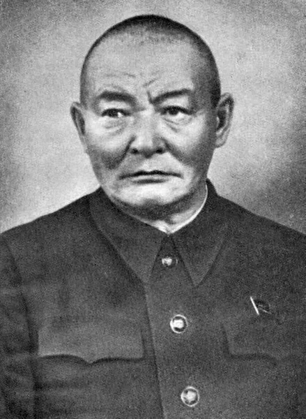
Choibalsan is the economic hub of eastern Mongolia, named after the Stalinist dictator Khorloogiin Choibalsan (1895-1952). The city sits at 750 metres above sea level on the bank of the Kherlen River and serves as the capital of Dornod Province, with a population of around 38,000. It lies roughly 655 kilometres east of Ulaanbaatar. Until 1991 the Soviet Union maintained one of its largest Mongolian military bases here, peaking at over 6,000 troops and including a military airfield now operating as the civilian Choibalsan Airport. During the Second World War the city served as the staging area for joint Soviet, Mongolian forces ahead of the 1939 Battle of Khalkhin Gol against the Japanese Kwantung Army. Today the local economy revolves around livestock farming, meat processing and a wool-washing facility. A railway line links Choibalsan directly to Russia, and the region remains a key commercial gateway towards the northeast.
- Location: Mongolia
- Top sights: Buddha · Ts.Damdinsurengiin khoshoo ch * damdinsUrUng un qOsiye · Borte uzhinii khoshoo
- Population: ~44.835 (2026)
Best time to visit & climate
The most pleasant time to visit is Jun–Aug.
| Jan | Feb | Mar | Apr | May | Jun | Jul | Aug | Sep | Oct | Nov | Dec | |
|---|---|---|---|---|---|---|---|---|---|---|---|---|
| Avg °C | -19 | -15 | -6 | 4 | 12 | 19 | 22 | 19 | 12 | 2 | -8 | -17 |
| Rain mm | 3 | 3 | 6 | 9 | 22 | 48 | 69 | 51 | 25 | 12 | 6 | 5 |
Geography
Facts
- Bevölkerung rund 38.000 Einwohner
- Liegt 655 Kilometer östlich von Ulaanbaatar
- Benannt nach Diktator Choibalsan (1895 bis 1952)
- Sowjetischer Militärstützpunkt bis 1991 mit 6.000 Soldaten
- Aufmarschgebiet vor der Schlacht von Khalkhin Gol 1939
- Auf 750 Metern Höhe am Cherlen-Fluss
- Bahnverbindung nach Russland und Fleischindustrie
- Hauptstadt der Provinz Dornod
Explore nearby
Notable places around
Route planner — Car & Motorhome
Where do you start? We build the route here, with stops and country notes along the way.
© OpenStreetMap contributors · OpenRouteService
Sights in the town Choibalsan (8)
Frequently asked questions
What is the climate like in Tschoibalsan?
What attractions are there in Tschoibalsan?
How can I get to Tschoibalsan?
What is the region known for?
Are there accommodations for tourists?
Choibalsan: where is it located?
Choibalsan: what is there to see?
Choibalsan: when is the best time to visit?
Choibalsan: why is it worth visiting?

Nearby cities
Nature

More places