Plizio Visual Lab
Tagant Plateau
Weather…
Water temperature…
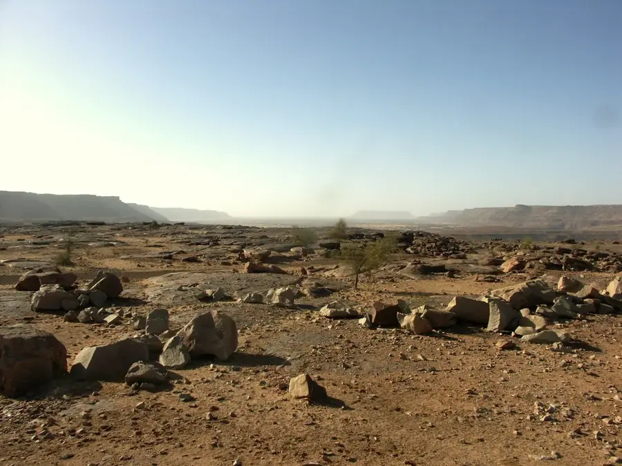
The Tagant Plateau is a rugged sandstone highland in central Mauritania that stands as a vital ecological island within the vastness of the Sahara Desert. Its elevated topography creates a unique environment characterized by deep canyons and 'gueltas', natural rock pools that collect and store rainwater, sometimes for months or even years. These permanent and semi-permanent water sources are critical for the survival of rare desert wildlife, including various species of reptiles and the endangered desert antelope. Remarkably, some of the most remote gueltas on the plateau still harbor isolated populations of West African crocodiles, remnants of a wetter prehistoric era. The plateau's vegetation consists of hardy acacia trees and drought-resistant shrubs, providing essential forage for the livestock of nomadic herders who have traversed these heights for generations. For the adventurous traveler, the Tagant Plateau gives a landscape of stark contrasts, where dark, wind-swept cliffs meet the encroaching golden dunes, serving as a powerful reminder of nature's resilience in one of the world's harshest climates.
- Location: Mauritania
- Nearby: Tidjikja (40 km)
Best time to visit & climate
The most pleasant time to visit is Jan, Feb, Dec.
| Jan | Feb | Mar | Apr | May | Jun | Jul | Aug | Sep | Oct | Nov | Dec | |
|---|---|---|---|---|---|---|---|---|---|---|---|---|
| Avg °C | 19 | 22 | 26 | 30 | 33 | 34 | 33 | 31 | 30 | 29 | 25 | 20 |
| Rain mm | 1 | 1 | 33 | 1 | 2 | 8 | 42 | 86 | 48 | 38 | 1 | 0 |
📋 Practical info
Geography
Facts
- Average elevation: 500 m.
- Area: 100,000 km².
- 50+ archaeological sites.
- Highest point: 700 m.
- Annual rainfall: 100 mm.
- 20 mammal species.
Explore nearby
Notable places around
Route planner — Car & Motorhome
Where do you start? We build the route here, with stops and country notes along the way.
© OpenStreetMap contributors · OpenRouteService
Sights nearby
Frequently asked questions
What is special about the Tagant plateau?
Is hiking there safe?
When is the best time to travel?
Are there crocodiles there?
Is a 4x4 vehicle necessary?
Tagant Plateau: where is it located?
Tagant Plateau: when is the best time to visit?
Tagant Plateau: why is it worth visiting?

Nearby cities


