Plizio Visual Lab
Oued el Mya
Weather…
Water temperature…
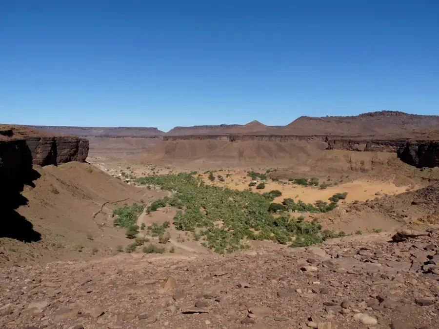
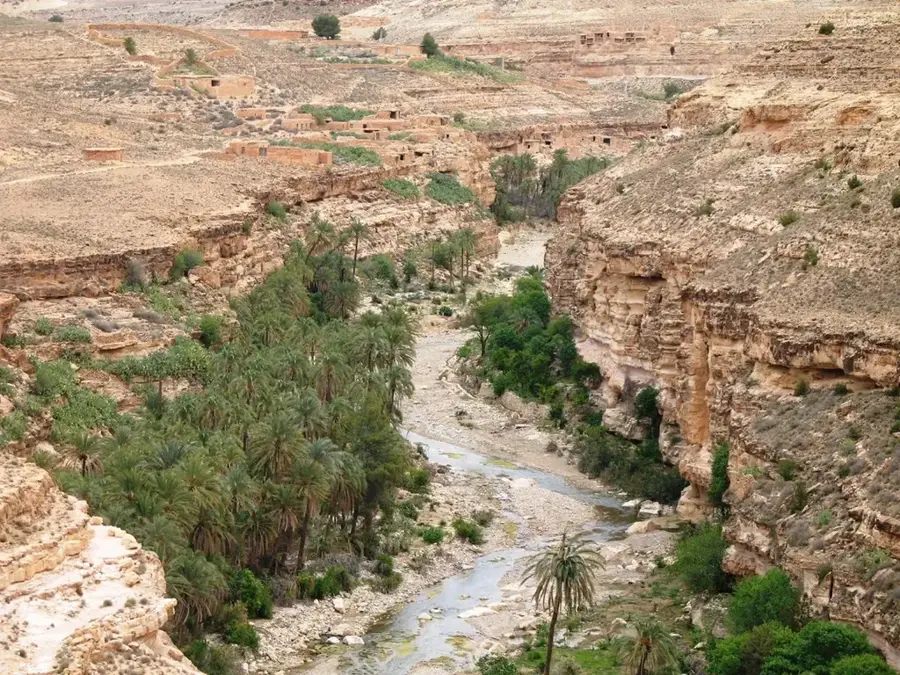
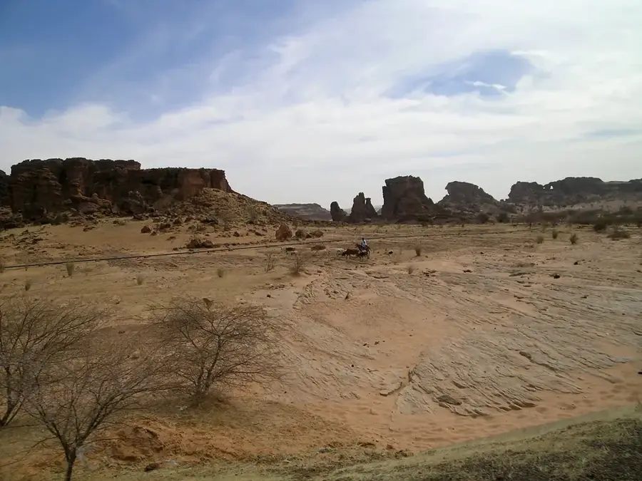
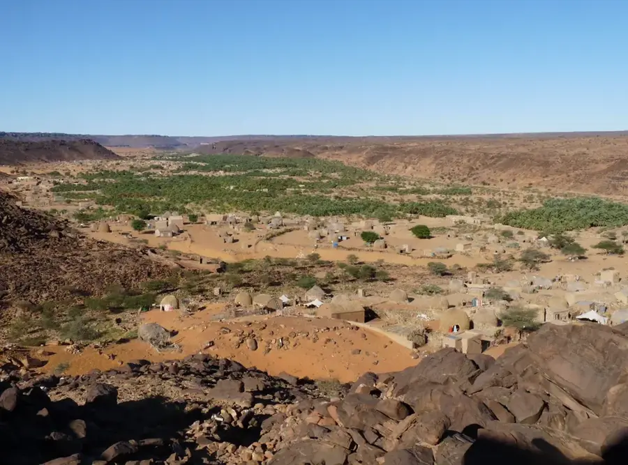
Oued el Mya is a prominent example of the geomorphological features found within the Mauritanian Sahara, cutting through the rugged Adrar Plateau. This dry valley, or wadi, acts as a fossil river system that dates back to wetter climatic periods when permanent water sources shaped the desert landscape. Today, the riverbed remains dry for most of the year, filled with vast deposits of sand and silt that shift with the prevailing winds. It is only after sporadic and heavy rainfall that the valley transforms into a seasonal watercourse, providing a brief pulse of moisture to the surrounding desert environment. In this sparsely populated region, the Oued serves as a natural corridor for movement, offering a relatively flat path for transport across the challenging plateau terrain. Geologically, the area is significant for studying erosion patterns and the long-term impact of climatic shifts on the Saharan topography.
- Location: Mauritania
- Nearby: Terjit (67 km)
Best time to visit & climate
The most pleasant time to visit is Jan, Feb, Dec.
| Jan | Feb | Mar | Apr | May | Jun | Jul | Aug | Sep | Oct | Nov | Dec | |
|---|---|---|---|---|---|---|---|---|---|---|---|---|
| Avg °C | 20 | 22 | 25 | 29 | 32 | 35 | 35 | 34 | 34 | 31 | 25 | 21 |
| Rain mm | 2 | 1 | 2 | 0 | 0 | 4 | 13 | 25 | 18 | 114 | 1 | 0 |
📋 Practical info
Geography
Facts
- Drains portions of the Adrar Massif
- Key aquifer source for nearby desert wells
- Carries surface water only after heavy thunderstorms
- Erosion has carved deep channels into the hard rock
- Preferred habitat for indigenous acacia trees
- Acts as a natural route through rugged terrain
Explore nearby
Notable places around
Route planner — Car & Motorhome
Where do you start? We build the route here, with stops and country notes along the way.
© OpenStreetMap contributors · OpenRouteService
Sights nearby
Frequently asked questions
What is Oued el Mya?
Can you camp there?
Is there wildlife there?
Is the place visited?
Do I need insurance?
Oued el Mya: where is it located?
Oued el Mya: when is the best time to visit?
Oued el Mya: why is it worth visiting?

Nearby cities


History & landmarks

Nature
More places