Plizio Visual Lab
Comoé
Weather…
Water temperature…
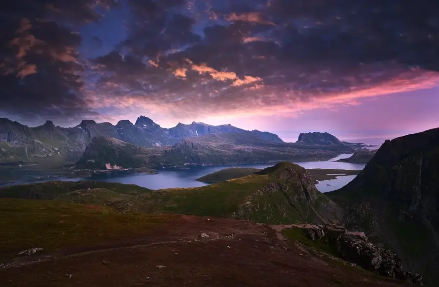
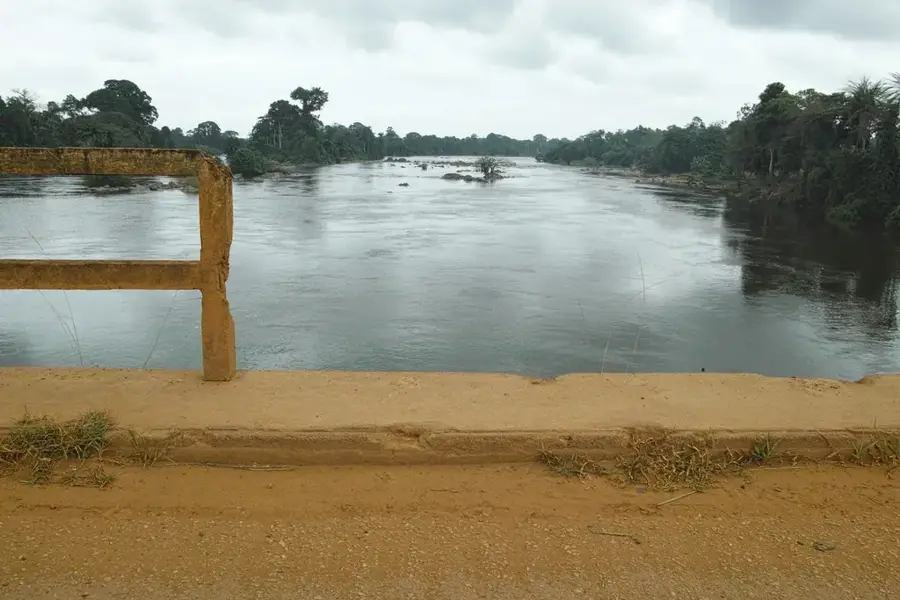
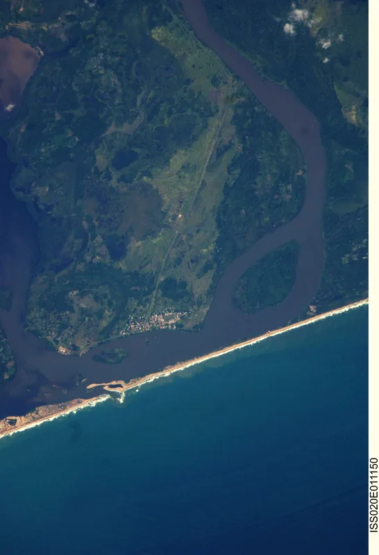
The Comoé River is a major West African waterway, stretching approximately 1,160 kilometers from its source on the Sikasso Plateau in Burkina Faso to its mouth at Grand-Bassam in Ivory Coast. It possesses the largest drainage basin in the country, playing a vital role in the hydrology of the northeastern savanna and coastal regions. The river flows through the Comoé National Park, a UNESCO World Heritage site, where it supports a rich variety of wildlife, including hippos, elephants, and crocodiles, within its lush gallery forests. For a significant portion of its upper course, it forms the international border between Ivory Coast and Burkina Faso. Although the river is largely unnavigable due to seasonal low waters and numerous rapids, it is indispensable for agriculture, providing water for rice, banana, and pineapple plantations. Its estuary at Grand-Bassam is historically significant as the site of the country's first colonial capital.
- Location: Côte d’Ivoire
- Nearby: Assouindé (20 km)
Best time to visit & climate
The most pleasant time to visit is Jan, Aug, Sep.
| Jan | Feb | Mar | Apr | May | Jun | Jul | Aug | Sep | Oct | Nov | Dec | |
|---|---|---|---|---|---|---|---|---|---|---|---|---|
| Avg °C | 27 | 28 | 28 | 28 | 27 | 26 | 25 | 24 | 25 | 26 | 27 | 27 |
| Rain mm | 37 | 65 | 125 | 170 | 232 | 267 | 87 | 34 | 70 | 138 | 98 | 57 |
📋 Practical info
Geography
Facts
- The Comoé is the longest river passing through Ivory Coast at 1,160 km.
- Its drainage basin covers approximately 78,000 square kilometers.
- The river is the primary water source for the Comoé National Park.
- It marks the border with Burkina Faso for over 100 kilometers.
- Grand-Bassam, the estuary town, was the Ivorian capital until 1896.
- The river is known for its high biodiversity, including the West African slender-snouted crocodile.
Explore nearby
Notable places around
Route planner — Car & Motorhome
Where do you start? We build the route here, with stops and country notes along the way.
© OpenStreetMap contributors · OpenRouteService
Sights nearby
Frequently asked questions
Does the river cross a national park?
Are there rapids?
When is the water level lowest?
What birds live on the banks?
How long is the river?
Comoé: where is it located?
Comoé: when is the best time to visit?
Comoé: why is it worth visiting?

Nature
More places