Plizio Visual Lab
Mount Binalud
Weather…
Water temperature…
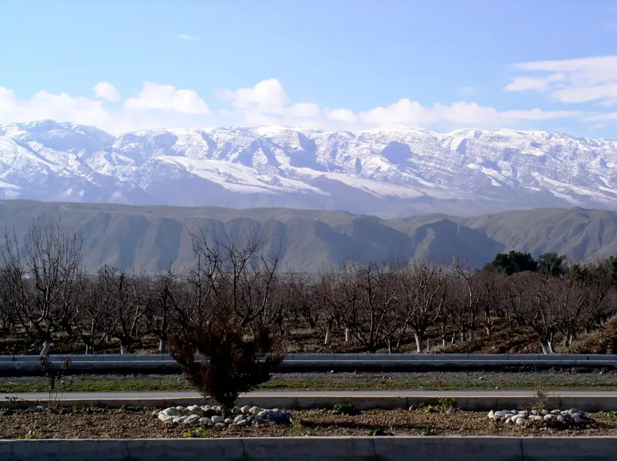
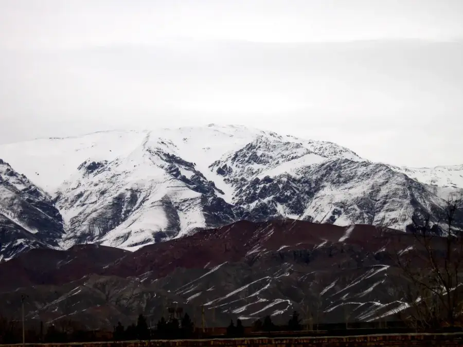
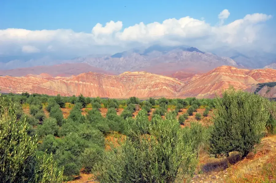
The Binalud mountain range unfolds majestically in northeastern Iran, within the vast Khorasan Razavi Province, acting as a formidable barrier between the historically fertile Nishapur plain and the metropolitan area of Mashhad. Often dubbed the roof of Khorasan, this massif is renowned for its expansive, high-altitude alpine pastures that have served as a pastoral base for local nomadic communities since ancient times. During harsh winters, abundant snowfalls blanket the peaks with a thick layer of snow, whose gradual melting in spring provides the essential freshwater resources for villages and agricultural zones in the adjacent valleys. Its diverse topography, combining gentle hills, steep rocky precipices, and verdant gorges planted with fruit trees, is extremely appealing to hiking enthusiasts. The ancient villages at its foothills impress with their traditional terraced architecture built seamlessly into the mountainside.
- Location: Iran
- Nearby: Neyshabur (15 km)
Best time to visit & climate
The most pleasant time to visit is Jun, Aug, Sep.
| Jan | Feb | Mar | Apr | May | Jun | Jul | Aug | Sep | Oct | Nov | Dec | |
|---|---|---|---|---|---|---|---|---|---|---|---|---|
| Avg °C | -1 | 1 | 6 | 12 | 18 | 22 | 24 | 22 | 18 | 13 | 5 | 1 |
| Rain mm | 20 | 29 | 36 | 30 | 16 | 4 | 2 | 1 | 2 | 6 | 18 | 15 |
📋 Practical info
Geography
Facts
- The Shirbad peak reaches 3,321 meters, recognized as the highest mountain peak in the entire Khorasan Razavi province.
- The mountain structure extends over a length of roughly 130 kilometers, oriented along a northwest-southeast axis.
- Water-rich valleys, such as the famous Akhlamad Valley, host spectacular waterfalls and large apple orchards.
- At higher elevations, unaffected by pollution, a wide variety of rare medicinal plants grow and are harvested by locals.
- The mountain range functions as a critical watershed for important historical rivers in the region, such as the Kashaf River.
- The picturesque mountain village of Kang attracts tourists thanks to its unique urban structure, featuring houses terraced directly on the steep slope.
Explore nearby
Notable places around
Route planner — Car & Motorhome
Where do you start? We build the route here, with stops and country notes along the way.
© OpenStreetMap contributors · OpenRouteService
Sights nearby
Frequently asked questions
Where are the Binalud Mountains?
Is it good for hiking?
Is there snow there?
What is the highest elevation?
How to get there?
Mount Binalud: where is it located?
Mount Binalud: when is the best time to visit?
Mount Binalud: why is it worth visiting?

Nearby cities
History & landmarks
More places